Toggle navigation
LMEC Home
Exhibitions
Georeferencing
Tools for Teachers
Collections
My Favorites
Sign Up / Log In
Search
Search the map portal
Map Collection
Map Collection
Map Sets
Search
Search
Search for
Search In
All Fields
Creator
Title
Subject
Place
Search All Digital Collections
Advanced Search
953 Results
My Search
Start Over
More Like
commonwealth-oai:st74hp42z
Remove constraint More Like: commonwealth-oai:st74hp42z
Filter your Search
Place
North and Central America
913
United States
637
Canada
221
New York
193
Quebec
114
Saint Lawrence River
66
Pennsylvania
60
New Jersey
54
more
Place
»
Topic
United States--History--Revolution, 1775-1783--Maps
305
United States--History--French and Indian War, 1754-1763--Maps
162
Saint Lawrence River--Maps
67
Newport (R.I.)--Maps
27
Québec (Québec)--Maps
27
New York (State)--Maps
25
Hudson River (N.Y. and N.J.)--Maps
21
Louisbourg (N.S.)--Maps
20
more
Topic
»
Date
Date range begin
–
Date range end
Current results range from
1700
to
1900
View distribution
Creator
Jefferys, Thomas, -1771
30
Holland, Samuel, 1728-1801
29
Montrésor, John, 1736-1799
29
Rocque, Mary Ann
29
Bellin, Jacques Nicolas, 1703-1772
28
Clinton, Henry, Sir, 1738?-1795
19
Robert Sayer and John Bennett (Firm)
16
Orme, Robert, -1781
14
more
Creator
»
Format
Maps/Atlases
937
Drawings/Illustrations
11
Documents
5
Manuscripts
1
Prints
1
Georeferenced
No
953
Collection
American Revolutionary War-Era Maps
948
William L. Clements Library Collection
909
Library and Archives Canada Collection
19
Norman B. Leventhal Map & Education Center Collection
9
American Antiquarian Society Collection
5
Richard H. Brown Revolutionary War Map Collection at Mount Vernon
4
MacLean Collection Map Library
3
New York Public Library Collection
3
more
Collection
»
Available to use
No known restrictions
10
Creative Commons license
7
Search Constraints
Sort by relevance
relevance
title
date (asc)
date (desc)
Number of results to display per page
20 per page
10
per page
20
per page
50
per page
100
per page
View results as:
grid view
map view
Search Results
361.
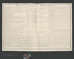
Explanation of the references
362.
Falmouth, Maine
363.
Flatbush
364.
La Floride divisée en Floride et Caroline
365.
Flynt Jenkins sold to Taylor Foster &c plans 1778
366.
Fort Germain and neighboring posts
367.
Fort Harmar at the Ohio and Muskingum Rivers, ca. 1786
368.
Fort Independence to Slaughter's Landing
369.
Fort Lafayette and Verplank Point
370.
Fort Lee
371.
Fort Pitt
372.
Forts of the Highlands, ca. 1777
373.
Four wood lots in no 3
374.
Fragment of map showing two small fortifications
375.
From Fishkill Creek to the Croton River
376.
From Freehold toward Trenton
377.
A front view of Fort George Majabigwaduce June 1780
378.
Gardiners Bay
379.
A general map of North America drawn from the best surveys 1795
380.
A general map of the middle British colonies, in America; viz Virginia, Maryland, Delaware, Pensilvania, New-Jersey, New-York,...
‹ Prev
Next ›
1
2
…
15
16
17
18
19
20
21
22
23
…
47
48