Toggle navigation
LMEC Home
Exhibitions
Georeferencing
Tools for Teachers
Collections
My Favorites
Sign Up / Log In
Search
Search the map portal
Map Collection
Map Collection
Map Sets
Search
Search
Search for
Search In
All Fields
Creator
Title
Subject
Place
Search All Digital Collections
Advanced Search
1253 Results
My Search
Start Over
More Like
commonwealth-oai:pv63kz90b
Remove constraint More Like: commonwealth-oai:pv63kz90b
Filter your Search
Place
North and Central America
1,216
United States
956
Canada
227
New York
193
Quebec
111
Pennsylvania
61
New Jersey
57
Massachusetts
50
more
Place
»
Topic
United States--History--Revolution, 1775-1783--Maps
330
United States--Maps
330
United States--History--French and Indian War, 1754-1763--Maps
151
Saint Lawrence River--Maps
44
Elections--United States--Maps
36
Railroads--United States--Maps
34
Canada--Maps
29
Newport (R.I.)--Maps
27
more
Topic
»
Date
Date range begin
–
Date range end
Current results range from
1700
to
2023
View distribution
Creator
Paullin, Charles Oscar, 1868 or 1869-1944
70
Wright, John Kirtland, 1891-1969
70
Rocque, Mary Ann
29
Bellin, Jacques Nicolas, 1703-1772
26
Holland, Samuel, 1728-1801
25
Jefferys, Thomas, -1771
25
Montrésor, John, 1736-1799
25
Clinton, Henry, Sir, 1738?-1795
19
more
Creator
»
Format
Maps/Atlases
1,235
Drawings/Illustrations
11
Documents
5
Manuscripts
5
Prints
3
Books
1
Objects/Artifacts
1
Posters
1
Georeferenced
Yes
67
No
1,186
Collection
American Revolutionary War-Era Maps
959
William L. Clements Library Collection
909
Norman B. Leventhal Map & Education Center Collection
296
American Antiquarian Society Collection
27
MacLean Collection Map Library
11
Boston and New England Maps
5
Newberry Library Collection
3
Urban Maps
3
more
Collection
»
Available to use
No known restrictions
223
Creative Commons license
9
Search Constraints
Sort by relevance
relevance
title
date (asc)
date (desc)
Number of results to display per page
20 per page
10
per page
20
per page
50
per page
100
per page
View results as:
grid view
map view
Search Results
861.
A map of the French settlements in North America
862.
A map of the Indian nations in the southern department, 1766
863.
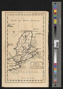
A map of the island of Cape Breton
864.
A map of the isthmus of Panama drawn from Spanish surveys
865.
A map of the lakes & Hudsons Bay
866.
A map of the lakes & Hudsons Bay
867.
Map of the middle states of America : comprehends New-York, New-Jersey, Pennsylvania, Delaware, and the territory N:W: of Ohio
868.
Map of the middle states of America : comprehends New-York, New-Jersey, Pennsylvania, Delaware, and the territory N:W: of Ohio
869.
A map of the north west parts of the United States of America
870.
A map of the North Western Territory
871.
A map of the northern and middle states; comprehending the western territory and the British dominions in North America from...
872.
Map of the northern part of the United States of America
873.
A map of the province of Massachusetts Bay, and colony of Rhode Island, with part of Connecticut, New Hampshire, and Vermont
874.
A map of the sea coast of Georgia & the inland parts thereof extending to the westward of that part of Savannah called Broad...
875.
Map of the Second Nine Partners Tract in Dutchess County, protracted by a scale of one hundred chains to an inch
876.
Map of the United States and their territory
877.
A map of the western parts of the colony of Virginia
878.
A map of two lots of land in Livingston, on the south side of the road leading from Johnstown to Ancram, containing 127 acres :...
879.
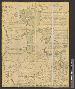
A map of West Florida and part of Et: Florida, Georgia part of So: Carolina i[n]cluding [torn] & Chactaw, Chickasaw & Creek...
880.
A map or draft of a certain tract and parcell of arable and low land of Collo. Henry Beekman being situate & lying within the...
‹ Prev
Next ›
1
2
…
40
41
42
43
44
45
46
47
48
…
62
63


![A map of West Florida and part of Et: Florida, Georgia part of So: Carolina i[n]cluding [torn] & Chactaw, Chickasaw & Creek nations with [torn] [r]oad [torn] Pensacola through ye: Creek nation to Augusitus & Charlestown](https://bpldcassets.blob.core.windows.net/derivatives/metadata/commonwealth-oai:v98001375/image_thumbnail_300.jpg)