Toggle navigation
LMEC Home
Exhibitions
Georeferencing
Tools for Teachers
Collections
My Favorites
Sign Up / Log In
Search
Search the map portal
Map Collection
Map Collection
Map Sets
Search
Search
Search for
Search In
All Fields
Creator
Title
Subject
Place
Search All Digital Collections
Advanced Search
922 Results
My Search
Start Over
More Like
commonwealth-oai:pc28fg18b
Remove constraint More Like: commonwealth-oai:pc28fg18b
Filter your Search
Place
North and Central America
896
United States
625
Canada
205
New York
193
Quebec
111
Pennsylvania
60
New Jersey
54
Nova Scotia
48
more
Place
»
Topic
United States--History--Revolution, 1775-1783--Maps
305
United States--History--French and Indian War, 1754-1763--Maps
149
Saint Lawrence River--Maps
43
Newport (R.I.)--Maps
27
New York (State)--Maps
24
Hudson River (N.Y. and N.J.)--Maps
21
Québec (Québec)--Maps
21
Louisbourg (N.S.)--Maps
20
more
Topic
»
Date
Date range begin
–
Date range end
Current results range from
1700
to
1921
View distribution
Creator
Rocque, Mary Ann
29
Holland, Samuel, 1728-1801
25
Montrésor, John, 1736-1799
25
Bellin, Jacques Nicolas, 1703-1772
24
Jefferys, Thomas, -1771
24
Clinton, Henry, Sir, 1738?-1795
19
Robert Sayer and John Bennett (Firm)
15
Hills, John, active 1777-1819
13
more
Creator
»
Format
Maps/Atlases
906
Drawings/Illustrations
11
Documents
5
Prints
1
Georeferenced
Yes
1
No
921
Collection
American Revolutionary War-Era Maps
910
William L. Clements Library Collection
909
Norman B. Leventhal Map & Education Center Collection
12
Urban Maps
7
Maritime Charts and Atlases
2
American Antiquarian Society Collection
1
Available to use
No known restrictions
12
Search Constraints
Sort by relevance
relevance
title
date (asc)
date (desc)
Number of results to display per page
20 per page
10
per page
20
per page
50
per page
100
per page
View results as:
grid view
map view
Search Results
1.
Schauplatz des kriegs zwischen Engelland und seinen collonien in America nach richtigen carten gezeichnet und in diese form...
2.
Sketch of part of the island of Ste. Lucie : computed at about 2500 feet to 1 inch
3.
To his excellency General Washington, commander in chief of the armies of the United States of America : this plan of the...
4.
Virgin Islands surveyed in 1774
5.
Plan of the city & harbour of Havanna, capital of Cuba
6.
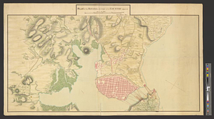
Plan of the Havana with part of the country adjacent
7.
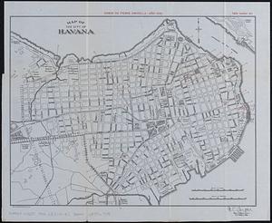
Map of Havana and Havana Harbor showing the fortifications and public buildings
8.
Map of the city of Havana : [casos de fiebre amarilla, muertes de niños menores, y muertes de tuberculosis]
9.
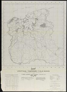
Map showing locations of temporary field works erected by the Spanish for the land defense of Havana, 1897-1898
10.
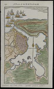
A plan of the Havanah
11.
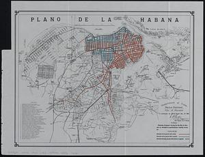
Plano de la Habana : showing proposed paving for the city of Havana as encluded in specifications recently drawn up
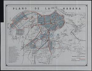
12.
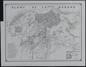
Plano de la Habana : showing work done on streets during six months ending Dec. 31st, 1900
13.
Plano de la Habana : showing track laying completed and paved
14.
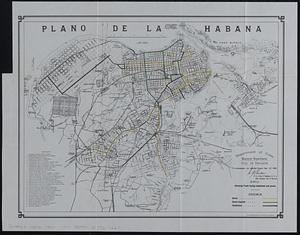
Plano de la Habana : showing status of survey for street grades
15.
Plano pintoresco de la Habana : con los numeros de las casas
16.
The Rand-McNally map of the city of Havana showing suburbs, parks, forts, and principal buildings
17.
Various plans and draughts of cities, towns, harbours &c. drawn from the latest authorities
18.
West Indies, Cuba, harbor of Havana : from the most recent Spanish surveys to 1887
19.
West Indies, Cuba, harbor of Havana : from the most recent Spanish surveys to 1879
20.
15 lots of 440a each in Great Lot no. 4 of Macomb purchase : 6600 acres within 2 miles of the St. Lawrence Turnpike & 1/2 mile...
‹ Prev
Next ›
1
2
3
4
5
…
46
47