Toggle navigation
LMEC Home
Exhibitions
Georeferencing
Tools for Teachers
Collections
My Favorites
Sign Up / Log In
Search
Search the map portal
Map Collection
Map Collection
Map Sets
Search
Search
Search for
Search In
All Fields
Creator
Title
Subject
Place
Search All Digital Collections
Advanced Search
931 Results
My Search
Start Over
More Like
commonwealth-oai:m039q4378
Remove constraint More Like: commonwealth-oai:m039q4378
Filter your Search
Place
North and Central America
901
United States
636
Canada
216
New York
193
Quebec
111
Pennsylvania
60
New Jersey
54
Nova Scotia
48
more
Place
»
Topic
United States--History--Revolution, 1775-1783--Maps
305
United States--History--French and Indian War, 1754-1763--Maps
162
Saint Lawrence River--Maps
46
Newport (R.I.)--Maps
27
Québec (Québec)--Maps
27
New York (State)--Maps
25
Hudson River (N.Y. and N.J.)--Maps
21
Louisbourg (N.S.)--Maps
20
more
Topic
»
Date
Date range begin
–
Date range end
Current results range from
1700
to
1900
View distribution
Creator
Rocque, Mary Ann
29
Jefferys, Thomas, -1771
28
Holland, Samuel, 1728-1801
26
Montrésor, John, 1736-1799
25
Bellin, Jacques Nicolas, 1703-1772
24
Clinton, Henry, Sir, 1738?-1795
19
Robert Sayer and John Bennett (Firm)
15
Orme, Robert, -1781
14
more
Creator
»
Format
Maps/Atlases
915
Drawings/Illustrations
11
Documents
5
Prints
1
Georeferenced
No
931
Collection
American Revolutionary War-Era Maps
930
William L. Clements Library Collection
909
Library and Archives Canada Collection
8
Norman B. Leventhal Map & Education Center Collection
5
Richard H. Brown Revolutionary War Map Collection at Mount Vernon
4
American Antiquarian Society Collection
3
MacLean Collection Map Library
1
New-York Historical Society Collection
1
Available to use
No known restrictions
6
Creative Commons license
4
Search Constraints
Sort by relevance
relevance
title
date (asc)
date (desc)
Number of results to display per page
20 per page
10
per page
20
per page
50
per page
100
per page
View results as:
grid view
map view
Search Results
481.
A new map of the Cherokee nation with the names of the towns & rivers : they are situated on no. lat. from 34 to 36
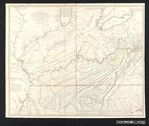
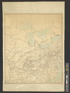
482.
A new map of the western parts of Virginia, Pennsylvania, Maryland and North Carolina; comprehending the river Ohio, and all...
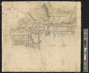
483.
New Port
484.
The New York campaign of 1776
485.
The New York campaign of 1776
486.
Newark Bay and its immediate vicinity
487.
Newark, New Jersey
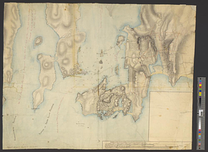
488.
Newport and its environs, ca. 1778
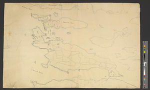
489.
Newport County, ca. 1779
490.
North America
491.
North America
492.
North America east of the Mississippi, ca. 1790
493.
North America with the West India islands
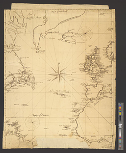
494.
North Atlantic Ocean, ca. 1785
495.
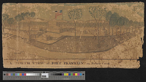
A north view of Fort Franklin on French Creek
496.
Northeastern end of Long Island
497.
Northern New Jersey
498.
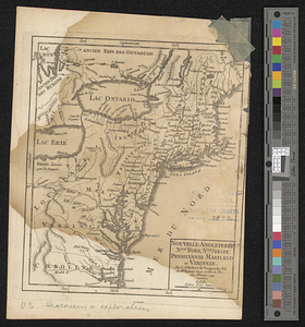
Nouvelle Angleterre, Nlle. York, Nlle. Jeersey, Pensilvanie, Mariland et Virginie
499.
La Nouvelle France ou Canada
500.
Nova orbis sive America Septentrionalis per sua regna provinc. et insul. cura et opera
‹ Prev
Next ›
1
2
…
21
22
23
24
25
26
27
28
29
…
46
47