Toggle navigation
LMEC Home
Exhibitions
Georeferencing
Tools for Teachers
Collections
My Favorites
Sign Up / Log In
Search
Search the map portal
Map Collection
Map Collection
Map Sets
Search
Search
Search for
Search In
All Fields
Creator
Title
Subject
Place
Search All Digital Collections
Advanced Search
1055 Results
My Search
Start Over
More Like
commonwealth-oai:kp78mc90b
Remove constraint More Like: commonwealth-oai:kp78mc90b
Filter your Search
Place
North and Central America
1,027
United States
745
New York
251
Canada
220
Quebec
118
Pennsylvania
69
Maine
66
New Jersey
65
more
Place
»
Topic
United States--History--Revolution, 1775-1783--Maps
330
United States--History--French and Indian War, 1754-1763--Maps
150
New York (State)--Maps
85
Maine--Maps
55
Saint Lawrence River--Maps
44
New England--Maps
28
Newport (R.I.)--Maps
27
Pennsylvania--Maps
27
more
Topic
»
Date
Date range begin
–
Date range end
Current results range from
1700
to
1983
View distribution
Creator
Rocque, Mary Ann
29
Holland, Samuel, 1728-1801
27
Montrésor, John, 1736-1799
26
Bellin, Jacques Nicolas, 1703-1772
25
Jefferys, Thomas, -1771
25
Clinton, Henry, Sir, 1738?-1795
19
Robert Sayer and John Bennett (Firm)
17
Hills, John, active 1777-1819
13
more
Creator
»
Format
Maps/Atlases
1,039
Drawings/Illustrations
11
Manuscripts
9
Documents
5
Objects/Artifacts
1
Prints
1
Georeferenced
Yes
12
No
1,043
Collection
American Revolutionary War-Era Maps
960
William L. Clements Library Collection
909
Norman B. Leventhal Map & Education Center Collection
96
Boston and New England Maps
50
American Antiquarian Society Collection
24
MacLean Collection Map Library
10
Applied Geographics, Inc. Records
4
Library and Archives Canada Collection
4
more
Collection
»
Available to use
No known restrictions
99
Creative Commons license
5
Search Constraints
Sort by relevance
relevance
title
date (asc)
date (desc)
Number of results to display per page
20 per page
10
per page
20
per page
50
per page
100
per page
View results as:
grid view
map view
Search Results
781.
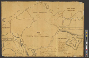
Part of the state of Pennsylvania : to the honble. Josiah Harmar esqr. brigdr. genl. & lt. col. commdg. 1st U.S. Regt.
782.
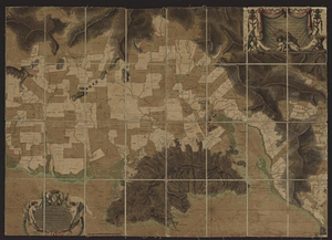
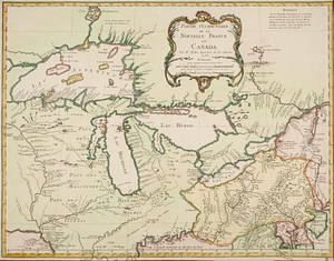
Partie occidentale de la Nouvelle France ou Canada
783.
Partie occidentale du Canada contenant les cinq Grands Lacs, avec les pays circonvoisons
784.
Partie occidentale du Canada contenant les cinqs grands lac [sic], avec les pays criconvoisins [sic]
785.
Penobscot Bay
786.
Pensacola
787.
Phillipse Manor
788.
A plan & section of a survey taken April 20, 1801 on a new prepared course for the Middlesex Canal, from the south end of...
789.
Plan and elevation of a stockade work, with block-house bastions; designed for the defence of the settlement of Coleraine, on...
790.
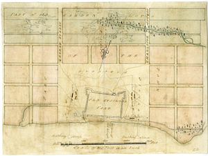
Plan and profile of retrenched work round Harkemeis house at ye German Flats 1756
791.
Plan and project, for fortifying the high commanding ground at the church of Deschambeaux as also the island of Richlieu [sic]
792.
A plan and section of the two routs in Woburn, say 1795 : Middlesex Canal
793.
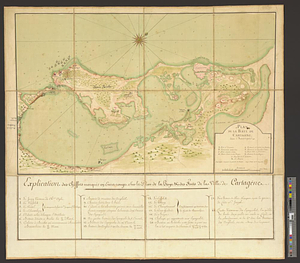
Plan de la baye de Cartagene dans l'Amérique
794.
Plan de la plaine du Cap François en l'Isle St. Domingue : redigé d'après les dernières opérations géometriques des ingénieurs...
795.
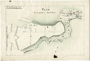
Plan de la pointe à Rochefort
796.
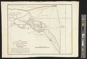
Plan de la rivière d'Albanie dans la baye de Hudson
797.
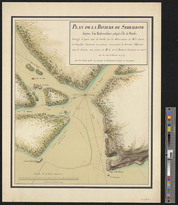
Plan de la rivière de Serraleone depuis son embouchûre jusqu'à l'ile de Banse : corrigé d'aprés celui de Smith, sur les...
798.
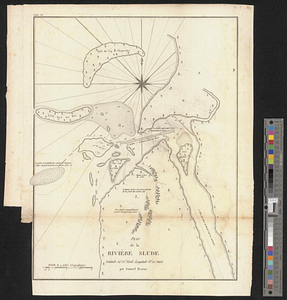
Plan de la rivière Slude
799.
Plan de la ville de Boston et ses environs
800.
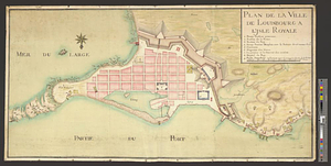
Plan de la ville de Louisbourg à l'Isle Royale
‹ Prev
Next ›
1
2
…
36
37
38
39
40
41
42
43
44
…
52
53
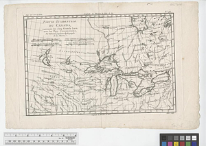
![Partie occidentale du Canada contenant les cinqs grands lac [sic], avec les pays criconvoisins [sic]](https://bpldcassets.blob.core.windows.net/derivatives/metadata/commonwealth-oai:tx31vg299/image_thumbnail_300.jpg)

![Plan and project, for fortifying the high commanding ground at the church of Deschambeaux as also the island of Richlieu [sic]](https://bpldcassets.blob.core.windows.net/derivatives/metadata/commonwealth-oai:pz50mt24s/image_thumbnail_300.jpg)