Toggle navigation
LMEC Home
Exhibitions
Georeferencing
Tools for Teachers
Collections
My Favorites
Sign Up / Log In
Search
Search the map portal
Map Collection
Map Collection
Map Sets
Search
Search
Search for
Search In
All Fields
Creator
Title
Subject
Place
Search All Digital Collections
Advanced Search
938 Results
My Search
Start Over
More Like
commonwealth-oai:k356f1598
Remove constraint More Like: commonwealth-oai:k356f1598
Filter your Search
Place
North and Central America
912
United States
626
Canada
231
New York
193
Quebec
113
Pennsylvania
60
New Jersey
54
Nova Scotia
48
more
Place
»
Topic
United States--History--Revolution, 1775-1783--Maps
305
United States--History--French and Indian War, 1754-1763--Maps
149
Saint Lawrence River--Maps
43
Newport (R.I.)--Maps
27
New York (State)--Maps
25
Hudson River (N.Y. and N.J.)--Maps
21
Québec (Québec)--Maps
21
Louisbourg (N.S.)--Maps
20
more
Topic
»
Date
Date range begin
–
Date range end
Current results range from
1700
to
1921
View distribution
Creator
Rocque, Mary Ann
29
Bellin, Jacques Nicolas, 1703-1772
25
Holland, Samuel, 1728-1801
25
Jefferys, Thomas, -1771
25
Montrésor, John, 1736-1799
25
Clinton, Henry, Sir, 1738?-1795
19
Robert Sayer and John Bennett (Firm)
15
Hills, John, active 1777-1819
13
more
Creator
»
Format
Maps/Atlases
922
Drawings/Illustrations
11
Documents
5
Prints
1
Georeferenced
No
938
Collection
American Revolutionary War-Era Maps
916
William L. Clements Library Collection
909
Norman B. Leventhal Map & Education Center Collection
22
Library and Archives Canada Collection
4
MacLean Collection Map Library
3
Available to use
No known restrictions
22
Search Constraints
Sort by relevance
relevance
title
date (asc)
date (desc)
Number of results to display per page
20 per page
10
per page
20
per page
50
per page
100
per page
View results as:
grid view
map view
Search Results
781.
The River St. Lawrence from Mal Bay to the Basin of Quebec
782.
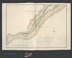
The River St. Lawrence from the Basin of Quebec to the Falls of Richeu
783.
River valley with several foothills and swamp
784.
La rivière du Détroit depuis le Lac Sainte Claire jusqu'au Lac Erié
785.
The road from New Bridge and Hackinsack to Burlington
786.
Roads from Windsor to Easton through the highlands
787.
A rough draught of New Haven fort
788.
Rough Scetch of the King's Domain at Detroit
789.
A rough sketch of the field of battle, near Turtle Creek, of the 9th July, with the disposition of the British troops, and...
790.
A rude sketch of a part of the road between the township of Horton and Granville on the river of Annapolis, relative to a...
791.
S. east view of Fort St. Tammany : N. Hayward to Major H. Burbeck
792.
Saml Wath to Abel Richardson : Wm Foster to James Foster exec ditto
793.
Sandy Hook, New Jersey
794.
Sault aux Recollets
795.
Savannah and its defenses
796.
Savannah River and Savannah Sound
797.
A scetch [sic] of that part of Statten island from the Old Star [Ferry] to Deckers Ferry and the lands lying to the westd. of...
798.
Scetch [sic] of the blockhouse at the east of Oneda Lake
799.
Schauplatz des kriegs zwischen Engelland und seinen collonien in America nach richtigen carten gezeichnet und in diese form...
800.
The seat of action between the British and American forces or an authentic plan of Staten Island with the neighbouring...
‹ Prev
Next ›
1
2
…
36
37
38
39
40
41
42
43
44
…
46
47


![A scetch [sic] of that part of Statten island from the Old Star [Ferry] to Deckers Ferry and the lands lying to the westd. of the road leading from Deckers Ferry to the Old Star made from a view of the same by Thomas Millidge major of the 5th battn. of N: J V](https://bpldcassets.blob.core.windows.net/derivatives/metadata/commonwealth-oai:1831hj84z/image_thumbnail_300.jpg)
![Scetch [sic] of the blockhouse at the east of Oneda Lake](https://bpldcassets.blob.core.windows.net/derivatives/metadata/commonwealth-oai:zs2626251/image_thumbnail_300.jpg)