Toggle navigation
LMEC Home
Exhibitions
Georeferencing
Tools for Teachers
Collections
My Favorites
Sign Up / Log In
Search
Search the map portal
Map Collection
Map Collection
Map Sets
Search
Search
Search for
Search In
All Fields
Creator
Title
Subject
Place
Search All Digital Collections
Advanced Search
975 Results
My Search
Start Over
More Like
commonwealth-oai:j96060056
Remove constraint More Like: commonwealth-oai:j96060056
Filter your Search
Place
North and Central America
949
United States
683
Canada
205
New York
197
Quebec
111
Rhode Island
79
Massachusetts
71
Pennsylvania
61
more
Place
»
Topic
United States--History--Revolution, 1775-1783--Maps
305
United States--History--French and Indian War, 1754-1763--Maps
149
Rhode Island--Maps
49
Saint Lawrence River--Maps
43
Connecticut--Maps
40
Massachusetts--Maps
38
New York (State)--Maps
27
Newport (R.I.)--Maps
27
more
Topic
»
Date
Date range begin
–
Date range end
Current results range from
1700
to
1990
View distribution
Creator
Rocque, Mary Ann
29
Holland, Samuel, 1728-1801
25
Montrésor, John, 1736-1799
25
Bellin, Jacques Nicolas, 1703-1772
24
Jefferys, Thomas, -1771
24
Clinton, Henry, Sir, 1738?-1795
19
Robert Sayer and John Bennett (Firm)
15
Hills, John, active 1777-1819
13
more
Creator
»
Format
Maps/Atlases
959
Drawings/Illustrations
11
Documents
5
Manuscripts
1
Prints
1
Georeferenced
Yes
19
No
956
Collection
American Revolutionary War-Era Maps
917
William L. Clements Library Collection
909
Norman B. Leventhal Map & Education Center Collection
59
Boston and New England Maps
45
American Antiquarian Society Collection
5
David Judkins Weaver Papers
5
Sidney R. Knafel Map Collection at Phillips Academy
2
Mapping Boston Collection
1
more
Collection
»
Available to use
No known restrictions
58
Creative Commons license
1
Search Constraints
Sort by relevance
relevance
title
date (asc)
date (desc)
Number of results to display per page
20 per page
10
per page
20
per page
50
per page
100
per page
View results as:
grid view
map view
Search Results
61.
Geographical, statistical, and historical map of Rhode Island
62.
Hammond's new road map of Rhode Island and southeastern Massachusetts
63.
Map of Massachusetts and Rhode Island
64.
A map of Rhode Island
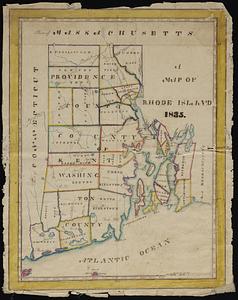
65.
A map of the State of Rhode Island
66.
Map of the State of Rhode Island and Providence Plantations
67.
Map of the State of Rhode Island, and Providence Plantations
68.
Massachusetts and Rhode Island
69.
Massachusetts and Rhode Island
70.
National topographic map of Massachusetts and Rhode Island : showing counties, townships, cities, villages and post offices ......
71.
New York, New Haven & Hartford Railroad : Old Colony system
72.
Rhode Island
73.
Rhode Island
74.
Rhode Island
75.
Route of the proposed Providence & Worcester rail-road
76.
Route of the Providence and Worcester rail road
77.
The State of Rhode Island, : from the latest surveys. 1796
78.
The state of Rhode Island
79.
The state of Rhode Island : compiled from the surveys and observations of Caleb Harris
80.
Topographic map of Massachusetts and Rhode Island
‹ Prev
Next ›
1
2
3
4
5
6
7
8
…
48
49