Toggle navigation
LMEC Home
Exhibitions
Georeferencing
Tools for Teachers
Collections
My Favorites
Sign Up / Log In
Search
Search the map portal
Map Collection
Map Collection
Map Sets
Search
Search
Search for
Search In
All Fields
Creator
Title
Subject
Place
Search All Digital Collections
Advanced Search
945 Results
My Search
Start Over
More Like
commonwealth-oai:d217vn11c
Remove constraint More Like: commonwealth-oai:d217vn11c
Filter your Search
Place
North and Central America
919
United States
652
Canada
205
New York
192
Quebec
111
Pennsylvania
60
New Jersey
54
South Carolina
50
more
Place
»
Topic
United States--History--Revolution, 1775-1783--Maps
305
United States--History--French and Indian War, 1754-1763--Maps
149
Saint Lawrence River--Maps
43
North Carolina--Maps
30
Newport (R.I.)--Maps
27
New York (State)--Maps
24
Hudson River (N.Y. and N.J.)--Maps
21
Québec (Québec)--Maps
21
more
Topic
»
Date
Date range begin
–
Date range end
Current results range from
1700
to
1987
View distribution
Creator
Rocque, Mary Ann
29
Bellin, Jacques Nicolas, 1703-1772
26
Holland, Samuel, 1728-1801
25
Montrésor, John, 1736-1799
25
Jefferys, Thomas, -1771
24
Clinton, Henry, Sir, 1738?-1795
19
Robert Sayer and John Bennett (Firm)
15
Hills, John, active 1777-1819
13
more
Creator
»
Format
Maps/Atlases
929
Drawings/Illustrations
11
Documents
5
Prints
1
Georeferenced
Yes
3
No
942
Collection
American Revolutionary War-Era Maps
919
William L. Clements Library Collection
909
Norman B. Leventhal Map & Education Center Collection
28
American Antiquarian Society Collection
7
Applied Geographics, Inc. Records
1
MacLean Collection Map Library
1
Available to use
No known restrictions
28
Search Constraints
Sort by relevance
relevance
title
date (asc)
date (desc)
Number of results to display per page
20 per page
10
per page
20
per page
50
per page
100
per page
View results as:
grid view
map view
Search Results
21.
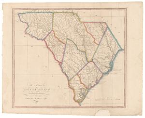
The state of South Carolina: from the best authorities
22.
Coast of North Carolina & Virginia
23.
Colton's new topographical map of the eastern portion of the State of North Carolina with part of Virginia & South Carolina...
24.
Colton's new topographical map of the eastern portion of the State of North Carolina with part of Virginia & South Carolina...
25.
Colton's North Carolina
26.
Manuscript maps of U.S. states
27.
Manuscript maps of U.S. states, possibly drawn by a schoolchild
28.
Map of North Carolina
29.
Map of North Carolina
30.
Middle Virginia and North Carolina
31.
Mountain region of North Carolina and Tennessee
32.
Mountain region of North Carolina and Tennessee
33.
Mountain region of North Carolina and Tennessee
34.
North Carolina
35.
North Carolina form the best authorities. 1800
36.
Physiographical map of North Carolina
37.
The Rand McNally new commercial atlas map of North Carolina
38.
The state of North Carolina from the best authorities
39.
The state of North Carolina from the best authorities, &c
40.
15 lots of 440a each in Great Lot no. 4 of Macomb purchase : 6600 acres within 2 miles of the St. Lawrence Turnpike & 1/2 mile...
‹ Prev
Next ›
1
2
3
4
5
6
…
47
48