Toggle navigation
LMEC Home
Exhibitions
Georeferencing
Tools for Teachers
Collections
My Favorites
Sign Up / Log In
Search
Search the map portal
Map Collection
Map Collection
Map Sets
Search
Search
Search for
Search In
All Fields
Creator
Title
Subject
Place
Search All Digital Collections
Advanced Search
946 Results
My Search
Start Over
More Like
commonwealth-oai:c534kn48m
Remove constraint More Like: commonwealth-oai:c534kn48m
Filter your Search
Place
North and Central America
910
United States
629
Canada
220
New York
194
Quebec
121
Saint Lawrence River
66
Pennsylvania
60
New Jersey
54
more
Place
»
Topic
United States--History--Revolution, 1775-1783--Maps
305
United States--History--French and Indian War, 1754-1763--Maps
149
Saint Lawrence River--Maps
67
Newport (R.I.)--Maps
27
New York (State)--Maps
24
Québec (Québec)--Maps
24
Hudson River (N.Y. and N.J.)--Maps
21
Louisbourg (N.S.)--Maps
20
more
Topic
»
Date
Date range begin
–
Date range end
Current results range from
1700
to
1923
View distribution
Creator
Montrésor, John, 1736-1799
29
Rocque, Mary Ann
29
Bellin, Jacques Nicolas, 1703-1772
28
Holland, Samuel, 1728-1801
28
Jefferys, Thomas, -1771
26
Clinton, Henry, Sir, 1738?-1795
19
Robert Sayer and John Bennett (Firm)
17
Cook, James, 1728-1779
13
more
Creator
»
Format
Maps/Atlases
930
Drawings/Illustrations
11
Documents
5
Manuscripts
1
Prints
1
Georeferenced
No
946
Collection
American Revolutionary War-Era Maps
934
William L. Clements Library Collection
909
Library and Archives Canada Collection
17
Norman B. Leventhal Map & Education Center Collection
12
MacLean Collection Map Library
3
New York Public Library Collection
3
Maps from AAS
2
Boston and New England Maps
1
Available to use
No known restrictions
12
Creative Commons license
3
Search Constraints
Sort by relevance
relevance
title
date (asc)
date (desc)
Number of results to display per page
20 per page
10
per page
20
per page
50
per page
100
per page
View results as:
grid view
map view
Search Results
81.
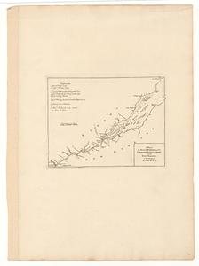
Iroquois or St. Lawrence
82.
A map of part of Canada for the use of His Majesty's Secretary of State, compiled in the Surveyor Generals Office, pursuant to...
83.
A map of the several dispositions of the English fleet & army on the river S.t Laurence, to the taking of Quebec
84.
A new map of the province of Quebec, : according to the Royal proclamation, of the 7th of October 1763
85.
A new map of the province of Quebec, : according to the Royal proclamation, of the 7th of October 1763
86.
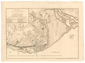
A plan of the city of Quebec the capital of Canada : as it surrender'd 18 Septemb.r 1759 to the British fleet and army ;...
87.
A plan of the River St. Laurence from Green Island to Cape Carrouge
88.
Plan of the river St Lawrence fom the Island of Anticosta to Quebec ... from a manuscript found on board ye Alcide taken June...
89.
Plan of the river St. Lawrence from the Island of Anticosta to Quebec ... from a manuscript found on board of the Alcide taken...
90.
Plan of the town of Quebec the capital of Canada in North America : with the bason and a part of the adjacent country shewing...
91.
Plan of the town of Quebec the capital of Canada in North America : with the bason and a part of the adjacent country shewing...
92.
Plan of the town of Quebec the capital of Canada in North America : with the bason and a part of the adjacent country shewing...
93.
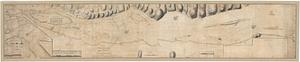
Profile of the river St. Lawrence between Montreal and Quebec shewing the deepening of the ship channel
94.
Sketch of the river St Lawrence from Montreal to the island of St Barnaby on the south side, and the islands of Jeremy on the...
95.
Sketch of the river St Lawrence from Montreal to the island of St Barnaby on the south side, and the islands of Jeremy on the...
96.
Sketch of the river St. Lawrence from Montreal to the island St. Barnaby on the south side, and the islands of Jeremy on the...
97.
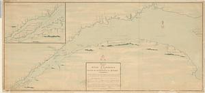
United States of America : The course of the River St. Laurence, from Lake Ontario, to Manicougan Point
98.
15 lots of 440a each in Great Lot no. 4 of Macomb purchase : 6600 acres within 2 miles of the St. Lawrence Turnpike & 1/2 mile...
99.
The above is a connection of the three surveys which I have been able to make on Peters Creek, of yours to gether with John...
100.
An accurate map of Canada, with the adjacent countries; exhibiting the late seat of war between the English & French in those...
‹ Prev
Next ›
1
2
3
4
5
6
7
8
9
…
47
48