Toggle navigation
LMEC Home
Exhibitions
Georeferencing
Tools for Teachers
Collections
My Favorites
Sign Up / Log In
Search
Search the map portal
Map Collection
Map Collection
Map Sets
Search
Search
Search for
Search In
All Fields
Creator
Title
Subject
Place
Search All Digital Collections
Advanced Search
929 Results
My Search
Start Over
More Like
commonwealth-oai:bz60ht038
Remove constraint More Like: commonwealth-oai:bz60ht038
Filter your Search
Place
North and Central America
903
United States
643
Canada
205
New York
192
Quebec
111
Pennsylvania
60
New Jersey
54
Nova Scotia
48
more
Place
»
Topic
United States--History--Revolution, 1775-1783--Maps
305
United States--History--French and Indian War, 1754-1763--Maps
149
Saint Lawrence River--Maps
43
Newport (R.I.)--Maps
27
New York (State)--Maps
24
Georgia--Maps
23
Hudson River (N.Y. and N.J.)--Maps
21
Québec (Québec)--Maps
21
more
Topic
»
Date
Date range begin
–
Date range end
Current results range from
1700
to
1987
View distribution
Creator
Rocque, Mary Ann
29
Bellin, Jacques Nicolas, 1703-1772
26
Holland, Samuel, 1728-1801
25
Montrésor, John, 1736-1799
25
Jefferys, Thomas, -1771
24
Clinton, Henry, Sir, 1738?-1795
19
Robert Sayer and John Bennett (Firm)
15
Hills, John, active 1777-1819
13
more
Creator
»
Format
Maps/Atlases
913
Drawings/Illustrations
11
Documents
5
Prints
1
Georeferenced
Yes
3
No
926
Collection
American Revolutionary War-Era Maps
915
William L. Clements Library Collection
909
Norman B. Leventhal Map & Education Center Collection
14
Maps from AAS
6
Applied Geographics, Inc. Records
1
Available to use
No known restrictions
14
Search Constraints
Sort by relevance
relevance
title
date (asc)
date (desc)
Number of results to display per page
20 per page
10
per page
20
per page
50
per page
100
per page
View results as:
grid view
map view
Search Results
301.
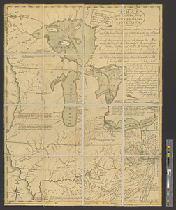
A map of the French settlements in North America
302.
A map of the Indian nations in the southern department, 1766
303.
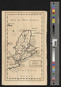
A map of the island of Cape Breton
304.
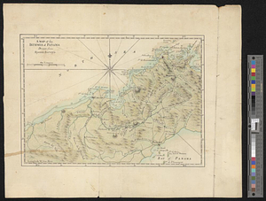
A map of the isthmus of Panama drawn from Spanish surveys
305.
A map of the lakes & Hudsons Bay
306.
A map of the lakes & Hudsons Bay
307.
Map of the middle states of America : comprehends New-York, New-Jersey, Pennsylvania, Delaware, and the territory N:W: of Ohio
308.
Map of the middle states of America : comprehends New-York, New-Jersey, Pennsylvania, Delaware, and the territory N:W: of Ohio
309.
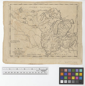
A map of the north west parts of the United States of America
310.
A map of the North Western Territory
311.
A map of the northern and middle states; comprehending the western territory and the British dominions in North America from...
312.
Map of the northern part of the United States of America
313.
A map of the pass at Jamaica, Long Island : surveyed by order of his excellency General Sir Henry Clinton K:B: commander in...
314.
Map of the powers at war with Great Britain, 1783
315.
A map of the province of Massachusetts Bay, and colony of Rhode Island, with part of Connecticut, New Hampshire, and Vermont
316.
Map of the Second Nine Partners Tract in Dutchess County, protracted by a scale of one hundred chains to an inch
317.
A map of the United States
318.
Map of the United States and their territory
319.
A map of the United States east of the Mississippi River in which the land ceded by the Treaty of Paris is divided by parallels...
320.
A map of the United States east of the Mississippi River in which the land ceded by the Treaty of Paris is divided by parallels...
‹ Prev
Next ›
1
2
…
12
13
14
15
16
17
18
19
20
…
46
47