Toggle navigation
LMEC Home
Exhibitions
Georeferencing
Tools for Teachers
Collections
My Favorites
Sign Up / Log In
Search
Search the map portal
Map Collection
Map Collection
Map Sets
Search
Search
Search for
Search In
All Fields
Creator
Title
Subject
Place
Search All Digital Collections
Advanced Search
973 Results
My Search
Start Over
More Like
commonwealth-oai:b5648r828
Remove constraint More Like: commonwealth-oai:b5648r828
Filter your Search
Place
North and Central America
945
United States
684
New York
229
Canada
206
Quebec
112
Pennsylvania
61
New Jersey
60
Massachusetts
49
more
Place
»
Topic
United States--History--Revolution, 1775-1783--Maps
330
United States--History--French and Indian War, 1754-1763--Maps
149
New York (N.Y.)--Maps
48
Saint Lawrence River--Maps
43
Manhattan (New York, N.Y.)--Maps
30
Newport (R.I.)--Maps
27
New York (State)--Maps
26
Hudson River (N.Y. and N.J.)--Maps
22
more
Topic
»
Date
Date range begin
–
Date range end
Current results range from
1700
to
1932
View distribution
Creator
Rocque, Mary Ann
29
Holland, Samuel, 1728-1801
26
Jefferys, Thomas, -1771
25
Montrésor, John, 1736-1799
25
Bellin, Jacques Nicolas, 1703-1772
24
Clinton, Henry, Sir, 1738?-1795
19
Robert Sayer and John Bennett (Firm)
16
Kitchin, Thomas, 1719-1784
14
more
Creator
»
Format
Maps/Atlases
957
Drawings/Illustrations
11
Manuscripts
6
Documents
5
Prints
1
Georeferenced
Yes
11
No
962
Collection
American Revolutionary War-Era Maps
936
William L. Clements Library Collection
909
Norman B. Leventhal Map & Education Center Collection
38
Urban Maps
25
American Antiquarian Society Collection
11
Boston and New England Maps
5
New-York Historical Society Collection
4
MacLean Collection Map Library
3
more
Collection
»
Available to use
No known restrictions
42
Creative Commons license
5
Search Constraints
Sort by relevance
relevance
title
date (asc)
date (desc)
Number of results to display per page
20 per page
10
per page
20
per page
50
per page
100
per page
View results as:
grid view
map view
Search Results
341.
Plan of the city of New York in North America : surveyed in the years 1766 & 1767
342.
Plan of the city of New-York
343.
The provinces of New York, and New Jersey, : with part of Pensilvania [sic], and the province of Quebec
344.
Rand McNally & Co.'s map of New York City, Brooklyn, Jersey City and vicinity
345.
The strangers mercantile guide map of the cities of New York, Brooklyn, Jersey City, Hoboken, etc
346.
This plan of the City of New York (within the palisades which were erected in the year 1743) was made for the purpose of...
347.
Topographical map of the City and County of New-York, and the adjacent country : with views in the border of the principal...
348.
Various plans and draughts of cities, towns, harbours &c. drawn from the latest authorities
349.
An accurate map of the United States of America : according to the Treaty of Peace of 1783
350.
Atlas to Marshall's life of Washington
351.
Boston its environs and harbour, : with the rebels works raised against that town in 1775, from the observations of Lieut. Page...
352.
Boston with its environs
353.
Carte de l'affaire de Montmouth, ou le Général Washington commandon l'armée Americaine, et le Général Clinton l'armée...
354.
Carte du theatre de la guerre presente en Amerique
355.
Carte nouvelle des posséssions angloises en Amérique dressée pour l'intelligence de la guerre présente et divisée suivant les...
356.
Centennial map of Concord, 1775-1875
357.
[Chart of Boston Harbor and the surrounding areas]
358.
Gen. Washington's Revolutionary campaign war map : after a survey ordered by him showing the position of his army in defence of...
359.
Map of American camp in New Jersey and surrounding countryside
360.
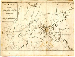
Map of the seat of the late war at Boston in the state of Massachusetts
‹ Prev
Next ›
1
2
…
14
15
16
17
18
19
20
21
22
…
48
49


![[Chart of Boston Harbor and the surrounding areas]](https://bpldcassets.blob.core.windows.net/derivatives/images/commonwealth:6108vs71d/image_thumbnail_300.jpg)