Toggle navigation
LMEC Home
Exhibitions
Georeferencing
Tools for Teachers
Collections
My Favorites
Sign Up / Log In
Search
Search the map portal
Map Collection
Map Collection
Map Sets
Search
Search
Search for
Search In
All Fields
Creator
Title
Subject
Place
Search All Digital Collections
Advanced Search
1206 Results
My Search
Start Over
More Like
commonwealth-oai:3j337173v
Remove constraint More Like: commonwealth-oai:3j337173v
Filter your Search
Place
North and Central America
1,180
United States
899
Massachusetts
267
New York
254
Canada
209
Quebec
112
Pennsylvania
70
Suffolk (county)
68
more
Place
»
Topic
United States--History--Revolution, 1775-1783--Maps
306
Massachusetts--Maps
235
United States--History--French and Indian War, 1754-1763--Maps
150
New York (State)--Maps
85
Boston (Mass.)--Maps
57
Saint Lawrence River--Maps
43
New England--Maps
35
Rhode Island--Maps
35
more
Topic
»
Date
Date range begin
–
Date range end
Current results range from
1700
to
2020
View distribution
Creator
Rocque, Mary Ann
29
Holland, Samuel, 1728-1801
26
Bellin, Jacques Nicolas, 1703-1772
25
Montrésor, John, 1736-1799
25
Jefferys, Thomas, -1771
24
MassGIS (Office : Mass.)
20
Clinton, Henry, Sir, 1738?-1795
19
Geo. H. Walker & Co
17
more
Creator
»
Format
Maps/Atlases
1,188
Drawings/Illustrations
11
Manuscripts
11
Documents
5
Prints
2
Ephemera
1
Georeferenced
Yes
72
No
1,134
Collection
American Revolutionary War-Era Maps
943
William L. Clements Library Collection
909
Norman B. Leventhal Map & Education Center Collection
253
Boston and New England Maps
183
Applied Geographics, Inc. Records
20
David Judkins Weaver Papers
18
American Antiquarian Society Collection
13
Urban Maps
12
more
Collection
»
Available to use
No known restrictions
252
Creative Commons license
13
Search Constraints
Sort by relevance
relevance
title
date (asc)
date (desc)
Number of results to display per page
20 per page
10
per page
20
per page
50
per page
100
per page
View results as:
grid view
map view
Search Results
961.
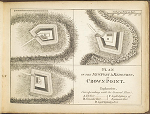
Plan of the new fort & redoubts, at Crown Point
962.
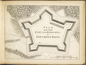
Plan of the new fort and redoubts, at New Crown Point
963.
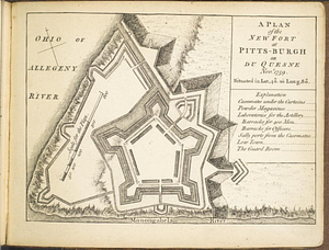
A plan of the new fort at Pitts-Burgh or Du Quesne Novr. 1759 : situated in lat. 40 20' long. 80
964.
A plan of the Palace Barracks at Quebec with the environs, relative to a report of this date and an estimate of the expence of...
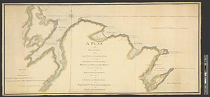
965.
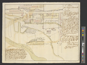
Plan of the part of Canada and the River St; Lawrence which lies between the Coteau des Cedres the uppermost settlements of...
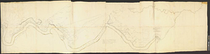
966.
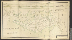
Plan of the peninsula of Chesopeak Bay : compiled from actual surveys
967.
Plan of the position of his majesty's troops at Rhode Island, after the defeat of the rebels the 29th of August 1778
968.
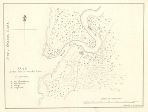
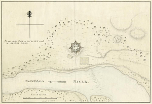
Plan of the post at Oneida Lake
969.
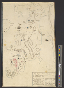
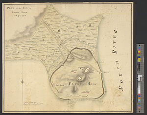
Plan of the post at Paulus's Hook, 24 July 1778
970.
Plan of the post at the west end of Oneida Lake
971.
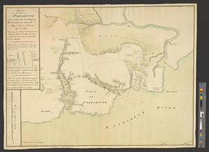
Plan of the post of Portsmouth as it is occupied by his majesty's forces under the command of Major General Phillips, April...
972.
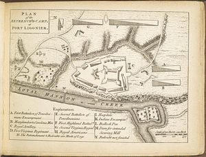
Plan of the retrench'd camp, at Fort Ligonier
973.
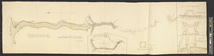
Plan of the river &c from Albany to Oswego in America
974.
Plan of the river Mississippi from the Indian village of the Tonicas to the river Ibberville, shewing the lands surveyed...
975.
A plan of the river Ohio from Fort Pitt to the Mississipi : by order of ye chief engineer
976.
A plan of the river St. Laurence, from Sillery to the fall of Montmerenci, with the operations of the siege of Quebec; under...
977.
Plan of the road and river between Niagara and fort Schlosser with the different posts erected on the communication, by order...
978.
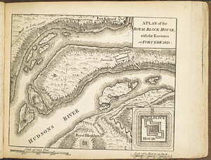
A plan of the Royal Block House, with the environs at Fort Edward
979.
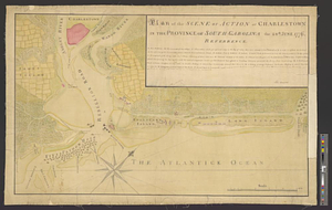
Plan of the scene of action at Charlestown in the province of South Carolina the 28th June 1776
980.
A plan of the sea coast from Gage Point to Cumberland Cape including Dartmouth and Granby Bays with the coal mines in that...
‹ Prev
Next ›
1
2
…
45
46
47
48
49
50
51
52
53
…
60
61
![Plan of the part of Canada and the River St; Lawrence which lies between the Coteau des Cedres the uppermost settlements of Canada, and the Island of St; Therese, containing the Island of Montreal; Isle Jesus; Isle Bisare; Isle Perault &c. the lakes of St; Louis les Deux Montagnes &c, formed by the River St; Lawrence. the city of Montreal, all the villages, fortified posts; habitations and cultivated country throughout the whole extent. The whole from a survey carried on under the direction of the Honourble; [sic] Brigr; General Murray, govenour [sic] of Quebec](https://bpldcassets.blob.core.windows.net/derivatives/metadata/commonwealth-oai:vq283p14m/image_thumbnail_300.jpg)