Toggle navigation
LMEC Home
Exhibitions
Georeferencing
Tools for Teachers
Collections
My Favorites
Sign Up / Log In
Search
Search the map portal
Map Collection
Map Collection
Map Sets
Search
Search
Search for
Search In
All Fields
Creator
Title
Subject
Place
Search All Digital Collections
Advanced Search
1015 Results
My Search
Start Over
More Like
commonwealth-oai:1j92m497c
Remove constraint More Like: commonwealth-oai:1j92m497c
Filter your Search
Place
North and Central America
989
United States
716
New York
251
Canada
209
Quebec
112
Pennsylvania
69
New Jersey
62
Nova Scotia
48
more
Place
»
Topic
United States--History--Revolution, 1775-1783--Maps
305
United States--History--French and Indian War, 1754-1763--Maps
150
New York (State)--Maps
85
Saint Lawrence River--Maps
43
New Hampshire--Maps
32
New England--Maps
29
Vermont--Maps
29
Pennsylvania--Maps
28
more
Topic
»
Date
Date range begin
–
Date range end
Current results range from
1700
to
1981
View distribution
Creator
Rocque, Mary Ann
29
Holland, Samuel, 1728-1801
26
Bellin, Jacques Nicolas, 1703-1772
25
Montrésor, John, 1736-1799
25
Jefferys, Thomas, -1771
24
Clinton, Henry, Sir, 1738?-1795
19
Robert Sayer and John Bennett (Firm)
15
Hills, John, active 1777-1819
13
more
Creator
»
Format
Maps/Atlases
999
Drawings/Illustrations
11
Documents
5
Manuscripts
2
Prints
1
Georeferenced
Yes
13
No
1,002
Collection
American Revolutionary War-Era Maps
936
William L. Clements Library Collection
909
Norman B. Leventhal Map & Education Center Collection
81
Boston and New England Maps
38
American Antiquarian Society Collection
18
MacLean Collection Map Library
4
Applied Geographics, Inc. Records
1
David Judkins Weaver Papers
1
more
Collection
»
Available to use
No known restrictions
82
Creative Commons license
1
Search Constraints
Sort by relevance
relevance
title
date (asc)
date (desc)
Number of results to display per page
20 per page
10
per page
20
per page
50
per page
100
per page
View results as:
grid view
map view
Search Results
861.
Region of Gaspee Bay
862.
Region of Hare Island
863.
Report of the state of the town wall and citadel of Montreal the 4th June 1774
864.
Richmond
865.
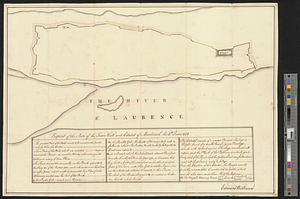
The River St. Lawrence from Mal Bay to the Basin of Quebec
866.
The River St. Lawrence from the Basin of Quebec to the Falls of Richeu
867.
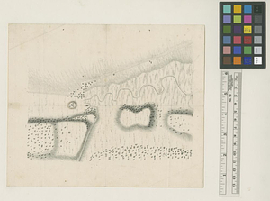
River valley with several foothills and swamp
868.
La rivière du Détroit depuis le Lac Sainte Claire jusqu'au Lac Erié
869.
The road from New Bridge and Hackinsack to Burlington
870.
Roads from Windsor to Easton through the highlands
871.
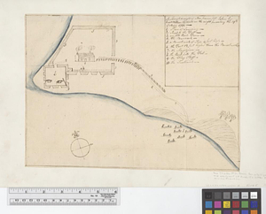
A rough draught of New Haven fort
872.
Rough Scetch of the King's Domain at Detroit
873.
A rough sketch of the field of battle, near Turtle Creek, of the 9th July, with the disposition of the British troops, and...
874.
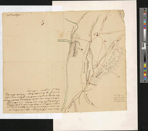
A rude sketch of a part of the road between the township of Horton and Granville on the river of Annapolis, relative to a...
875.
S. east view of Fort St. Tammany : N. Hayward to Major H. Burbeck
876.
Saml Wath to Abel Richardson : Wm Foster to James Foster exec ditto
877.
Sandy Hook, New Jersey
878.
Sault aux Recollets
879.
Savannah and its defenses
880.
Savannah River and Savannah Sound
‹ Prev
Next ›
1
2
…
40
41
42
43
44
45
46
47
48
…
50
51