Toggle navigation
LMEC Home
Exhibitions
Georeferencing
Tools for Teachers
Collections
My Favorites
Sign Up / Log In
Search
Search the map portal
Map Collection
Map Collection
Map Sets
Search
Search
Search for
Search In
All Fields
Creator
Title
Subject
Place
Search All Digital Collections
Advanced Search
1028 Results
My Search
Start Over
More Like
commonwealth-oai:0c487j853
Remove constraint More Like: commonwealth-oai:0c487j853
Filter your Search
Place
North and Central America
988
United States
696
New York
251
Canada
236
Quebec
122
Pennsylvania
69
Saint Lawrence River
66
New Jersey
62
more
Place
»
Topic
United States--History--Revolution, 1775-1783--Maps
305
United States--History--French and Indian War, 1754-1763--Maps
162
New York (State)--Maps
85
Saint Lawrence River--Maps
67
Newport (R.I.)--Maps
27
Pennsylvania--Maps
27
Québec (Québec)--Maps
24
Hudson River (N.Y. and N.J.)--Maps
23
more
Topic
»
Date
Date range begin
–
Date range end
Current results range from
1700
to
1976
View distribution
Creator
Jefferys, Thomas, -1771
30
Bellin, Jacques Nicolas, 1703-1772
29
Holland, Samuel, 1728-1801
29
Montrésor, John, 1736-1799
29
Rocque, Mary Ann
29
Clinton, Henry, Sir, 1738?-1795
19
Robert Sayer and John Bennett (Firm)
17
Orme, Robert, -1781
14
more
Creator
»
Format
Maps/Atlases
1,012
Drawings/Illustrations
11
Documents
5
Manuscripts
3
Prints
1
Georeferenced
Yes
7
No
1,021
Collection
American Revolutionary War-Era Maps
965
William L. Clements Library Collection
909
Norman B. Leventhal Map & Education Center Collection
68
Library and Archives Canada Collection
19
Boston and New England Maps
14
American Antiquarian Society Collection
13
MacLean Collection Map Library
9
Richard H. Brown Revolutionary War Map Collection at Mount Vernon
4
more
Collection
»
Available to use
No known restrictions
70
Creative Commons license
8
Search Constraints
Sort by relevance
relevance
title
date (asc)
date (desc)
Number of results to display per page
20 per page
10
per page
20
per page
50
per page
100
per page
View results as:
grid view
map view
Search Results
221.
Cours du fleuve St. Laurent : troisieme feuille : depuis le mont Camille jusqu'a l'isle d'Anticosti
222.
Iroquois or St. Lawrence
223.
A map of part of Canada for the use of His Majesty's Secretary of State, compiled in the Surveyor Generals Office, pursuant to...
224.
A map of the several dispositions of the English fleet & army on the river S.t Laurence, to the taking of Quebec
225.
A new map of the province of Quebec, : according to the Royal proclamation, of the 7th of October 1763
226.
A new map of the province of Quebec, : according to the Royal proclamation, of the 7th of October 1763
227.
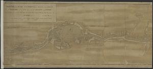
A plan of the city of Quebec the capital of Canada : as it surrender'd 18 Septemb.r 1759 to the British fleet and army ;...
228.
A plan of the River St. Laurence from Green Island to Cape Carrouge
229.
Plan of the river St Lawrence fom the Island of Anticosta to Quebec ... from a manuscript found on board ye Alcide taken June...
230.
Plan of the river St. Lawrence from the Island of Anticosta to Quebec ... from a manuscript found on board of the Alcide taken...
231.
Plan of the town of Quebec the capital of Canada in North America : with the bason and a part of the adjacent country shewing...
232.
Plan of the town of Quebec the capital of Canada in North America : with the bason and a part of the adjacent country shewing...
233.
Plan of the town of Quebec the capital of Canada in North America : with the bason and a part of the adjacent country shewing...
234.
Profile of the river St. Lawrence between Montreal and Quebec shewing the deepening of the ship channel
235.
Sketch of the river St Lawrence from Montreal to the island of St Barnaby on the south side, and the islands of Jeremy on the...
236.
Sketch of the river St Lawrence from Montreal to the island of St Barnaby on the south side, and the islands of Jeremy on the...
237.
Sketch of the river St. Lawrence from Montreal to the island St. Barnaby on the south side, and the islands of Jeremy on the...
238.
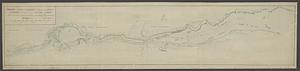
United States of America : The course of the River St. Laurence, from Lake Ontario, to Manicougan Point
239.
1st. sheet of De Witt's state-map of New York
240.
Carte de la Nouvelle Angleterre, Nouvelle Yorck, et Pensilvanie. : Pour servir à l'Histoire générale des voyages
‹ Prev
Next ›
1
2
…
8
9
10
11
12
13
14
15
16
…
51
52