Toggle navigation
LMEC Home
Exhibitions
Georeferencing
Tools for Teachers
Collections
My Favorites
Sign Up / Log In
Search
Search the map portal
Map Collection
Map Collection
Map Sets
Search
Search
Search for
Search In
All Fields
Creator
Title
Subject
Place
Search All Digital Collections
Advanced Search
340 Results
My Search
Start Over
More Like
commonwealth:z603vv407
Remove constraint More Like: commonwealth:z603vv407
Filter your Search
Place
North and Central America
273
United States
211
Suffolk (county)
75
Boston
73
Massachusetts
41
New York
32
Canada
28
North America
27
more
Place
»
Topic
Boston (Mass.)--Maps--Early works to 1800
49
Boston Harbor (Mass.)--Maps--Early works to 1800
22
Boston (Mass.)--History--Revolution, 1775-1783--Maps--Early works to 1800
19
North America--Maps--Early works to 1800
18
New England--Maps--Early works to 1800
11
United States--History--Revolution, 1775-1783--Maps--Early works to 1800
11
Vues d'optique
10
Bunker Hill, Battle of, Boston, Mass., 1775--Maps--Early works to 1800
9
more
Topic
»
Date
Date range begin
–
Date range end
Current results range from
1694
to
1879
View distribution
Creator
Faden, William, 1749-1836
33
Jefferys, Thomas, -1771
30
Le Rouge, Georges-Louis
24
Des Barres, Joseph F. W. (Joseph Frederick Wallet), 1722-1824
22
Sayer, Robert, 1725-1794
19
Korn, Christoph Heinrich, 1726-1783
11
Raspe, Gabriel Nicolaus, 1712-1785
11
Simcoe, John Graves, 1752-1806
10
more
Creator
»
Format
Maps/Atlases
297
Prints
32
Manuscripts
25
Drawings/Illustrations
9
Books
2
Georeferenced
Yes
18
No
322
Collection
American Revolutionary War-Era Maps
330
Richard H. Brown Revolutionary War Map Collection at Mount Vernon
293
Boston and New England Maps
42
Norman B. Leventhal Map & Education Center Collection
39
Urban Maps
25
Mapping Boston Collection
8
Maritime Charts and Atlases
6
Library of Congress Collection
3
more
Collection
»
Available to use
Creative Commons license
305
No known restrictions
33
Search Constraints
Sort by relevance
relevance
title
date (asc)
date (desc)
Number of results to display per page
20 per page
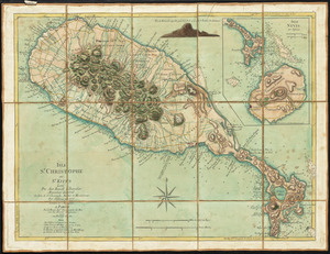
10
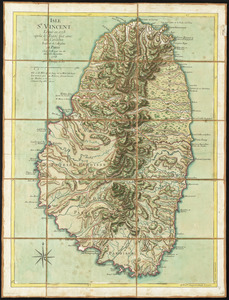
per page
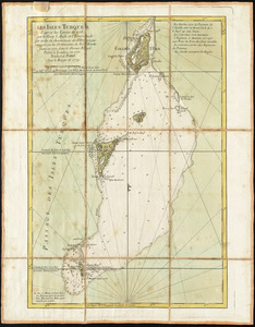
20
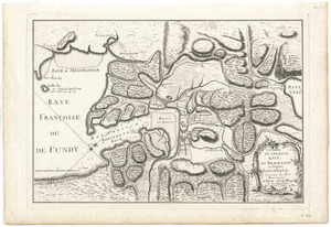
per page
50
per page
100
per page
View results as:
grid view
map view
Search Results
141.
Exact plan of General Gage's lines on Boston Neck in America
142.
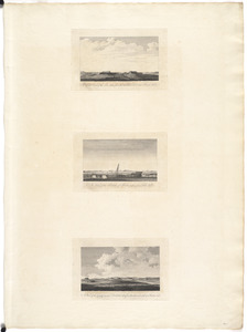
A front view of the lines taken from the advanced post near Browns house : A view of the harbour of Boston taken from Fort Hill...
143.
A general map of North America : in which is express'd the several new roads, forts, engagements, &c, taken from actual surveys...
144.
A general map of the middle British colonies, in America : viz Virginia, Màriland, Dèlaware, Pensilvania, New-Jersey,...
145.
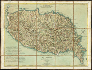
La Grenade : divisée par paroisses
146.
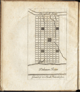
Grundriss der stadt Philadelphia
147.
Grundriss des nördlichen theils der Neujorks Insel : nebst den am 16. Novbr. 1776. eroberten Fort Washington nun das Fort...
148.
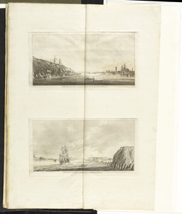
The harbour and part of the town of Havannah : The entrance of Havannah, from within the harbour
149.
Isle St. Christophe ou St. Kitts
150.
Isle St. Vincent
151.
Les Isles Turques d'après les levées de 1753 par le sloop l'Aigle et l'Emeraude par ordre du Gouverneur de St. Domingue...
152.
L'isthme de l'Acadie, Baye du Beaubassin, en Anglois Shegnekto, environs du Fort Beausejour
153.
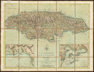
La Jamaique
154.
Karte von dem Ostlichen-Stucke von Neu Franckreich oder Canada in America : besonders aber Acadia und Neu Schottland
155.
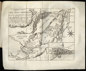
Karte von der Insel Montreal und den gegenden umher, nach den manuscripten der karten, grundrisse und tagebücher beÿ der...
156.
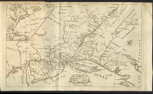
Karte von Neu England, Neu Yorck und Pensilvanien
157.
Krigs theatreni i America, 1777 = : seat of war in America, 1777
158.
LʼAmérique Septentrionale et Méridionale divisée suivant ses différens pays
159.
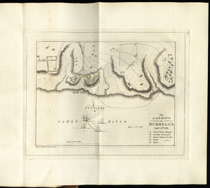
The landing at Burrell's, April 17th. 1781
160.
A large and particular plan of Shegnekto Bay, and the circumjacent country, with the forts and settlements of the French 'till...
‹ Prev
Next ›
1
2
…
4
5
6
7
8
9
10
11
12
…
16
17