Toggle navigation
LMEC Home
Exhibitions
Georeferencing
Tools for Teachers
Collections
My Favorites
Sign Up / Log In
Search
Search the map portal
Map Collection
Map Collection
Map Sets
Search
Search
Search for
Search In
All Fields
Creator
Title
Subject
Place
Search All Digital Collections
Advanced Search
378 Results
My Search
Start Over
More Like
commonwealth:z603vv08g
Remove constraint More Like: commonwealth:z603vv08g
Filter your Search
Place
North and Central America
289
United States
180
North America
110
Canada
31
New York
31
Suffolk (county)
31
Boston
29
South America
11
more
Place
»
Topic
North America--Maps
85
North America--Maps--Early works to 1800
18
Boston (Mass.)--History--Revolution, 1775-1783--Maps--Early works to 1800
16
United States--Maps
11
Vues d'optique
10
Gibraltar--History--Siege, 1779-1783--Maps--Early works to 1800
9
New York (N.Y.)--Pictorial works--Early works to 1800
9
United States--History--French and Indian War, 1754-1763--Maps--Early works to 1800
9
more
Topic
»
Date
Date range begin
–
Date range end
Current results range from
1740
to
1945
View distribution
Creator
Faden, William, 1749-1836
35
Jefferys, Thomas, -1771
31
Le Rouge, Georges-Louis
24
Des Barres, Joseph F. W. (Joseph Frederick Wallet), 1722-1824
21
Sayer, Robert, 1725-1794
21
Raspe, Gabriel Nicolaus, 1712-1785
12
Korn, Christoph Heinrich, 1726-1783
11
Simcoe, John Graves, 1752-1806
10
more
Creator
»
Format
Maps/Atlases
335
Prints
32
Manuscripts
23
Drawings/Illustrations
9
Books
2
Georeferenced
Yes
25
No
353
Collection
American Revolutionary War-Era Maps
336
Richard H. Brown Revolutionary War Map Collection at Mount Vernon
293
Norman B. Leventhal Map & Education Center Collection
41
American Antiquarian Society Collection
17
William L. Clements Library Collection
12
New York Public Library Collection
9
MacLean Collection Map Library
6
Boston and New England Maps
4
more
Collection
»
Available to use
Creative Commons license
303
No known restrictions
41
Search Constraints
Sort by relevance
relevance
title
date (asc)
date (desc)
Number of results to display per page
20 per page
10
per page
20
per page
50
per page
100
per page
View results as:
grid view
map view
Search Results
21.
Carte du Mexique et des pays limitrophes situés au nord et à l'est : dressée d'après la grande carte de la Nouvelle Espagne...
22.
Carte nouvelle des posséssions angloises en Amérique dressée pour l'intelligence de la guerre présente et divisée suivant les...
23.
Colton's map of the United States of America, the British provinces, Mexico and the West Indies : showing the country from the...
24.
Diagram of the United States of America, Mexico, the West India Islands and Isthmus of Darien : showing proposed routes of the...
25.
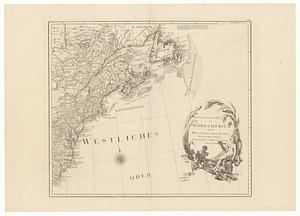
General karte von Nord America samt den Westindischen Inseln
26.
A General map of North America
27.
A general map of North America
28.
A general map of North America drawn from the best surveys 1795
29.
Illustrated Times map of North America
30.
Johnson's North America
31.
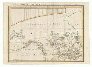
Karte des nordens von America, zur beurtheilung der wahrscheinlichkeit einer north=westlichen durchfahrt
32.
Karte von Nord-America für den schul- und privatgebrauch
33.
Linguistic families of American Indians north of Mexico
34.
A Map exhibiting the frontiers of Canada and the United States : intended to illustrate the operations of the British &...
35.
Map of North America : showing all routes to Alaska and Klondike country
36.
Map of North America
37.
Map of North America : reduced from map on scale of 1:5,000,000
38.
Map of North America
39.
Map of North America : to illustrate facts of geographical distribution
40.
A map of North America and the West Indies
‹ Prev
Next ›
1
2
3
4
5
6
…
18
19