Toggle navigation
LMEC Home
Exhibitions
Georeferencing
Tools for Teachers
Collections
My Favorites
Sign Up / Log In
Search
Search the map portal
Map Collection
Map Collection
Map Sets
Search
Search
Search for
Search In
All Fields
Creator
Title
Subject
Place
Search All Digital Collections
Advanced Search
160 Results
My Search
Start Over
More Like
commonwealth:z603vn03v
Remove constraint More Like: commonwealth:z603vn03v
Filter your Search
Place
North and Central America
135
United States
75
Rhode Island
17
Canada
13
Connecticut
10
Massachusetts
10
San Juan
8
Florida
7
more
Place
»
Topic
Manuscript maps--Early works to 1800
138
Rhode Island--Maps--Early works to 1800
14
Connecticut--Maps--Early works to 1800
10
Massachusetts--Maps--Early works to 1800
10
Añasco (P.R.)--Maps--Early works to 1800
6
Coasts--Florida--Maps--Early works to 1800
6
Coasts--Puerto Rico--Añasco--Maps--Early works to 1800
6
Coasts--Puerto Rico--Mayagüez--Maps--Early works to 1800
6
more
Topic
»
Date
Date range begin
–
Date range end
Current results range from
1700
to
1909
View distribution
Creator
Dumont de Montigny
14
Adlum, John, 1759-1836
9
Bingham, William, 1752-1804
9
Des Barres, Joseph F. W. (Joseph Frederick Wallet), 1722-1824
7
De Brahm, John Gerar William, 1717-approximately 1799
4
Real Escuela de Navegación (Cádiz, Spain)
4
Bew, John, -1793
2
Dampierre, chevalier de, fl. 1756
2
more
Creator
»
Format
Maps/Atlases
160
Manuscripts
140
Georeferenced
Yes
3
No
157
Collection
American Revolutionary War-Era Maps
154
Library of Congress Collection
97
Newberry Library Collection
39
Maritime Charts and Atlases
24
Norman B. Leventhal Map Center Collection
18
Boston and New England Maps
12
Urban Maps
8
Sidney R. Knafel Map Collection at Phillips Academy
4
more
Collection
»
Available to use
Creative Commons license
99
No known restrictions
18
Search Constraints
Sort by date (desc)
relevance
title
date (asc)
date (desc)
Number of results to display per page
20 per page
10
per page
20
per page
50
per page
100
per page
View results as:
grid view
map view
Search Results
21.
Plano del Puerto de Sn. Christobal de la Habana situado en la costa del N. de la ysla de Cuba en la latd. de 23 gs. 10 ms. y en...
22.
20 tracts, Charleston
23.
Armstrong County
24.
Cawanesque
25.
Jefferson, Venango & Armstrong
26.
Land ownership map of the William Bingham estate in Potter County, Pennsylvania
27.
The plot of Carroll'sburgh : [part of Washington D.C.]
28.
Susquehanna & Sinnemahoning
29.
Venango Co
30.
W. Br. Pine Cr
31.
W. Su[q.?] Cr., Bradford Co
32.
Plano d. las aguadas d. Sn. Juan y Sn. Franco. d. Añasco en la ysla de Pto. Rico, año d. 1787
33.
Plano de Puerto Real en la costa del S. de la Ysla Jamaica, 12 leguas al ote. de la Punta Oriental y por la latitud de...
34.
Nuevo plano de Puerto Rico
35.
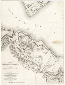
A plan of York Town and Gloucester, in the province of Virginia, shewing the works constructed for the defence of those posts...
36.
Pto. Rico
37.
Copia, del mapa de las Indias Occidentales : y del manifiesto que presentò D. Thomas Southuel, à la Superioridad, en el año...
38.
Plano del Lago de San Bernardo en el Seno Mexicano
39.
A map of the province of Massachusets Bay and colony of Rhode Island, with part of Connecticut, New Hampshire, and Vermont
40.
A map of the province of Massachusets Bay and colony of Rhode Island, with part of Connecticut, New Hampshire, and Vermont
‹ Prev
Next ›
1
2
3
4
5
6
7
8


![W. Su[q.?] Cr., Bradford Co](https://bpldcassets.blob.core.windows.net/derivatives/images/commonwealth:q524ng417/image_thumbnail_300.jpg)