Toggle navigation
LMEC Home
Exhibitions
Georeferencing
Tools for Teachers
Collections
My Favorites
Sign Up / Log In
Search
Search the map portal
Map Collection
Map Collection
Map Sets
Search
Search
Search for
Search In
All Fields
Creator
Title
Subject
Place
Search All Digital Collections
Advanced Search
186 Results
My Search
Start Over
More Like
commonwealth:z603vh26b
Remove constraint More Like: commonwealth:z603vh26b
Filter your Search
Place
North and Central America
117
United States
57
West Indies
51
Canada
22
North America
20
Caribbean Sea
13
New York
11
Boston
10
more
Place
»
Topic
West Indies--Maps
52
United States--Maps
27
North America--Maps
20
Canada--Maps
14
Caribbean Area--Maps
13
Mexico, Gulf of--Maps
13
Central America--Maps
11
Boston (Mass.)--Maps
9
more
Topic
»
Date
Date range begin
–
Date range end
Current results range from
1700
to
1993
View distribution
Creator
Reid, John, 1764?-1828
11
Bellin, Jacques Nicolas, 1703-1772
9
Farwell, John Whittemore, 1843-1929
9
Kitchin, Thomas, 1718-1784
9
Carleton, Osgood, 1742-1816
6
Tanner, Benjamin, 1775-1848
6
Anderson, Alexander, 1775-1870
5
Gibson, J. (John), active 1750-1792
5
more
Creator
»
Format
Maps/Atlases
186
Manuscripts
12
Georeferenced
Yes
22
No
164
Collection
American Revolutionary War-Era Maps
147
American Antiquarian Society Collection
138
Norman B. Leventhal Map Center Collection
39
Maritime Charts and Atlases
9
William L. Clements Library Collection
9
Boston and New England Maps
1
Available to use
No known restrictions
39
Creative Commons license
1
Search Constraints
Sort by date (asc)
relevance
title
date (asc)
date (desc)
Number of results to display per page
20 per page
10
per page
20
per page
50
per page
100
per page
View results as:
grid view
map view
Search Results
141.
The states of Maryland and Delaware from the latest surveys, 1799
142.
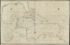
A chart of the West Indies, from the latest marine journals and surveys
143.
An Exact map of the province of Quebec with part of New York & New England from the latest surveys
144.
[Map of parts of Pennsylvania, New York and New Jersey]
145.
A Map of the United States
146.
North America
147.
North Carolina form the best authorities. 1800
148.
Nth. America
149.
Plan of the bay of Tortuga
150.
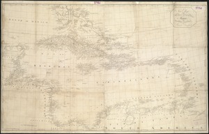
A new and correct general chart of the West Indies including the Gulf of Mexico & Bay of Honduras &c : collected from the...
151.
Chart of the West Indies and Spanish Dominions in North America
152.
Heathers, improved chart of the Bermudas, drawn from the best surveys
153.
Indie Occidentali
154.
A map of the United States and Canada, New-Scotland, New-Brunswick and New-Foundland = Carte des Etats-Unis avec le Canada, la...
155.
A new map of the West Indies, for the history of the British Colonies
156.
Map of North America from 20 to 80 degrees north latitude : exhibiting the recent discoveries, geographical and nautical; drawn...
157.
The north coast of the Gulf of Mexico, from St. Marks to Galveston
158.
Antilles ou Indes Occidentales
159.
Westindische Inseln
160.
Map of the United States of America, the British Provinces, Mexico, the West Indies and Central America, with part of New...
‹ Prev
Next ›
1
2
…
4
5
6
7
8
9
10


![[Map of parts of Pennsylvania, New York and New Jersey]](https://bpldcassets.blob.core.windows.net/derivatives/images/commonwealth:6108vt40m/image_thumbnail_300.jpg)