Toggle navigation
LMEC Home
Exhibitions
Georeferencing
Tools for Teachers
Collections
My Favorites
Sign Up / Log In
Search
Search the map portal
Map Collection
Map Collection
Map Sets
Search
Search
Search for
Search In
All Fields
Creator
Title
Subject
Place
Search All Digital Collections
Advanced Search
313 Results
My Search
Start Over
More Like
commonwealth:z603vg69x
Remove constraint More Like: commonwealth:z603vg69x
Filter your Search
Place
North and Central America
274
United States
153
New York
139
New Jersey
37
Canada
30
Hudson River
29
New England
23
Manhattan
18
more
Place
»
Topic
New York (State)--Maps
81
New York (N.Y.)--Maps
47
United States--History--Revolution, 1775-1783--Maps
46
New Jersey--Maps
37
Hudson River (N.Y. and N.J.)--Maps
29
New England--Maps
25
United States--Maps
21
Railroads--New York (State)--Maps
20
more
Topic
»
Date
Date range begin
–
Date range end
Current results range from
1700
to
1976
View distribution
Creator
Kitchin, Thomas, 1718-1784
11
Reid, John, 1764?-1828
11
Bellin, Jacques Nicolas, 1703-1772
9
Farwell, John Whittemore, 1843-1929
9
Carleton, Osgood, 1742-1816
6
Tanner, Benjamin, 1775-1848
6
United States. Post Office Dept
6
Anderson, Alexander, 1775-1870
5
more
Creator
»
Format
Maps/Atlases
313
Manuscripts
14
Drawings/Illustrations
1
Georeferenced
Yes
36
No
277
Collection
American Revolutionary War-Era Maps
214
American Antiquarian Society Collection
138
Norman B. Leventhal Map Center Collection
100
William L. Clements Library Collection
68
Urban Maps
20
Boston and New England Maps
15
New-York Historical Society Collection
3
New York Public Library Collection
2
more
Collection
»
Available to use
No known restrictions
103
Creative Commons license
4
Search Constraints
Sort by date (desc)
relevance
title
date (asc)
date (desc)
Number of results to display per page
20 per page
10
per page
20
per page
50
per page
100
per page
View results as:
grid view
map view
Search Results
1.
Transportation map of New York
2.
Map of Ho-De-No-Sau-Nee-Ga or the people of the long house : compiled 1851 by Lewis H. Morgan & Ely S. Parker a Seneca sachem...
3.
An aerial view of New York City showing how easily the weary traveler may reach the Herald Square Hotel wherein he will find...
4.
A map of the Seneca villages and the Jesuit and French contacts 1615-1708
5.
A map of the history of New York state
6.
A map of the wondrous isle of Manhattan
7.
Rand McNally official 1920 auto trails map : District number 6 : New England, eastern New York
8.
The official map of New York : compiled from United States government surveys, official state surveys, and other sources
9.
Hammond's complete map of New York City
10.
International map of the world on the scale 1:1,000,000
11.
Map of Ontario and Quebec showing location and capacity of flour mills and elevators
12.
A survey of the empire group : with a complete distance table, a compendious index of cities and post offices, with populations...
13.
A survey of the empire group : with a complete distance table, a compendious index of cities and post offices, with populations...
14.
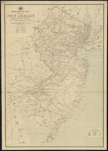
Post route map of the state of New Jersey showing post offices with the intermediate distances on mail routes in operation on...
15.
Post route map of the state of New York showing post offices with the intermediate distances on mail routes in operation on the...
16.
Scarborough's new railroad, post office, township and county map of New York with distances between stations
17.
New Jersey showing forest area and its relation to the principal watersheds
18.
Road map of the Albany-Troy district
19.
Map of greater New York : Map of the borough of Manhattan
20.
Map of northern part of New York City
‹ Prev
Next ›
1
2
3
4
5
…
15
16