Toggle navigation
LMEC Home
Exhibitions
Georeferencing
Tools for Teachers
Collections
My Favorites
Sign Up / Log In
Search
Search the map portal
Map Collection
Map Collection
Map Sets
Search
Search
Search for
Search In
All Fields
Creator
Title
Subject
Place
Search All Digital Collections
Advanced Search
320 Results
My Search
Start Over
More Like
commonwealth:z603vg69x
Remove constraint More Like: commonwealth:z603vg69x
Filter your Search
Place
North and Central America
307
United States
275
New York
151
New Jersey
43
Canada
30
Hudson River
29
New England
25
Massachusetts
22
more
Place
»
Topic
New York (State)--Maps
85
New York (N.Y.)--Maps
48
United States--History--Revolution, 1775-1783--Maps
47
New Jersey--Maps
40
Hudson River (N.Y. and N.J.)--Maps
29
New England--Maps
27
United States--Maps
21
Railroads--New York (State)--Maps
20
more
Topic
»
Date
Date range begin
–
Date range end
Current results range from
1700
to
1976
View distribution
Creator
Kitchin, Thomas, 1719-1784
11
Reid, John, 1764?-1828
11
Bellin, Jacques Nicolas, 1703-1772
9
Farwell, John Whittemore, 1843-1929
9
Carey, Mathew, 1760-1839
6
Carleton, Osgood, 1742-1816
6
Tanner, Benjamin, 1775-1848
6
United States. Post Office Dept
6
more
Creator
»
Format
Maps/Atlases
320
Manuscripts
14
Drawings/Illustrations
1
Georeferenced
Yes
36
No
284
Collection
American Revolutionary War-Era Maps
220
Maps from AAS
138
Norman B. Leventhal Map & Education Center Collection
101
William L. Clements Library Collection
68
Urban Maps
21
Boston and New England Maps
15
MacLean Collection Map Library
7
New-York Historical Society Collection
3
more
Collection
»
Available to use
No known restrictions
104
Creative Commons license
4
Search Constraints
Sort by relevance
relevance
title
date (asc)
date (desc)
Number of results to display per page
20 per page
10
per page
20
per page
50
per page
100
per page
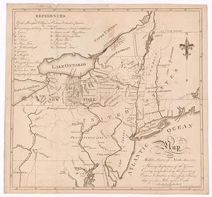
View results as:
grid view
map view
Search Results
141.
M. Progues wood land
142.
Map exhibiting the rail road, canal, lake and river routes from New York and Boston to the west, via Ogdensburgh, Buffalo and...
143.
Map exhibiting the rail road routes leading from Boston, to Ogdensburg and Buffalo, N.Y
144.
A map of a piece of land surveyd for Peter Coem in lot no 3 belonging the Henry Livingston esqr & laid down from a scale of 10...
145.
Map of Ho-De-No-Sau-Nee-Ga or the people of the long house : compiled 1851 by Lewis H. Morgan & Ely S. Parker a Seneca sachem...
146.
A map of lot no 1 in the Hardenbergh Patent
147.
Map of Morris's Purchase or West Geneseo in the state of New York : exhibiting part of the Lakes Erie and Ontario, the...
148.
Map of New England exhibiting the rail road & telegraphic lines now in operation
149.
A map of New York showing counties, manors, townships, and estates, ca. 1778
150.
A map of New York showing counties, manors, townships, and estates, ca. 1778
151.
Map of the country embracing the several routes examined with a view to a national road from Washington to Lake Ontario
152.
Map of the eastern division and branches, Erie Railway
153.
A map of the middle states of North America, shewing the position of the Geneseo country comprehending the counties of Ontario...
154.
Map of the New York Central & Hudson River and Boston & Albany Railroads : sea shore and summer resorts of New York and New...
155.
Map of the northern part of the state of New York
156.
A map of the Seneca villages and the Jesuit and French contacts 1615-1708
157.
Map of the several routes from Rochester to Buffalo : compiled from county maps and actual surveys in the office of the...
158.
Map of the Sodus Canal, and the internal improvements connecting with it forming the great route from the Atlantic to the Lakes
159.
A map of the state of New York
160.
Map of the State of New York
‹ Prev
Next ›
1
2
…
4
5
6
7
8
9
10
11
12
…
15
16