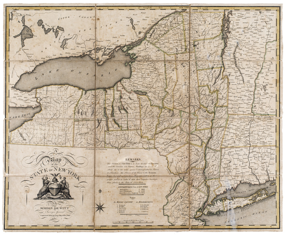
A map of the state of New York
This map is also available in American Revolutionary Geographies Online (ARGO), a collections portal especially built for material relating to the American Revolutionary War Era. Visit ARGO to learn more about this item and explore the historical geography of North America in the late eighteenth century.
Item Information
- Title:
- A map of the state of New York
- Cartographer:
- De Witt, Simeon, 1756-1834
- Publisher:
- Fairman, Gideon, 1774-1827
- Name on Item:
-
Simeon DeWitt, surveyor general
- Date:
-
1804
- Format:
-
Maps/Atlases
- Location:
- New-York Historical Society
- Collection (local):
-
New-York Historical Society Collection
- Subjects:
-
New York (State)--Maps
New York (State)--Administrative and political divisions--Maps
- Places:
-
New York
- Extent:
- 1 map : hand col. ; 57 x 70 cm.
- Terms of Use:
-
No known copyright restrictions.
No known restrictions on use.
- Publisher:
-
Albany :
G. Fairman
- Scale:
-
Scale [1:950,000]. 69 to a degree
- Language:
-
English
- Catalog Record:
-
https://library.nyu.edu/persistent/lcn/nyu_aleph003337058?institution=NYU&persistent
- Notes:
-
Shows county and town boundaries.
Relief shown pictorially.
"Contracted from his large map of the state."
"Entered according to Act of Congress the 19th day March 1804 by Simeon DeWitt of the state of New York."
Includes text, decorative cartouche, longitudes from New York, and index to towns in Kings and Richmond counties.
- Identifier:
-
93228d_StateNY1804_M31_2_9


