Toggle navigation
LMEC Home
Exhibitions
Georeferencing
Tools for Teachers
Collections
My Favorites
Sign Up / Log In
Search
Search the map portal
Map Collection
Map Collection
Map Sets
Search
Search
Search for
Search In
All Fields
Creator
Title
Subject
Place
Search All Digital Collections
Advanced Search
174 Results
My Search
Start Over
More Like
commonwealth:z603vg132
Remove constraint More Like: commonwealth:z603vg132
Filter your Search
Place
North and Central America
136
United States
56
Connecticut
37
Rhode Island
23
Canada
22
Massachusetts
21
New England
17
North America
17
more
Place
»
Topic
Connecticut--Maps
39
Rhode Island--Maps
24
Massachusetts--Maps
23
United States--Maps
20
New England--Maps
18
North America--Maps
17
West Indies--Maps
17
Canada--Maps
14
more
Topic
»
Date
Date range begin
–
Date range end
Current results range from
1750
to
1990
View distribution
Creator
Reid, John, 1764?-1828
11
Farwell, John Whittemore, 1843-1929
9
Kitchin, Thomas, 1718-1784
9
Bellin, Jacques Nicolas, 1703-1772
8
Carleton, Osgood, 1742-1816
6
Tanner, Benjamin, 1775-1848
6
Anderson, Alexander, 1775-1870
5
Gibson, J. (John), active 1750-1792
5
more
Creator
»
Format
Maps/Atlases
174
Manuscripts
13
Georeferenced
Yes
20
No
154
Collection
American Revolutionary War-Era Maps
140
American Antiquarian Society Collection
138
Norman B. Leventhal Map Center Collection
32
Boston and New England Maps
25
David Judkins Weaver Papers
5
William L. Clements Library Collection
3
Maritime Charts and Atlases
1
Sidney R. Knafel Map Collection at Phillips Academy
1
Available to use
No known restrictions
32
Creative Commons license
1
Search Constraints
Sort by date (desc)
relevance
title
date (asc)
date (desc)
Number of results to display per page
20 per page
10
per page
20
per page
50
per page
100
per page
View results as:
grid view
map view
Search Results
1.
Open space map of Connecticut, lands dedicated as open space, and selected undeveloped land, lands managed but not dedicated as...
2.
States of Massachusetts, Rhode Island and Connecticut : base map with highways and contours
3.
States of Massachusetts, Rhode Island and Connecticut : shaded relief
4.
States of Massachusetts, Rhode Island and Connecticut : base map with highways and contours
5.
Map of Connecticut
6.
The Commonwealth of Connecticut
7.
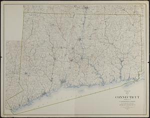
Connecticut
8.
Preliminary geological map of Connecticut
9.
Post route map of the states of Massachusetts, Rhode Island, Connecticut showing post offices with the intermediate distances...
10.
The National Publishing Company's railroad, post office, township and county map of Massachusetts, Rhode Island and Connecticut...
11.
Map of Connecticut
12.
Connecticut
13.
Johnson's Massachusetts Connecticut and Rhode Island
14.
Connecticut
15.
Connecticut with portions of New York & Rhode Island
16.
Map of Massachusetts, Connecticut and Rhode Island constructed from the latest authorities
17.
Sketch of the states of Massachusetts, Connecticut, and Rhode Island, and parts of New Hampshire & New York exhibiting the...
18.
Map of Massachusetts, Connecticut and Rhode Island constructed from the latest authorities
19.
Map of Massachusetts, Rhode-Island & Connecticut : compiled from the latest authorities
20.
Sketch of the states of Massachusetts, Connecticut, and Rhode Island, and parts of New Hampshire & New York exhibiting the...
‹ Prev
Next ›
1
2
3
4
5
…
8
9