Toggle navigation
LMEC Home
Exhibitions
Georeferencing
Tools for Teachers
Collections
My Favorites
Sign Up / Log In
Search
Search the map portal
Map Collection
Map Collection
Map Sets
Search
Search
Search for
Search In
All Fields
Creator
Title
Subject
Place
Search All Digital Collections
Advanced Search
962 Results
My Search
Start Over
More Like
commonwealth:z603vg06n
Remove constraint More Like: commonwealth:z603vg06n
Filter your Search
Place
North and Central America
948
United States
904
Boston
743
Suffolk (county)
743
Massachusetts
647
New York
56
Downtown Boston
35
South Carolina
28
more
Place
»
Topic
Boston (Mass.)--Maps
752
City planning--Massachusetts--Boston--Maps
104
Real property--Massachusetts--Boston--Maps
99
Landowners--Massachusetts--Boston--Maps
74
Urban renewal--Massachusetts--Boston--Maps
63
Massachusetts--Maps
50
New York (N.Y.)--Maps
48
Local transit--Massachusetts--Boston--Maps
47
more
Topic
»
Date
Date range begin
–
Date range end
Current results range from
1740
to
2023
View distribution
Creator
Boston Redevelopment Authority
114
Geo. H. Walker & Co
27
Boynton, George W., d. 1884
21
Sampson, Davenport & Co
21
Sampson, Murdock & Co
20
Bromley, George Washington
18
Bromley, Walter Scott
17
Lufkin, Richard F. (Richard Friend)
17
more
Creator
»
Format
Maps/Atlases
962
Manuscripts
22
Georeferenced
Yes
115
No
847
Collection
Norman B. Leventhal Map & Education Center Collection
657
Boston and New England Maps
580
Urban Maps
517
American Revolutionary War-Era Maps
190
Maps from AAS
138
Boston Redevelopment Authority Collection
120
William L. Clements Library Collection
42
Mapping Boston Collection
20
more
Collection
»
Available to use
No known restrictions
730
Creative Commons license
37
Search Constraints
Sort by relevance
relevance
title
date (asc)
date (desc)
Number of results to display per page
20 per page
10
per page
20
per page
50
per page
100
per page
View results as:
grid view
map view
Search Results
41.
Map of the city of Charleston, S.C. and vicinity : with table of reference to principle buildings, points of historical interest
42.
Plan de l'entrée de la rivière de Charleston le 30 Dexbre 1776
43.
Plan of Charleston and its defenses 1780
44.
Plan of Charlestown 1781
45.
Plan of the harbour of Charles Town, South Carolina
46.
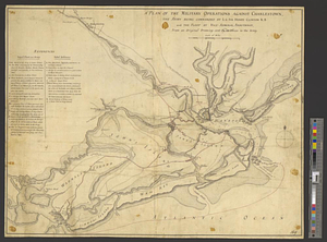
A plan of the military operations against Charlestown, the army being commanded by L.G. Sir Henry Clinton K.B. and the fleet by...
47.
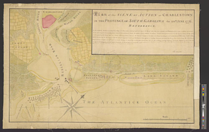
Plan of the scene of action at Charlestown in the province of South Carolina the 28th June 1776
48.
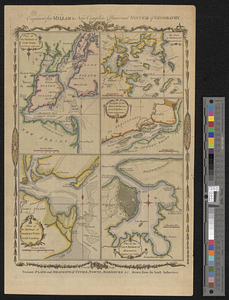
Plan of the seige [sic] of Charlestown in South Carolina
49.
A plan of the town, bar, harbour and environs, of Charlestown in South Carolina, with all the channels, soundings,...
50.
Siege of Charleston, South Carolina 1780
51.
Siege of Charlestown 1780
52.
Survey of the wharf lots lying between Broad and Queen streets, to ascertain the line, between Mr. Samuel Prideau junior & Mr....
53.
An aerial view of New York City showing how easily the weary traveler may reach the Herald Square Hotel wherein he will find...
54.
British troop dispositions in and near New York City
55.
British troop dispositions in and near New York City, July and August 1781
56.
Citizens & travelers guide map in, to and from the city of New York and adjacent places
57.
The Firemen's guide : a map of the City of New-York, showing the fire districts, fire limits, hydrants, public cisterns,...
58.
Grundriss des nördlichen Theils der Neujorks Insel nebst den am 16. Novbr. 1776. eroberten Fort Washington nun das Fort...
59.
Hammond's complete map of New York City
60.
Johnson's map of New York and the adjacent cities
‹ Prev
Next ›
1
2
3
4
5
6
7
…
48
49


![Plan of the seige [sic] of Charlestown in South Carolina](https://bpldcassets.blob.core.windows.net/derivatives/metadata/commonwealth-oai:rb692949z/image_thumbnail_300.jpg)