Toggle navigation
LMEC Home
Exhibitions
Georeferencing
Tools for Teachers
Collections
My Favorites
Sign Up / Log In
Search
Search the map portal
Map Collection
Map Collection
Map Sets
Search
Search
Search for
Search In
All Fields
Creator
Title
Subject
Place
Search All Digital Collections
Advanced Search
192 Results
My Search
Start Over
More Like
commonwealth:z603vg000
Remove constraint More Like: commonwealth:z603vg000
Filter your Search
Place
North and Central America
158
United States
101
Southern United States
27
South Carolina
26
Charleston
23
Charleston (county)
23
Canada
22
West Indies
18
more
Place
»
Topic
Southern States--Maps
29
United States--History--Revolution, 1775-1783--Maps
29
Charleston (S.C.)--Maps
23
United States--Maps
20
West Indies--Maps
18
North America--Maps
17
Canada--Maps
14
Boston (Mass.)--Maps
9
more
Topic
»
Date
Date range begin
–
Date range end
Current results range from
1750
to
1978
View distribution
Creator
Reid, John, 1764?-1828
11
Farwell, John Whittemore, 1843-1929
9
Kitchin, Thomas, 1719-1784
9
Bellin, Jacques Nicolas, 1703-1772
8
Carleton, Osgood, 1742-1816
6
Tanner, Benjamin, 1775-1848
6
Anderson, Alexander, 1775-1870
5
Gibson, J. (John), active 1750-1792
5
more
Creator
»
Format
Maps/Atlases
192
Manuscripts
12
Georeferenced
Yes
16
No
176
Collection
American Revolutionary War-Era Maps
168
American Antiquarian Society Collection
138
William L. Clements Library Collection
28
Norman B. Leventhal Map & Education Center Collection
23
MacLean Collection Map Library
2
Boston and New England Maps
1
Maritime Charts and Atlases
1
New York Public Library Collection
1
Available to use
No known restrictions
23
Creative Commons license
2
Search Constraints
Sort by relevance
relevance
title
date (asc)
date (desc)
Number of results to display per page
20 per page
10
per page
20
per page
50
per page
100
per page
View results as:
grid view
map view
Search Results
21.
Lines of Charleston
22.
Map of Charleston, S.C
23.
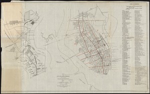
Map of the city of Charleston, S.C. and vicinity : with table of reference to principle buildings, points of historical interest
24.
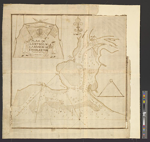
Plan de l'entrée de la rivière de Charleston le 30 Dexbre 1776
25.
Plan of Charleston and its defenses 1780
26.
Plan of Charlestown 1781
27.
Plan of the harbour of Charles Town, South Carolina
28.
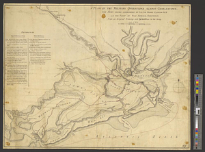
A plan of the military operations against Charlestown, the army being commanded by L.G. Sir Henry Clinton K.B. and the fleet by...
29.
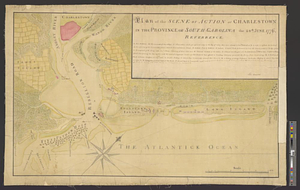
Plan of the scene of action at Charlestown in the province of South Carolina the 28th June 1776
30.
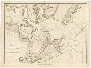
Plan of the seige [sic] of Charlestown in South Carolina
31.
A plan of the town, bar, harbour and environs, of Charlestown in South Carolina, with all the channels, soundings,...
32.
Siege of Charleston, South Carolina 1780
33.
Siege of Charlestown 1780
34.
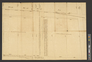
Survey of the wharf lots lying between Broad and Queen streets, to ascertain the line, between Mr. Samuel Prideau junior & Mr....
35.
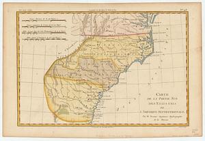
Carte de la partie sud des Etats Unis de l'Amerique Septentrionale
36.
Colton's rail road and county map of the Southern States containing the latest information
37.
The cotton kingdom
38.
Johnson's new rail road & county copper plate map of the Southern States from the latest and best information
39.
Lloyd's map of the Southern States, showing all the railroads, their stations & distances : also the counties, towns, villages,...
40.
Lloyd's new military map of the border & southern states
‹ Prev
Next ›
1
2
3
4
5
6
…
9
10


![Plan of the seige [sic] of Charlestown in South Carolina](https://bpldcassets.blob.core.windows.net/derivatives/metadata/commonwealth-oai:rb692949z/image_thumbnail_300.jpg)