Toggle navigation
LMEC Home
Exhibitions
Georeferencing
Tools for Teachers
Collections
My Favorites
Sign Up / Log In
Search
Search the map portal
Map Collection
Map Collection
Map Sets
Search
Search
Search for
Search In
All Fields
Creator
Title
Subject
Place
Search All Digital Collections
Advanced Search
178 Results
My Search
Start Over
More Like
commonwealth:xg94mq943
Remove constraint More Like: commonwealth:xg94mq943
Filter your Search
Place
North and Central America
159
Canada
151
Saint Lawrence River
68
United States
56
Quebec
50
New France
28
North America
15
Québec
14
more
Place
»
Topic
Canada--Maps--Early works to 1800
79
Saint Lawrence River--Maps
67
United States--Maps--Early works to 1800
26
New France--Maps
24
United States--History--French and Indian War, 1754-1763--Maps
24
Seven Years' War, 1756-1763--Campaigns--Canada--Maps
21
Longue-Pointe (Québec)--Maps
12
Mingan Islands (Québec)--Maps
12
more
Topic
»
Date
Date range begin
–
Date range end
Current results range from
1618
to
1891
View distribution
Creator
Jefferys, Thomas, -1771
17
Bellin, Jacques Nicolas, 1703-1772
15
Robert Sayer and John Bennett (Firm)
15
Cook, James, 1728-1779
14
Desjardins, pilot of Québec
12
Saunders, Charles, Sir, 1713?-1775
12
Holland, Samuel, 1728-1801
10
Anville, Jean Baptiste Bourguignon d', 1697-1782
7
more
Creator
»
Format
Maps/Atlases
178
Manuscripts
3
Georeferenced
No
178
Collection
American Revolutionary War-Era Maps
166
Library and Archives Canada Collection
52
William L. Clements Library Collection
43
MacLean Collection Map Library
40
Norman B. Leventhal Map & Education Center Collection
28
New York Public Library Collection
5
Richard H. Brown Revolutionary War Map Collection at Mount Vernon
3
American Antiquarian Society Collection
2
more
Collection
»
Available to use
No known restrictions
29
Creative Commons license
10
Search Constraints
Sort by relevance
relevance
title
date (asc)
date (desc)
Number of results to display per page
20 per page
10
per page
20
per page
50
per page
100
per page
View results as:
grid view
map view
Search Results
101.
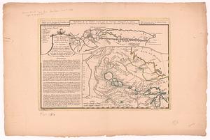
Carte d'une partie de l'Amérique Septentrionale pour servir à l'intelligence du mémoire sur les prétentions des Anglois au...
102.
Carte d'une partie du Nord Amerique dans la quelle se trouvent les isles et les provinces suivantes : l'Isle de la Terre-Neuve...
103.
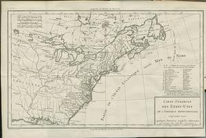
Carte générale des Etats-Unis de l'Amerique Septentrionale, renfermant aussi quelques provinces angloises adjacentes, pour les...
104.
Carte minéralogique, où l'on voit la nature des terreins du Canada et de la Louisiane
105.
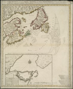
Carte nouvelle contenant la partie d'Amerique la plus septentrionale, ou sont exactement dêcrites les provinces suivantes...
106.
Carte nouvelle de l'Amerique angloise contenant tout ce que les anglois possedent sur le continent de l'Amerique Septentrionale...
107.
Carte physique des terreins les plus eleves de la partie occidentale du Canada : ou l'on voit les nouvelles decouveres des...
108.
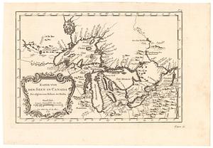
Karte von den seen in Canada zur allgemeinen historie der reisen
109.
A map exhibiting all the new discoveries in the interior parts of North America inscribed by permission to the honorable...
110.
A map exhibiting all the new discoveries in the interior parts of North America inscribed by permission to the honorable...
111.
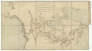
A map of America, between latitudes 40 and 70 north, and longitudes 45 and 180 west : exhibiting Mackenzie's track from...
112.
A map of Canada and the north part of Louisiana with the adjacent countrys
113.
A map of Canada and the north part of Louisiana with the adjacent countrys
114.
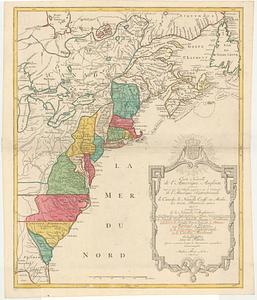
A map of the British and French dominions in North America : with the roads, distances, limits, and extent of the settlements,...
115.
A map of the northern and middle states : comprehending the western territory and the British dominions in North America from...
116.
A map of the northern and middle states : comprehending the western territory and the British dominions in North America ;...
117.
A map of the northern and middle states : comprehending the western territory and the British dominions in North America, from...
118.
A map of the northern and middle states : comprehending the western territory and the British dominions in North America :...
119.
Map of the United States in North America : with the British, French and Spanish dominions adjoining, according to the treaty...
120.
A new and accurate map of the British dominions in America, according to the treaty of 1763 : divided into the several...
‹ Prev
Next ›
1
2
3
4
5
6
7
8
9