Toggle navigation
LMEC Home
Exhibitions
Georeferencing
Tools for Teachers
Collections
My Favorites
Sign Up / Log In
Search
Search the map portal
Map Collection
Map Collection
Map Sets
Search
Search
Search for
Search In
All Fields
Creator
Title
Subject
Place
Search All Digital Collections
Advanced Search
8769 Results
My Search
Start Over
More Like
commonwealth:x633j6818
Remove constraint More Like: commonwealth:x633j6818
Filter your Search
Place
North and Central America
6,000
United States
4,916
Massachusetts
2,087
Europe
1,396
Suffolk (county)
1,047
Boston
1,020
Canada
451
Asia
438
more
Place
»
Topic
Boston (Mass.)--Maps
587
United States--Maps
284
Real property--Massachusetts--Boston--Maps
175
Massachusetts--Maps
171
Landowners--Massachusetts--Boston--Maps
133
New England--Maps
108
North America--Maps--Early works to 1800
103
Europe--Maps
79
more
Topic
»
Date
Date range begin
–
Date range end
Current results range from
1482
to
2023
View distribution
Creator
United States. Hydrographic Office
595
O.H. Bailey & Co
148
Des Barres, Joseph F. W. (Joseph Frederick Wallet), 1722-1824
123
United States. Post Office Dept
120
Ptolemy, 2nd cent
100
Walling, Henry Francis, 1825-1888
94
Geological Survey (U.S.)
91
Jefferys, Thomas, -1771
86
more
Creator
»
Format
Maps/Atlases
8,709
Manuscripts
216
Prints
56
Books
36
Objects/Artifacts
10
Drawings/Illustrations
8
Posters
5
Georeferenced
Yes
872
No
7,897
Collection
Norman B. Leventhal Map & Education Center Collection
8,702
Boston and New England Maps
2,240
Urban Maps
2,023
Maritime Charts and Atlases
1,083
American Revolutionary War-Era Maps
680
Boston Redevelopment Authority Collection
87
William L. Clements Library Collection
35
Maps from AAS
25
more
Collection
»
Available to use
No known restrictions
8,559
Creative Commons license
49
Search Constraints
Sort by relevance
relevance
title
date (asc)
date (desc)
Number of results to display per page
20 per page
10
per page
20
per page
50
per page
100
per page
View results as:
grid view
map view
Search Results
241.
A map of part of West Florida done under the direction of the honourable John Stuart esqr: & by him humbly inscribed to his...
242.
A map of West Florida and part of Et: Florida, Georgia part of So: Carolina i[n]cluding [torn] & Chactaw, Chickasaw & Creek...
243.
A new & accurate map of Louisiana, with part of Florida and Canada, : and the adjacent countries drawn from surveys assisted by...
244.
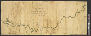
A sketch of the river Missisippi from New Orleans to the Rock of Davion
245.
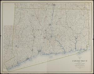
Connecticut from the best authorities
246.
Connecticut from the best authorities
247.
Map of Connecticut
248.
A new and correct map of Connecticut : one of the United States of North America
249.
Open space map of Connecticut, lands dedicated as open space, and selected undeveloped land, lands managed but not dedicated as...
250.
A particular discription of that part of the coast of Connecticut extending from Byram River to Stratford Point : these...
251.
Carte de la Nouvelle Angleterre, Nouvelle Yorck, et Pensilvanie. : Pour servir à l'Histoire générale des voyages
252.
An Exact map of New England, New York, Pensylvania & New Jersey, : from the latest surveys
253.
[Map of parts of Pennsylvania, New York and New Jersey]
254.
A map of Pensylvania, with part of the adjacent states, from the latest surveys
255.
A map of Pensylvania, with part of the adjacent states, from the latest surveys
256.
A map of the state of Pennsylvania
257.
A map of the western parts of the colony of Virginia
258.
Part of the modern counties of Monmouth, Middlesex, Somerset, Hunterdon, Mercer, Burlington, and Ocean in New Jersey and...
259.
Part of the modern counties of Philadelphia, Bucks, Chester, Montgomery, Lehigh, Northampton, Lancaster, and Lebanon
260.
Part of the modern counties of Philadelphia, Bucks, Montgomery, Delaware, Chester, and Lancaster in Pennsylvania; New Castle in...
‹ Prev
Next ›
1
2
…
9
10
11
12
13
14
15
16
17
…
438
439

![A map of West Florida and part of Et: Florida, Georgia part of So: Carolina i[n]cluding [torn] & Chactaw, Chickasaw & Creek nations with [torn] [r]oad [torn] Pensacola through ye: Creek nation to Augusitus & Charlestown](https://bpldcassets.blob.core.windows.net/derivatives/metadata/commonwealth-oai:v98001375/image_thumbnail_300.jpg)


![[Map of parts of Pennsylvania, New York and New Jersey]](https://bpldcassets.blob.core.windows.net/derivatives/images/commonwealth:6108vt40m/image_thumbnail_300.jpg)