Toggle navigation
LMEC Home
Exhibitions
Georeferencing
Tools for Teachers
Collections
My Favorites
Sign Up / Log In
Search
Search the map portal
Map Collection
Map Collection
Map Sets
Search
Search
Search for
Search In
All Fields
Creator
Title
Subject
Place
Search All Digital Collections
Advanced Search
174 Results
My Search
Start Over
More Like
commonwealth:x633fb40b
Remove constraint More Like: commonwealth:x633fb40b
Filter your Search
Place
North and Central America
140
United States
137
Boston
77
Suffolk (county)
76
Boston Harbor
36
New England
30
World
19
Bunker Hill
16
more
Place
»
Topic
Boston (Mass.)--History--Revolution, 1775-1783--Maps--Early works to 1800
45
New England--Maps--Early works to 1800
24
Fortification--Massachusetts--Boston--Maps--Early works to 1800
21
Boston (Mass.)--Maps
20
Boston Harbor (Mass.)--Maps--Early works to 1800
19
World maps--Early works to 1800
19
Bunker Hill, Battle of, Boston, Mass., 1775--Maps--Early works to 1800
18
Boston (Mass.)--Maps--Early works to 1800
12
more
Topic
»
Date
Date range begin
–
Date range end
Current results range from
1493
to
1927
View distribution
Creator
Page, Thomas Hyde, Sir, 1746-1821
11
Faden, William, 1749-1836
6
United States Coast Survey
6
Beaurain, Jean de, 1696-1771
5
Southack, Cyprian, 1662-1745
5
Williams, Richard, active 1750-1776
5
Bache, A. D. (Alexander Dallas), 1806-1867
4
Bellin, Jacques Nicolas, 1703-1772
4
more
Creator
»
Format
Maps/Atlases
170
Manuscripts
8
Drawings/Illustrations
3
Prints
1
Georeferenced
Yes
31
No
143
Collection
Norman B. Leventhal Map Center Collection
152
Mapping Boston Collection
139
Boston and New England Maps
85
American Revolutionary War-Era Maps
68
Maritime Charts and Atlases
28
Urban Maps
27
Richard H. Brown Revolutionary War Map Collection at Mount Vernon
17
Library of Congress Collection
4
more
Collection
»
Available to use
Creative Commons license
159
No known restrictions
15
Search Constraints
Sort by date (desc)
relevance
title
date (asc)
date (desc)
Number of results to display per page
20 per page
10
per page
20
per page
50
per page
100
per page
View results as:
grid view
map view
Search Results
61.
Plan de Boston avec les sondes et les directions pour la navigation : traduit de l'anglais
62.
A plan of the action at Bunkers Hill, on the 17th. of June, 1775 : between His Majesty's troops under the command of Major...
63.
A plan of the action at Bunkers Hill, on the 17th. of June, 1775 : between His Majesty's troops under the command of Major...
64.
Plan of the town of Boston with the attack on Bunkers-Hill in the peninsula of Charlestown the 17th of June 1775
65.
Carta della Nuova Inghilterra, Nuova Iork, e Pensilvania
66.
A plan of Boston in New England with its environs : including Milton, Dorchester, Roxbury, Brooklin, Cambridge, Medford,...
67.
A plan of Boston in New England with its environs : including Milton, Dorchester, Roxbury, Brooklin, Cambridge, Medford,...
68.
A plan of Boston in New England with its environs : including Milton, Dorchester, Roxbury, Brooklin, Cambridge, Medford,...
69.
A plan of the town of Boston, with the intrenchments &c. of His Majestys forces in 1775 : from the observations of Lieut. Page...
70.
A plan of the town of Boston, with the intrenchments &c. of His Majestys forces in 1775 : from the observations of Lieut. Page...
71.
An accurate map of the country round Boston in New England from the best authorities
72.
An accurate map of the country round Boston in New England from the best authorities
73.
Bowles's new pocket map of the most inhabited part of New England : comprehending the provinces of Massachusets Bay and New...
74.
Carte du port et havre de Boston avec les côtes adjacentes, dans laquel on a tracée les camps et les retranchemens occupé,...
75.
Carte du port et havre de Boston avec les côtes adjacentes, dans laquel on a tracée les camps et les retranchemens occupé,...
76.
Carte du port et havre de Boston avec les côtes adjacentes, dans laquel on a tracée les camps et les retranchemens occupé,...
77.
Carte von dem Hafen und der Stadt Boston : mit den umliegenden Gegenden und der Lägern sowohl der Americaner als auch des...
78.
Carte von dem Hafen und der Stadt Boston : mit den umliegenden Gegenden und der Lägern sowohl der Americaner als auch des...
79.
A chart of Boston Bay and vicinity
80.
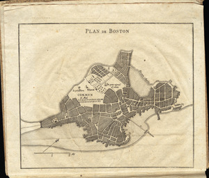
Plan de Boston
‹ Prev
Next ›
1
2
3
4
5
6
7
8
9