Toggle navigation
LMEC Home
Exhibitions
Georeferencing
Tools for Teachers
Collections
My Favorites
Sign Up / Log In
Search
Search the map portal
Map Collection
Map Collection
Map Sets
Search
Search
Search for
Search In
All Fields
Creator
Title
Subject
Place
Search All Digital Collections
Advanced Search
174 Results
My Search
Start Over
More Like
commonwealth:x633fb40b
Remove constraint More Like: commonwealth:x633fb40b
Filter your Search
Place
North and Central America
140
United States
137
Boston
77
Suffolk (county)
76
Boston Harbor
36
New England
30
World
19
Bunker Hill
16
more
Place
»
Topic
Boston (Mass.)--History--Revolution, 1775-1783--Maps--Early works to 1800
45
New England--Maps--Early works to 1800
24
Fortification--Massachusetts--Boston--Maps--Early works to 1800
21
Boston (Mass.)--Maps
20
Boston Harbor (Mass.)--Maps--Early works to 1800
19
World maps--Early works to 1800
19
Bunker Hill, Battle of, Boston, Mass., 1775--Maps--Early works to 1800
18
Boston (Mass.)--Maps--Early works to 1800
12
more
Topic
»
Date
Date range begin
–
Date range end
Current results range from
1493
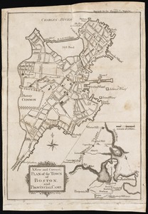
to
1927
View distribution
Creator
Page, Thomas Hyde, Sir, 1746-1821
11
Faden, William, 1749-1836
6
United States Coast Survey
6
Beaurain, Jean de, 1696-1771
5
Southack, Cyprian, 1662-1745
5
Williams, Richard, active 1750-1776
5
Bache, A. D. (Alexander Dallas), 1806-1867
4
Bellin, Jacques Nicolas, 1703-1772
4
more
Creator
»
Format
Maps/Atlases
170
Manuscripts
8
Drawings/Illustrations
3
Prints
1
Georeferenced
Yes
31
No
143
Collection
Norman B. Leventhal Map Center Collection
152
Mapping Boston Collection
139
Boston and New England Maps
85
American Revolutionary War-Era Maps
68
Maritime Charts and Atlases
28
Urban Maps
27
Richard H. Brown Revolutionary War Map Collection at Mount Vernon
17
Library of Congress Collection
4
more
Collection
»
Available to use
Creative Commons license
159
No known restrictions
15
Search Constraints
Sort by date (asc)
relevance
title
date (asc)
date (desc)
Number of results to display per page
20 per page
10
per page
20
per page
50
per page
100
per page
View results as:
grid view
map view
Search Results
61.
Carte de la Baye de Baston : située dans la Nouvelle Angleterre
62.
Plan de la ville de Boston
63.
Plan de la ville et du port de Boston : capitale de la Nouvelle Angleterre : erigée prémierement en 1630, et en 1735 elle fut...
64.
Plan de la ville et du port de Boston : capitale de la Nouvelle Angleterre
65.
A new and correct chart of the sea coast of New-England from Cape Codd to Casco Bay
66.
An accurate map of North America : describing and distinguishing the British and Spanish dominions on this great continent :...
67.
The able doctor; or America swallowing the bitter draught
68.
A map of the most inhabited part of New England : containing the provinces of Massachusets Bay and New Hampshire, with the...
69.
[Battle of Bunker Hill]
70.
Boston, S. West part : No. 25
71.
Exact plan of General Gage's lines on Boston Neck in America
72.
Exact plan of General Gage's lines on Boston Neck in America
73.
[Map of Boston]
74.
A Map of forty miles north, thirty miles west, and twentyfive miles south of Boston : including an accurate draft of the...
75.
Map of the environs of Boston
76.
A new and correct plan of the town of Boston
77.
A new and correct plan of the town of Boston, and provincial camp
78.
Order of battle of the army under the command of Lt. General Gage at Boston, July 17th, 1775
79.
A Plan of the Battle of Bunker Hill
80.
Plan of the battle, on Bunker's Hill : fought on the 17th of June 1775
‹ Prev
Next ›
1
2
3
4
5
6
7
8
9


![[Battle of Bunker Hill]](https://bpldcassets.blob.core.windows.net/derivatives/images/commonwealth:z603vj11x/image_thumbnail_300.jpg)


![[Map of Boston]](https://bpldcassets.blob.core.windows.net/derivatives/images/commonwealth:z603vw17n/image_thumbnail_300.jpg)