Carte de la Baye de Baston : située dans la Nouvelle Angleterre
Item Information
- Title:
- Carte de la Baye de Baston : située dans la Nouvelle Angleterre
- Title (alt.):
-
Carte de la Baye de Boston
- Description:
-
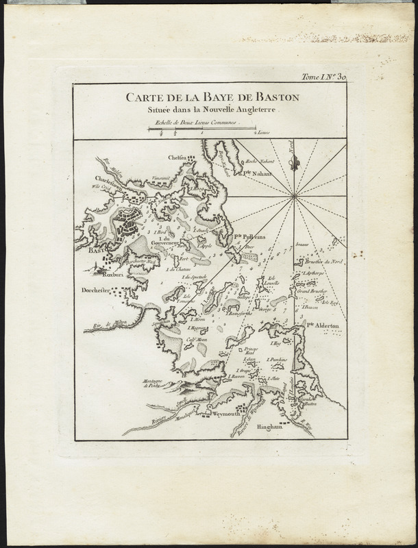
Published for a French audience, this small, page-sized map depicts Boston Bay and its many islands in detail. The coast line extends from Nahant in the north all the way south to Hingham and Hull.
- Creator:
- Bellin, Jacques Nicolas, 1703-1772
- Date:
-
[1764]
- Format:
-
Maps/Atlases
- Location:
- Private Collection
- Collection (local):
-
Mapping Boston Collection
- Subjects:
-
Nautical charts--Massachusetts--Boston Bay
Boston Bay (Mass.)--Maps
- Places:
-
MassachusettsBoston Harbor
- Extent:
- 1 map ; 21 x 17 cm.
- Terms of Use:
-
No known copyright restrictions.
This work is licensed for use under a Creative Commons Attribution Non-Commercial Share Alike License (CC BY-NC-SA).

- Publisher:
-
Paris :
s.n.
- Scale:
-
Scale not given
- Language:
-
French
- Notes:
-
Relief shown pictorially.
Depths shown by soundings.
- Notes (date):
-
This date is inferred.
- Identifier:
-
06_01_001176
- Barcode:
-
39999052508718


