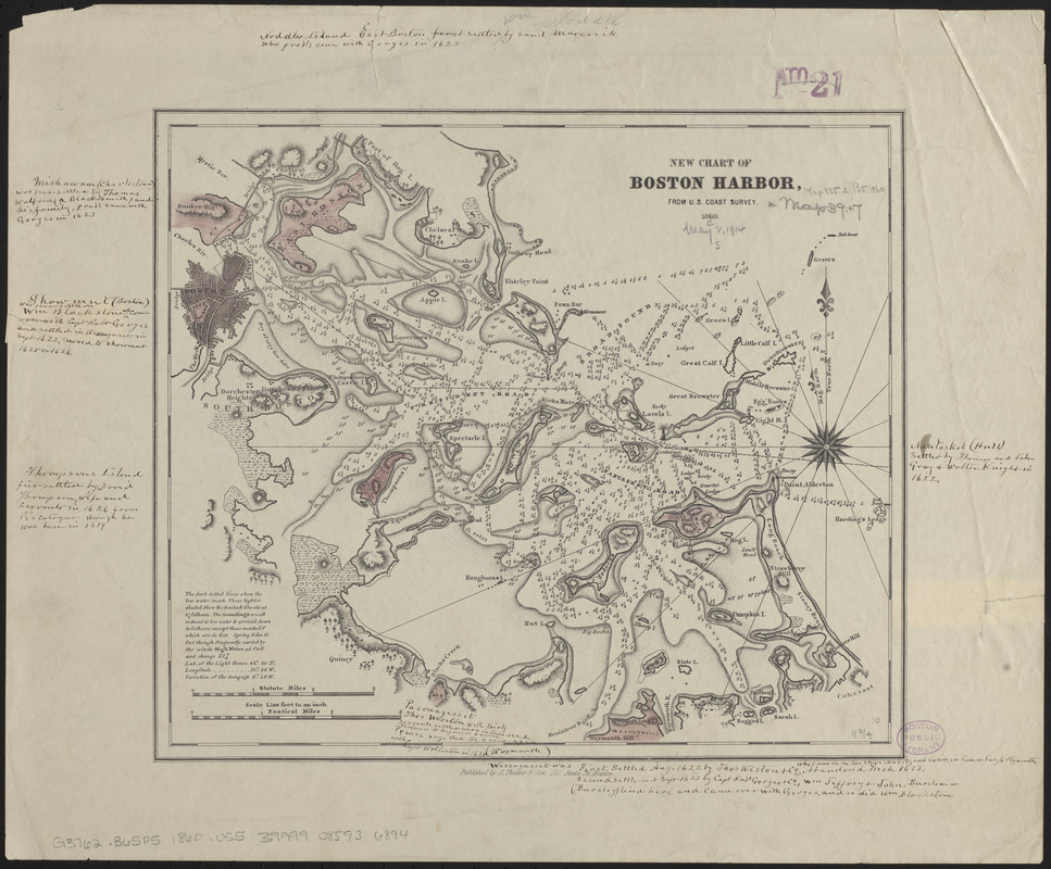
New chart of Boston Harbor
Item Information
- Title:
- New chart of Boston Harbor
- Cartographer:
- United States Coast Survey
- Publisher:
- S. Thaxter & Son
- Name on Item:
-
from U.S. Coast Survey
- Date:
-
1860
- Format:
-
Maps/Atlases
- Location:
-
Boston Public Library
Norman B. Leventhal Map & Education Center - Collection (local):
-
Norman B. Leventhal Map & Education Center Collection
- Subjects:
-
Nautical charts--Massachusetts--Boston Harbor
Nautical charts--Massachusetts--Boston Bay
Boston Harbor (Mass.)--Maps
Boston Bay (Mass.)--Maps
- Places:
-
MassachusettsBoston Harbor
- Extent:
- 1 map : hand colored ; 26 x 30 cm
- Terms of Use:
-
No known copyright restrictions.
No known restrictions on use.
- Publisher:
-
Boston :
Published by S. Thaxter & Son, 125 State St.
- Scale:
-
Scale approximately 1:64,000
- Language:
-
English
- Notes:
-
Relief shown by hachures. Depths shown by soundings.
Includes explanatory note.
Includes manuscript annotations in ink.
- Identifier:
-
06_01_015486
- Call #:
-
G3762.B65P5 1860 .U55
- Barcode:
-
39999085936894


