Toggle navigation
LMEC Home
Exhibitions
Georeferencing
Tools for Teachers
Collections
My Favorites
Sign Up / Log In
Search
Search the map portal
Map Collection
Map Collection
Map Sets
Search
Search
Search for
Search In
All Fields
Creator
Title
Subject
Place
Search All Digital Collections
Advanced Search
8674 Results
My Search
Start Over
More Like
commonwealth:ht250312g
Remove constraint More Like: commonwealth:ht250312g
Filter your Search
Place
North and Central America
5,913
United States
4,832
Massachusetts
2,092
Europe
1,392
Suffolk (county)
1,052
Boston
1,025
Canada
449
Asia
437
more
Place
»
Topic
Boston (Mass.)--Maps
592
United States--Maps
279
Real property--Massachusetts--Boston--Maps
175
Massachusetts--Maps
161
Landowners--Massachusetts--Boston--Maps
133
North America--Maps--Early works to 1800
103
New England--Maps
101
Europe--Maps
79
more
Topic
»
Date
Date range begin
–
Date range end
Current results range from
1482
to
2023
View distribution
Creator
United States. Hydrographic Office
595
O.H. Bailey & Co
148
Des Barres, Joseph F. W. (Joseph Frederick Wallet), 1722-1824
124
United States. Post Office Dept
120
Ptolemy, 2nd cent
100
Walling, Henry Francis, 1825-1888
94
Geological Survey (U.S.)
86
Jefferys, Thomas, -1771
85
more
Creator
»
Format
Maps/Atlases
8,614
Manuscripts
215
Prints
56
Books
36
Objects/Artifacts
10
Drawings/Illustrations
8
Posters
6
Georeferenced
Yes
872
No
7,802
Collection
Norman B. Leventhal Map & Education Center Collection
8,661
Boston and New England Maps
2,237
Urban Maps
1,996
Maritime Charts and Atlases
1,090
American Revolutionary War-Era Maps
626
Boston Redevelopment Authority Collection
89
Mapping Boston Collection
14
William L. Clements Library Collection
10
more
Collection
»
Available to use
No known restrictions
8,507
Creative Commons license
61
Search Constraints
Sort by relevance
relevance
title
date (asc)
date (desc)
Number of results to display per page
20 per page
10
per page
20
per page
50
per page
100
per page
View results as:
grid view
map view
Search Results
1.
Boston Harbor, Massachusetts
2.
Eldridge's new chart of Boston Harbor : compiled from the latest surveys
3.
Boston Harbor, Massachusetts
4.
Boston Harbor
5.
Boston Harbor, Massachusetts
6.
Plano de la bahia y puerto de Boston
7.
Sketch of Boston Harbor and Bay
8.
Boston Harbor, Massachusetts
9.
Boston Harbour : from the survey of A.S. Wadsworth Esq. U.S.N. and the chart of Des Barres
10.
Chart of Boston Harbour : surveyed in 1817
11.
Map of Boston inner harbor to accompany report under chapter 93, resolves of 1907, December 1, 1907
12.
Carte de la Baye de Baston : située dans la Nouvelle Angleterre
13.
Boston Harbor, Massachusetts
14.
Boston Harbor, Massachusetts
15.
Boston Harbour : from the survey of A.S. Wadsworth, Esq., U.S.N. and the chart of Des Barres
16.
A chart of the Harbour of Boston, with the soundings, sailing-marks and other directions
17.
Plan of the Inner Harbor of Boston
18.
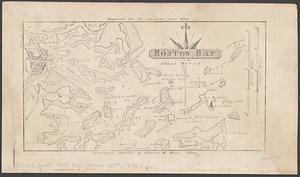
Boston Bay
19.
Massachusetts Bay with the coast from Cape Ann to Cape Cod
20.
Boston Bay and Harbor
‹ Prev
Next ›
1
2
3
4
5
…
433
434