Toggle navigation
LMEC Home
Exhibitions
Georeferencing
Tools for Teachers
Collections
My Favorites
Sign Up / Log In
Search
Search the map portal
Map Collection
Map Collection
Map Sets
Search
Search
Search for
Search In
All Fields
Creator
Title
Subject
Place
Search All Digital Collections
Advanced Search
8859 Results
My Search
Start Over
More Like
commonwealth:x633f915s
Remove constraint More Like: commonwealth:x633f915s
Filter your Search
Place
North and Central America
6,011
United States
4,859
Massachusetts
2,079
Europe
1,396
Suffolk (county)
1,046
Boston
1,019
Canada
454
Asia
442
more
Place
»
Topic
Boston (Mass.)--Maps
586
United States--Maps
282
North America--Maps--Early works to 1800
240
Real property--Massachusetts--Boston--Maps
175
Massachusetts--Maps
162
Landowners--Massachusetts--Boston--Maps
133
New England--Maps
102
Europe--Maps
79
more
Topic
»
Date
Date range begin
–
Date range end
Current results range from
1482
to
2023
View distribution
Creator
United States. Hydrographic Office
595
O.H. Bailey & Co
148
Des Barres, Joseph F. W. (Joseph Frederick Wallet), 1722-1824
123
United States. Post Office Dept
120
Ptolemy, 2nd cent
100
Jefferys, Thomas, -1771
94
Walling, Henry Francis, 1825-1888
94
Sayer, Robert, 1725-1794
89
more
Creator
»
Format
Maps/Atlases
8,799
Manuscripts
217
Prints
56
Books
36
Objects/Artifacts
10
Drawings/Illustrations
8
Posters
5
Georeferenced
Yes
872
No
7,987
Collection
Norman B. Leventhal Map & Education Center Collection
8,707
Boston and New England Maps
2,234
Urban Maps
2,023
Maritime Charts and Atlases
1,083
American Revolutionary War-Era Maps
754
Boston Redevelopment Authority Collection
87
MacLean Collection Map Library
67
New York Public Library Collection
36
more
Collection
»
Available to use
No known restrictions
8,556
Creative Commons license
121
Search Constraints
Sort by relevance
relevance
title
date (asc)
date (desc)
Number of results to display per page
20 per page
10
per page
20
per page
50
per page
100
per page
View results as:
grid view
map view
Search Results
6781.
Planta geral da cidade de São Paulo com indicações diversas
6782.
Planting beds on Dartmouth Street and Boylston Street in Copley Square
6783.
Plastische karte von Landeck, Tirol : ins ortlergebiet Kaunsertaler u. Oetztaleralpen, Silvretta u. Verwaligruppe...
6784.
Plastischer schul-atlas
6785.
Plat & environs of Lagoon Heights : showing property owned by the Lagoon Heights Land Co
6786.
Plat and environs of the property of Atlantic Land Co.
6787.
Plat map for Mount Wollaston Farm, Braintree, Massachusetts-Bay Colony
6788.
Plat of Benton township, Hocking County, Ohio
6789.
A plat of Good Hope township, Hocking County, Ohio
6790.
A plat of Green township, Hocking County, Ohio
6791.
Plat of lots in Boston (Dorchester Dist.) belonging to B.P. Cunningham
6792.
A plat of Starr township Hocking County Ohio
6793.
Plat of the ancient possessions of the upper prairie confirmed by the governors, their continuation from the Elm road to the...
6794.
Plat of the seven ranges of townships being part of the territory of the United States n.w. of the Ohio River which by a late...
6795.
Plat of the town of Logan
6796.
Plat of the United States road from Detroit to Chicago
6797.
A plat of Ward township, Hocking County Ohio
6798.
A plat of Washington Township, Hocking County Ohio
6799.
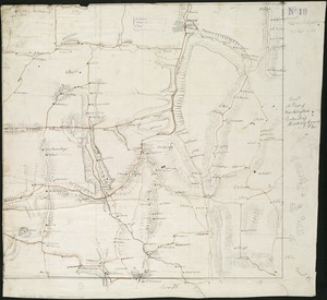
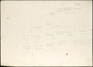
A plat showing the position of the different townships
6800.
Platte grond der stad Amsterdam
‹ Prev
Next ›
1
2
…
336
337
338
339
340
341
342
343
344
…
442
443