Toggle navigation
LMEC Home
Exhibitions
Georeferencing
Tools for Teachers
Collections
My Favorites
Sign Up / Log In
Search
Search the map portal
Map Collection
Map Collection
Map Sets
Search
Search
Search for
Search In
All Fields
Creator
Title
Subject
Place
Search All Digital Collections
Advanced Search
8551 Results
My Search
Start Over
More Like
commonwealth:wd376738d
Remove constraint More Like: commonwealth:wd376738d
Filter your Search
Place
North and Central America
5,846
United States
4,770
Massachusetts
2,052
Europe
1,359
Suffolk (county)
1,034
Boston
1,007
Canada
448
Asia
422
more
Place
»
Topic
Boston (Mass.)--Maps
577
United States--Maps
273
Real property--Massachusetts--Boston--Maps
174
Massachusetts--Maps
160
Landowners--Massachusetts--Boston--Maps
132
North America--Maps--Early works to 1800
103
New England--Maps
99
Europe--Maps
78
more
Topic
»
Date
Date range begin
–
Date range end
Current results range from
1482
to
2023
View distribution
Creator
United States. Hydrographic Office
594
O.H. Bailey & Co
148
Des Barres, Joseph F. W. (Joseph Frederick Wallet), 1722-1824
123
United States. Post Office Dept
120
Ptolemy, 2nd cent
100
Walling, Henry Francis, 1825-1888
94
Geological Survey (U.S.)
86
Jefferys, Thomas, -1771
85
more
Creator
»
Format
Maps/Atlases
8,492
Manuscripts
215
Prints
56
Books
36
Objects/Artifacts
10
Drawings/Illustrations
8
Posters
4
Georeferenced
Yes
869
No
7,682
Collection
Norman B. Leventhal Map & Education Center Collection
8,549
Boston and New England Maps
2,203
Urban Maps
1,935
Maritime Charts and Atlases
1,081
American Revolutionary War-Era Maps
618
Boston Redevelopment Authority Collection
87
William L. Clements Library Collection
2
Available to use
No known restrictions
8,408
Creative Commons license
46
Search Constraints
Sort by relevance
relevance
title
date (asc)
date (desc)
Number of results to display per page
20 per page
10
per page
20
per page
50
per page
100
per page
View results as:
grid view
map view
Search Results
3461.
Map of Chittenden County, Vermont
3462.
Map of Choctaw Nation, Indian Territory
3463.
Map of Cincinnati, Covington & Newport
3464.
Map of Cincinnati, Covington and Newport
3465.
Map of city of Schenectady and village of Scotia, 1917
3466.
Map of city of St. Louis and suburbs
3467.
Map of Cleveland & Toledo Rail Road, with its connections
3468.
Map of Cleveland and vicinity
3469.
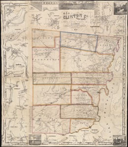
Map of Clinton Co., New York : from actual surveys
3470.
Map of Clinton County
3471.
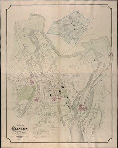
Map of Clinton Worcester Co. Mass
3472.
Map of Colville Region, Washington Ter
3473.
Map of Commonwealth Avenue Street Railway Company, and connecting lines : showing route to Norumbega Park
3474.
A map of Concord, the old Musketaquid Plantation
3475.
Map of Connecticut
3476.
Map of Connecticut, circa 1625, Indian trails, villages, sachemdoms
3477.
Map of Connecticut River from Barnet Vermont to Hartford Con : by actual survey in 1825
3478.
Map of Connecticut River in the states of Massachusetts & Connecticut : in nine sheets
3479.
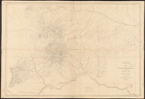
Map of Crazy Mountains and vicinity, Montana Ter
3480.
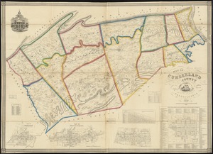
Map of Cumberland County, Pennsylvania : from actual surveys
‹ Prev
Next ›
1
2
…
170
171
172
173
174
175
176
177
178
…
427
428