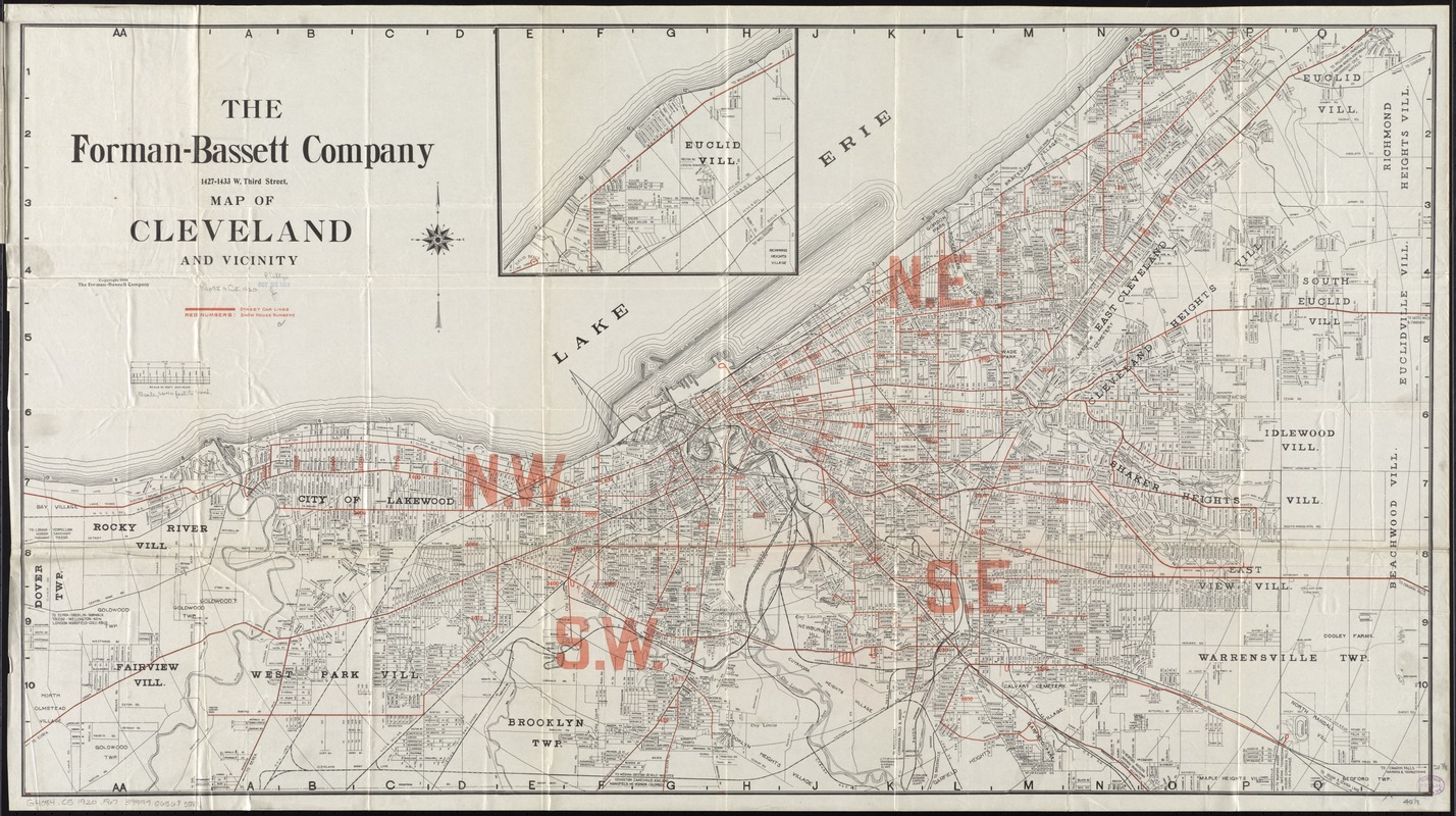
Map of Cleveland and vicinity
Item Information
- Title:
- Map of Cleveland and vicinity
- At head of title :
- Forman-Bassett Company
- Creator:
- Forman-Bassett Co
- Name on Item:
-
compiled, published, and copyrighted by the Forman-Bassett Company.
- Date:
-
[ca. 1920]
- Format:
-
Maps/Atlases
- Location:
-
Boston Public Library
Norman B. Leventhal Map & Education Center - Collection (local):
-
Norman B. Leventhal Map & Education Center Collection
- Subjects:
-
Cleveland (Ohio)--Maps
Cleveland Metropolitan Area (Ohio)--Maps
- Places:
-
OhioCuyahoga (county)Cleveland
- Extent:
- 1 map : col. ; 55 x 102 cm. + 1 booklet (32 p. ; 17 cm.)
- Terms of Use:
-
No known copyright restrictions.
No known restrictions on use.
- Publisher:
-
Cleveland, Ohio :
Forman-Bassett Company
- Scale:
-
Scale [ca. 1:32,000]
- Language:
-
English
- Notes:
-
Continuation inset: Euclid Vill.
Includes circles showing radial distance and red overprint indicating street car lines and house numbers.
Accompanied by "1920-1921 street directory and map index of Cleveland and suburbs showing all streets and points of interest."
- Identifier:
-
06_01_011292
- Call #:
-
G4084.C5 1920 .F67
- Barcode:
-
39999065683581