Toggle navigation
LMEC Home
Exhibitions
Georeferencing
Tools for Teachers
Collections
My Favorites
Sign Up / Log In
Search
Search the map portal
Map Collection
Map Collection
Map Sets
Search
Search
Search for
Search In
All Fields
Creator
Title
Subject
Place
Search All Digital Collections
Advanced Search
8932 Results
My Search
Start Over
More Like
commonwealth:wd3767064
Remove constraint More Like: commonwealth:wd3767064
Filter your Search
Place
North and Central America
6,163
United States
5,067
Massachusetts
2,204
Europe
1,396
Suffolk (county)
1,208
Boston
1,181
Canada
450
Asia
438
more
Place
»
Topic
Boston (Mass.)--Maps
752
United States--Maps
282
Massachusetts--Maps
235
Real property--Massachusetts--Boston--Maps
195
City planning--Massachusetts--Boston--Maps
157
Landowners--Massachusetts--Boston--Maps
142
New England--Maps
106
North America--Maps--Early works to 1800
103
more
Topic
»
Date
Date range begin
–
Date range end
Current results range from
1482
to
2023
View distribution
Creator
United States. Hydrographic Office
595
Boston Redevelopment Authority
162
O.H. Bailey & Co
148
Des Barres, Joseph F. W. (Joseph Frederick Wallet), 1722-1824
124
United States. Post Office Dept
120
Ptolemy, 2nd cent
100
Walling, Henry Francis, 1825-1888
95
Geological Survey (U.S.)
92
more
Creator
»
Format
Maps/Atlases
8,871
Manuscripts
217
Prints
56
Books
36
Objects/Artifacts
10
Drawings/Illustrations
8
Posters
5
Ephemera
1
Georeferenced
Yes
894
No
8,038
Collection
Norman B. Leventhal Map & Education Center Collection
8,765
Boston and New England Maps
2,403
Urban Maps
2,143
Maritime Charts and Atlases
1,083
American Revolutionary War-Era Maps
657
Boston Redevelopment Authority Collection
194
Mapping Boston Collection
22
Applied Geographics, Inc. Records
21
more
Collection
»
Available to use
No known restrictions
8,707
Creative Commons license
73
Search Constraints
Sort by relevance
relevance
title
date (asc)
date (desc)
Number of results to display per page
20 per page
10
per page
20
per page
50
per page
100
per page
View results as:
grid view
map view
Search Results
4301.
Map of Madison County, Virginia : prepared under the direction of P.S. Michie
4302.
Map of Madison, Wisconsin : A.A.A.S. XLII meeting, August 17-24, 1893
4303.
Map of Maine for the Maine register
4304.
Map of Maine, New Hampshire, and Vermont : compiled from the latest authorities
4305.
Map of Maine, New Hampshire and Vermont, from the most authentic sources
4306.
Map of Maine, New Hampshire, Vermont, Massachusetts, Rhode Island, and Connecticut : exhibiting the post offices, post roads,...
4307.
Map of Malta and its dependencies
4308.
Map of Manchuria, Corea & Japan
4309.
Map of Manitoba
4310.
Map of Manitoba
4311.
Map of Manitoba
4312.
Map of Manitoba, Saskatchewan & Alberta : showing the number of quarter sections available for homestead entry in each...
4313.
Map of Manitoba, Saskatchewan and Alberta : showing the number of quarter sections available for homestead entry in each township
4314.
Map of Manitoba, Saskatchewan and Alberta : showing the number of quarter-sections available for homestead entry in each...
4315.
Map of Manitoba, Saskatchewan and Alberta
4316.
Map of Manitoba shewing provincial government lands for sale
4317.
Map of Marshfield, Mass
4318.
Map of Massachusetts showing population according to census of 1910
4319.
Map of McHenry County, Illinois
4320.
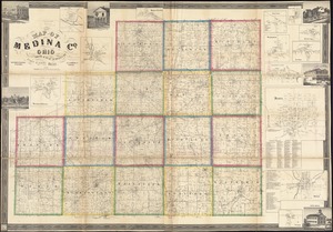
Map of Medina Co., Ohio
‹ Prev
Next ›
1
2
…
212
213
214
215
216
217
218
219
220
…
446
447