Map of McHenry County, Illinois
Item Information
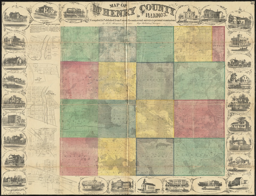
- Title:
- Map of McHenry County, Illinois
- Creator:
- M.H. Thompson & Bro
- Name on Item:
-
compiled & published from county records, actual surveys, & personal examination by M.H. Thompson & Brother, Map Publishers & Surveyors.
- Date:
-
1862
- Format:
-
Maps/Atlases
- Location:
-
Boston Public Library
Norman B. Leventhal Map & Education Center - Collection (local):
-
Norman B. Leventhal Map & Education Center Collection
- Subjects:
-
Landowners--Illinois--McHenry County--Maps
Real property--Illinois--McHenry County--Maps
McHenry County (Ill.)--Maps
- Places:
-
IllinoisMcHenry (county)
- Extent:
- 1 map : color ; 89 x 98 cm, on sheet 117 x 151 cm
- Terms of Use:
-
No known copyright restrictions.
No known restrictions on use.
- Publisher:
-
[Dundee, Illnois] :
M.H. Thompson & Brother,
- Scale:
-
Scale 1:42,240. 1 1/2 inches to a mile
- Language:
-
English
- Notes:
-
Includes business directories, lists of county officers, board of supervisors, "Early history of McHenry County," views of business, residential, and public buildings.
Insets: Map of McHenry, Ill. -- Map of West McHenry -- Map of Algonquin -- Map of Woodstock -- Map of Marengo.
- Identifier:
-
06_01_011114
- Call #:
-
G4103.M58G46 1862 .M24
- Barcode:
-
39999065681262
- LCCN:
-
2013593107


