Toggle navigation
LMEC Home
Exhibitions
Georeferencing
Tools for Teachers
Collections
My Favorites
Sign Up / Log In
Search
Search the map portal
Map Collection
Map Collection
Map Sets
Search
Search
Search for
Search In
All Fields
Creator
Title
Subject
Place
Search All Digital Collections
Advanced Search
8939 Results
My Search
Start Over
More Like
commonwealth:wd376704k
Remove constraint More Like: commonwealth:wd376704k
Filter your Search
Place
North and Central America
6,170
United States
5,074
Massachusetts
2,209
Europe
1,396
Suffolk (county)
1,215
Boston
1,188
Canada
450
Asia
438
more
Place
»
Topic
Boston (Mass.)--Maps
752
United States--Maps
282
Massachusetts--Maps
235
Real property--Massachusetts--Boston--Maps
195
City planning--Massachusetts--Boston--Maps
162
Landowners--Massachusetts--Boston--Maps
142
New England--Maps
106
North America--Maps--Early works to 1800
103
more
Topic
»
Date
Date range begin
–
Date range end
Current results range from
1482
to
2023
View distribution
Creator
United States. Hydrographic Office
595
Boston Redevelopment Authority
168
O.H. Bailey & Co
148
Des Barres, Joseph F. W. (Joseph Frederick Wallet), 1722-1824
124
United States. Post Office Dept
120
Ptolemy, 2nd cent
100
Walling, Henry Francis, 1825-1888
95
Geological Survey (U.S.)
92
more
Creator
»
Format
Maps/Atlases
8,878
Manuscripts
217
Prints
56
Books
36
Objects/Artifacts
10
Drawings/Illustrations
8
Posters
5
Ephemera
1
Georeferenced
Yes
894
No
8,045
Collection
Norman B. Leventhal Map & Education Center Collection
8,766
Boston and New England Maps
2,410
Urban Maps
2,148
Maritime Charts and Atlases
1,083
American Revolutionary War-Era Maps
657
Boston Redevelopment Authority Collection
200
David Judkins Weaver Papers
22
Mapping Boston Collection
22
more
Collection
»
Available to use
No known restrictions
8,714
Creative Commons license
73
Search Constraints
Sort by relevance
relevance
title
date (asc)
date (desc)
Number of results to display per page
20 per page
10
per page
20
per page
50
per page
100
per page
View results as:
grid view
map view
Search Results
8121.
Taputeouea or Drummond's Island, Kingsmill Group ; Peacock's anchorage at Drummond's Island, Kingsmill Group
8122.
Taunton
8123.
Taunton River : drainage area 450 sq. miles
8124.
Tax parcels that would have been underwater in 1630
8125.
Tayabas (northern part)
8126.
Tayabas (southern part)
8127.
Taylor Co., West Va
8128.
Taylor County, Wis.
8129.
Teâtre de la guerre en Amerique telle que'elle est à present possedée par les Espagnols, Anglois, François, et Hollandois...
8130.
Telegraph chart
8131.
Temperature chart of the United States : showing the distribution by isothermal curves of the mean annual temperature of the...
8132.
Tennassee : lately the S. Wn. Territory
8133.
Tennessee River basin
8134.
Tercia Europe tabula continet Gallia
8135.
Terra di Bari et Basilicata
8136.
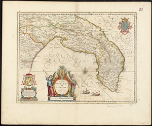
La Terra di Lavoro ed I principati citeriore ulteriore
8137.
Terra di Lavoro, olim Campania felix
8138.
Terra di Otranto olim Salentina et Iapigia
8139.
Terra Firma and the Caribbé Islands &c
8140.
Terra Firma et Novum regnum Granatense et Popayan
‹ Prev
Next ›
1
2
…
403
404
405
406
407
408
409
410
411
…
446
447