Toggle navigation
LMEC Home
Exhibitions
Georeferencing
Tools for Teachers
Collections
My Favorites
Sign Up / Log In
Search
Search the map portal
Map Collection
Map Collection
Map Sets
Search
Search
Search for
Search In
All Fields
Creator
Title
Subject
Place
Search All Digital Collections
Advanced Search
8931 Results
My Search
Start Over
More Like
commonwealth:wd376610h
Remove constraint More Like: commonwealth:wd376610h
Filter your Search
Place
North and Central America
6,162
United States
5,064
Massachusetts
2,194
Europe
1,396
Suffolk (county)
1,207
Boston
1,180
Canada
450
Asia
438
more
Place
»
Topic
Boston (Mass.)--Maps
752
United States--Maps
282
Massachusetts--Maps
235
Real property--Massachusetts--Boston--Maps
195
City planning--Massachusetts--Boston--Maps
157
Landowners--Massachusetts--Boston--Maps
142
New England--Maps
106
North America--Maps--Early works to 1800
103
more
Topic
»
Date
Date range begin
–
Date range end
Current results range from
1482
to
2023
View distribution
Creator
United States. Hydrographic Office
595
Boston Redevelopment Authority
162
O.H. Bailey & Co
148
Des Barres, Joseph F. W. (Joseph Frederick Wallet), 1722-1824
124
United States. Post Office Dept
120
Ptolemy, 2nd cent
100
Walling, Henry Francis, 1825-1888
95
Geological Survey (U.S.)
92
more
Creator
»
Format
Maps/Atlases
8,870
Manuscripts
217
Prints
56
Books
36
Objects/Artifacts
10
Drawings/Illustrations
8
Posters
5
Ephemera
1
Georeferenced
Yes
893
No
8,038
Collection
Norman B. Leventhal Map & Education Center Collection
8,764
Boston and New England Maps
2,403
Urban Maps
2,143
Maritime Charts and Atlases
1,083
American Revolutionary War-Era Maps
657
Boston Redevelopment Authority Collection
194
Mapping Boston Collection
22
Applied Geographics, Inc. Records
21
more
Collection
»
Available to use
No known restrictions
8,706
Creative Commons license
73
Search Constraints
Sort by relevance
relevance
title
date (asc)
date (desc)
Number of results to display per page
20 per page
10
per page
20
per page
50
per page
100
per page
View results as:
grid view
map view
Search Results
5001.
A map of the United States of North America : drawn from a number of critical researches
5002.
Map of the United States of North America, upper & lower Canada, New Brunswick, Nova Scotia & British Columbia, Mexico, Cuba,...
5003.
Map of the United States, showing by colors the area of freedom and slavery, and the territories whose destiny is yet to be...
5004.
Map of the United States showing principal cities, rivers, and mountain ranges
5005.
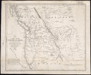
Map of the United States, Territory of Oregon, west of the Rocky Mountains, exhibiting the various trading depots or forts...
5006.
Map of the United States, the British provinces, Mexico, &c : showing the routes of the U.S. Mail steam packets to California,...
5007.
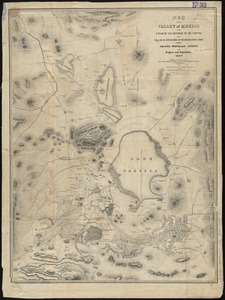
Map of the Valley of Mexico with a plan of the defences of the capital and the line of operations of the United States Army...
5008.
Map of the Vermont Central Rail Road and its connections, forming the Great Northern Route from the Atlantic to Montreal and...
5009.
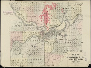
Map of the vicinity of Kansas City : including fifteen miles around
5010.
Map of the vicinity of Yorktown, Virginia, 1881
5011.
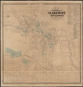
Map of the village of Claremont, New Hampshire
5012.
Map of the village of Concord, Merrimack County, N.H
5013.
Map of the village of Pawtucket Rhode Island
5014.
Map of the Virginian Railway
5015.
Map of the Warrior coal basin with columnar sections of formation, so far as it carries workable coals
5016.
A map of the Weald of Kent
5017.
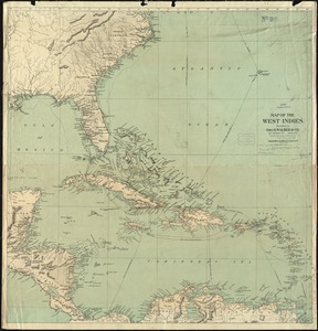
Map of the West Indies
5018.
A map of the West Indies and the Spanish Main
5019.
Map of the West Shore Railroad and connections
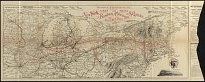
5020.
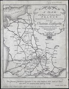
A map of the western and southern parts of France showing the motor routes and the principal cities on the way to Chateau...
‹ Prev
Next ›
1
2
…
247
248
249
250
251
252
253
254
255
…
446
447