Toggle navigation
LMEC Home
Exhibitions
Georeferencing
Tools for Teachers
Collections
My Favorites
Sign Up / Log In
Search
Search the map portal
Map Collection
Map Collection
Map Sets
Search
Search
Search for
Search In
All Fields
Creator
Title
Subject
Place
Search All Digital Collections
Advanced Search
8769 Results
My Search
Start Over
More Like
commonwealth:wd376604c
Remove constraint More Like: commonwealth:wd376604c
Filter your Search
Place
North and Central America
6,000
United States
4,904
Massachusetts
2,152
Europe
1,396
Suffolk (county)
1,047
Boston
1,020
Canada
450
Asia
438
more
Place
»
Topic
Boston (Mass.)--Maps
590
United States--Maps
282
Massachusetts--Maps
235
Real property--Massachusetts--Boston--Maps
175
Landowners--Massachusetts--Boston--Maps
133
New England--Maps
104
North America--Maps--Early works to 1800
103
Europe--Maps
79
more
Topic
»
Date
Date range begin
–
Date range end
Current results range from
1482
to
2023
View distribution
Creator
United States. Hydrographic Office
595
O.H. Bailey & Co
148
Des Barres, Joseph F. W. (Joseph Frederick Wallet), 1722-1824
123
United States. Post Office Dept
120
Ptolemy, 2nd cent
100
Walling, Henry Francis, 1825-1888
95
Geological Survey (U.S.)
92
Jefferys, Thomas, -1771
85
more
Creator
»
Format
Maps/Atlases
8,708
Manuscripts
217
Prints
56
Books
36
Objects/Artifacts
10
Drawings/Illustrations
8
Posters
5
Ephemera
1
Georeferenced
Yes
878
No
7,891
Collection
Norman B. Leventhal Map & Education Center Collection
8,737
Boston and New England Maps
2,279
Urban Maps
2,024
Maritime Charts and Atlases
1,083
American Revolutionary War-Era Maps
635
Boston Redevelopment Authority Collection
90
Applied Geographics, Inc. Records
20
David Judkins Weaver Papers
18
more
Collection
»
Available to use
No known restrictions
8,595
Creative Commons license
51
Search Constraints
Sort by relevance
relevance
title
date (asc)
date (desc)
Number of results to display per page
20 per page
10
per page
20
per page
50
per page
100
per page
View results as:
grid view
map view
Search Results
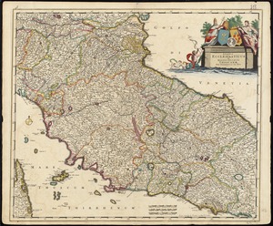
7801.
Status ecclesiasticus et magnus ducatus Thoscanae
7802.
Steam railroads in Boston 1888
7803.
Steden Wyser synde een perfecte en klare aenwysinge ... Leggen = L'echelle des villes montrant la distance ... l'autre
7804.
Storrow Memorial Embankment : plan of additions and changes under the requirements of Chapter 262, Acts of 1949
7805.
The story map of flying : being a chronicle of man's conquest of the air
7806.
Stoughton, Mass : 1879
7807.
Stoughton, Massachusetts : 1890
7808.
Stovel's map of Winnipeg, including St. Boniface and surrounding suburbs
7809.
Strait of Gibraltar : from the most recent surveys
7810.
Straits of Mackinac with the approaches thereto from Lakes Huron and Michigan and the entrance by the Détour Passage to the...
7811.
The Straits of Seniavine, Behring's Straits
7812.
The Straits of Seniavine, Behring's Straits
7813.
Straits of Tsugar, Japan : surveyed in the U.S. Str. John Hancock, 1855
7814.
The strangers mercantile guide map of the cities of New York, Brooklyn, Jersey City, Hoboken, etc
7815.
Strategic map of Central Europe showing the international frontiers
7816.
Strategic war points of the United States
7817.
Stratford, Conn : 1882
7818.
Straube's plan von Berlin (ganzes weichbild der stadt)
7819.
Street index map of Oakland, Albany, Berkeley, Emeryville, Piedmont, Alameda, San Leandro, Alameda Co., California
7820.
Street map of Philadelphia : issued by the Philadelphia Hotel Association, Philadelphia, Pa.
‹ Prev
Next ›
1
2
…
387
388
389
390
391
392
393
394
395
…
438
439