Toggle navigation
LMEC Home
Exhibitions
Georeferencing
Tools for Teachers
Collections
My Favorites
Sign Up / Log In
Search
Search the map portal
Map Collection
Map Collection
Map Sets
Search
Search
Search for
Search In
All Fields
Creator
Title
Subject
Place
Search All Digital Collections
Advanced Search
8972 Results
My Search
Start Over
More Like
commonwealth:wd376542k
Remove constraint More Like: commonwealth:wd376542k
Filter your Search
Place
North and Central America
6,207
United States
5,090
Massachusetts
2,084
Europe
1,392
Suffolk (county)
1,062
Boston
1,030
Canada
463
Asia
437
more
Place
»
Topic
Boston (Mass.)--Maps
591
United States--History--Revolution, 1775-1783--Maps
330
United States--Maps
280
Real property--Massachusetts--Boston--Maps
175
Massachusetts--Maps
162
Landowners--Massachusetts--Boston--Maps
133
North America--Maps--Early works to 1800
103
New England--Maps
102
more
Topic
»
Date
Date range begin
–
Date range end
Current results range from
1482
to
2023
View distribution
Creator
United States. Hydrographic Office
595
O.H. Bailey & Co
148
Des Barres, Joseph F. W. (Joseph Frederick Wallet), 1722-1824
124
United States. Post Office Dept
120
Ptolemy, 2nd cent
100
Walling, Henry Francis, 1825-1888
94
Geological Survey (U.S.)
86
Jefferys, Thomas, -1771
86
more
Creator
»
Format
Maps/Atlases
8,907
Manuscripts
219
Prints
56
Books
36
Drawings/Illustrations
13
Objects/Artifacts
10
Posters
5
Georeferenced
Yes
871
No
8,101
Collection
Norman B. Leventhal Map & Education Center Collection
8,648
Boston and New England Maps
2,221
Urban Maps
1,992
Maritime Charts and Atlases
1,083
American Revolutionary War-Era Maps
940
William L. Clements Library Collection
305
Boston Redevelopment Authority Collection
87
American Antiquarian Society Collection
8
more
Collection
»
Available to use
No known restrictions
8,507
Creative Commons license
52
Search Constraints
Sort by relevance
relevance
title
date (asc)
date (desc)
Number of results to display per page
20 per page
10
per page
20
per page
50
per page
100
per page
View results as:
grid view
map view
Search Results
41.
Carte des environs de York en Virginie avec les attaques et la position des armées Françoise et Américaine devant cette place...
42.
Carte du theatre de la guerre presente en Amerique
43.
Carte nouvelle des posséssions angloises en Amérique dressée pour l'intelligence de la guerre présente et divisée suivant les...
44.
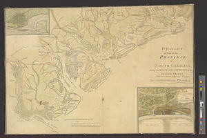
Charles Town, South Carolina, with a chart of the bars & harbour
45.
Charleston and its approaches from the sea
46.
Charleston and the British attack of June 1776
47.
[Chart of Boston Harbor and the surrounding areas]
48.
A chart of the harbour of Rhode Island and Narraganset Bay surveyed in pursuance of directions from the Lords of Trade to His...
49.
A chorographical map of the country round Philadelphia = Carte particuliere des environs de Philadelphia
50.
A compleat plan of part of the province of Pennsylvania East and West Jersey shewing the transactions of the royal army under...
51.
Confluence of the James River, York River, and Chesapeake Bay
52.
Delaware Bay and Chesapeake Bay
53.
Delaware Bay and Chesapeake Bay
54.
Disposition of the British forces before Charleston 1780
55.
Disposition of the British forces on Long Island, Staten Island, and Manhattan Island, under Cornwallis and Knyphausen
56.
Distances North River
57.
Distribution & strength of corps 1780
58.
A draft of the Nerernanset shore from the entrance to the mouth of Potewomet River northward and from the Nererganset Bay to...
59.
Draught of part of the province of South Carolina shewing the march & encampments of the British troops under the command of...
60.
A draught of Rhode Island, 1777
‹ Prev
Next ›
1
2
3
4
5
6
7
…
448
449


![[Chart of Boston Harbor and the surrounding areas]](https://bpldcassets.blob.core.windows.net/derivatives/images/commonwealth:6108vs71d/image_thumbnail_300.jpg)