Toggle navigation
LMEC Home
Exhibitions
Georeferencing
Tools for Teachers
Collections
My Favorites
Sign Up / Log In
Search
Search the map portal
Map Collection
Map Collection
Map Sets
Search
Search
Search for
Search In
All Fields
Creator
Title
Subject
Place
Search All Digital Collections
Advanced Search
8771 Results
My Search
Start Over
More Like
commonwealth:wd376496p
Remove constraint More Like: commonwealth:wd376496p
Filter your Search
Place
North and Central America
5,978
United States
4,916
Massachusetts
2,079
Europe
1,396
Suffolk (county)
1,046
Boston
1,019
Canada
469
Asia
438
more
Place
»
Topic
Boston (Mass.)--Maps
586
United States--Maps
282
Real property--Massachusetts--Boston--Maps
175
Massachusetts--Maps
162
Landowners--Massachusetts--Boston--Maps
133
North America--Maps--Early works to 1800
109
United States--Maps--Early works to 1800
103
New England--Maps
102
more
Topic
»
Date
Date range begin
–
Date range end
Current results range from
1482
to
2023
View distribution
Creator
United States. Hydrographic Office
595
O.H. Bailey & Co
148
Des Barres, Joseph F. W. (Joseph Frederick Wallet), 1722-1824
123
United States. Post Office Dept
120
Ptolemy, 2nd cent
100
Walling, Henry Francis, 1825-1888
94
Jefferys, Thomas, -1771
87
Geological Survey (U.S.)
86
more
Creator
»
Format
Maps/Atlases
8,711
Manuscripts
215
Prints
56
Books
36
Objects/Artifacts
10
Drawings/Illustrations
8
Posters
5
Georeferenced
Yes
871
No
7,900
Collection
Norman B. Leventhal Map & Education Center Collection
8,696
Boston and New England Maps
2,233
Urban Maps
2,023
Maritime Charts and Atlases
1,083
American Revolutionary War-Era Maps
690
Boston Redevelopment Authority Collection
87
MacLean Collection Map Library
43
New York Public Library Collection
15
more
Collection
»
Available to use
No known restrictions
8,556
Creative Commons license
75
Search Constraints
Sort by relevance
relevance
title
date (asc)
date (desc)
Number of results to display per page
20 per page
10
per page
20
per page
50
per page
100
per page
View results as:
grid view
map view
Search Results
7161.
Relief map of Canada and the United States
7162.
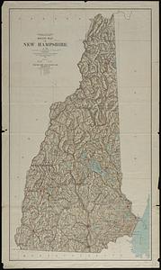
Relief map of New Hampshire
7163.
Relief map of New Jersey
7164.
Relief map of the Dominion of Canada
7165.
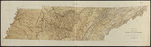
Relief map, state of Tennessee
7166.
Relief practice map
7167.
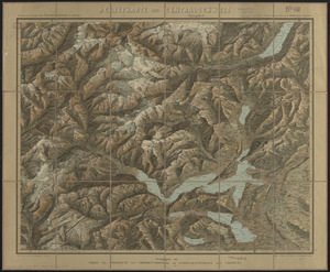
Reliefkarte der Centralschweiz
7168.
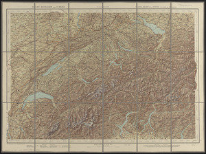
Relief-reisekarte der Schweiz = Carte-relief de la Suisse à l'usage des touristes
7169.
Remarks
7170.
Remarques sur la navigation de terre-neuve à New-York afin d'eviter les courrants et les bas-fonds au sud de Nantuckett et du...
7171.
Remarques sur la navigation de terre-neuve à New-York afin d'eviter les courrants et les bas-fonds au sud de Nantuckett et du...
7172.
Repræsentatio accubitus regum Sueciæ Daniæ q: Fridericiburgi d. 3, 4 et 5 Mart. 1658
7173.
Repraesentatio praelij d. 30 Ianua an. 1658 ad Ifwersnaas commissi inquo Seren. rex Sueciae Carolvs Gvstavus postquam copias...
7174.
Repræsentatio scenographica Arcis Cronenburg auspiciis S.R. M. Sueciæ. ductu vero Exell. Dn. Com. C.G. Wrangelij reg. Sue....
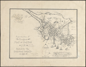
7175.
Reproduction of Burgiss' map of Boston, 1728 : printed for the Bostonian Society, 1885
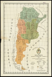
7176.
Republica Argentina : superficie, población, ferro-carriles, cultivos y ganados
7177.
República Mexicana, Territorio de Tepic
7178.
Republican mid-summer outing and Massachusetts Bay Cruise to Provincetown Saturday, August 4, 1934
7179.
Reseau parcouru par les voitures de la Compagnie Internationale des Wagons-lits
7180.
Rethinking hazardous beliefs : challenging perceptions of the "dirty city"
‹ Prev
Next ›
1
2
…
355
356
357
358
359
360
361
362
363
…
438
439