Toggle navigation
LMEC Home
Exhibitions
Georeferencing
Tools for Teachers
Collections
My Favorites
Sign Up / Log In
Search
Search the map portal
Map Collection
Map Collection
Map Sets
Search
Search
Search for
Search In
All Fields
Creator
Title
Subject
Place
Search All Digital Collections
Advanced Search
8549 Results
My Search
Start Over
More Like
commonwealth:wd3762658
Remove constraint More Like: commonwealth:wd3762658
Filter your Search
Place
North and Central America
5,844
United States
4,768
Massachusetts
2,052
Europe
1,359
Suffolk (county)
1,034
Boston
1,007
Canada
448
Asia
422
more
Place
»
Topic
Boston (Mass.)--Maps
577
United States--Maps
273
Real property--Massachusetts--Boston--Maps
174
Massachusetts--Maps
160
Landowners--Massachusetts--Boston--Maps
132
North America--Maps--Early works to 1800
103
New England--Maps
99
Europe--Maps
78
more
Topic
»
Date
Date range begin
–
Date range end
Current results range from
1482
to
2023
View distribution
Creator
United States. Hydrographic Office
594
O.H. Bailey & Co
147
Des Barres, Joseph F. W. (Joseph Frederick Wallet), 1722-1824
123
United States. Post Office Dept
120
Ptolemy, 2nd cent
100
Walling, Henry Francis, 1825-1888
94
Geological Survey (U.S.)
86
Jefferys, Thomas, -1771
85
more
Creator
»
Format
Maps/Atlases
8,490
Manuscripts
215
Prints
56
Books
36
Objects/Artifacts
10
Drawings/Illustrations
8
Posters
4
Georeferenced
Yes
869
No
7,680
Collection
Norman B. Leventhal Map & Education Center Collection
8,549
Boston and New England Maps
2,203
Urban Maps
1,935
Maritime Charts and Atlases
1,081
American Revolutionary War-Era Maps
616
Boston Redevelopment Authority Collection
87
Available to use
No known restrictions
8,408
Creative Commons license
46
Search Constraints
Sort by relevance
relevance
title
date (asc)
date (desc)
Number of results to display per page
20 per page
10
per page
20
per page
50
per page
100
per page
View results as:
grid view
map view
Search Results
8361.
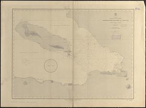
West Indies, harbors of Jamaica : from British surveys to 1879, cor. to 1881
8362.
West Indies, harbors of Jamaica : from British surveys to 1879, corrected to 1881
8363.
West Indies, harbors on Dominica Island : republished from the Brt. Admty. chart of June 1873
8364.
West Indies, Honduras, Chinchorro Bank : from a British survey in 1839
8365.
West Indies, Honduras Gulf with the Zapotillos Cays
8366.
West Indies, Island of Antigua : from British surveys in 1848 and 1863
8367.
West Indies, island of Guadeloupe, Basse-Terre Roads : from a French survey in 1867
8368.
West Indies, island of Guadeloupe, Port du Moule : from a French survey in 1868
8369.
West Indies, Island of Guadeloupe, Port Louis : from a French survey in 1868
8370.
West Indies, island of Guadeloupe, Port Sainte Marie : from a French survey in 1869
8371.
West Indies, island of Guadeloupe, Sainte Anne anchorage : from a French survey in 1867
8372.
West Indies, Island of Guadeloupe, St. François anchorage : from a French survey in 1867
8373.
West Indies, island of Haïti, Cape Haïti Harbor (Cape Guarico of the Spaniards) : from a British survey in 1840 :...
8374.
West Indies, island of Santo Domingo, approaches to Port au Prince : compiled from the latest information 1887
8375.
West Indies, island of Santo Domingo, Caldera Bay : from a survey in 1870 by the officers of the U.S.S. Nantasket, Lt. Comdr....
8376.
West Indies, island of Santo Domingo, harbor of Jacmel : from an English survey in 1817
8377.
West Indies, Island of Santo Domingo, Santo Domingo Harbor : surveyed by the officers of H.M.S. Hound, 1849
8378.
West Indies, island of Santo Domingo, the Môle of St. Nicolas : from the latest English survey
8379.
West Indies, Island of Santo Domingo with Mona Passage : compiled from the latest British and Spanish charts, 1886
8380.
West Indies, Jamaica--south coast, Port Morant : surveyed by Staff Commander G. Stanley, R.N. 1873 ; republication of British...
‹ Prev
Next ›
1
2
…
415
416
417
418
419
420
421
422
423
…
427
428