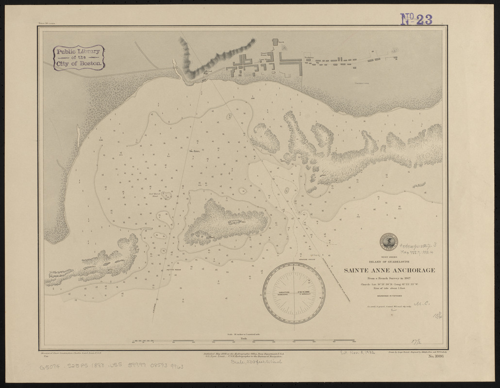
West Indies, island of Guadeloupe, Sainte Anne anchorage : from a French survey in 1867
Item Information
- Title:
- West Indies, island of Guadeloupe, Sainte Anne anchorage : from a French survey in 1867
- Title (alt.):
-
Sainte Anne anchorage
- Issuing body:
- United States. Hydrographic Office
- Engraver:
- Erni, A. (Adolphe)
- Draftsman:
- Noetzel, G. (Gregor)
- Engraver:
- Peabody, W. F. (William F.)
- Name on Item:
-
drawn by Gregor Noetzel ; engraved by Adolphe Erni and W.F. Peabody
- Date:
-
1888
- Format:
-
Maps/Atlases
- Location:
-
Boston Public Library
Norman B. Leventhal Map & Education Center - Collection (local):
-
Norman B. Leventhal Map & Education Center Collection
- Subjects:
-
Nautical charts--Guadeloupe--Sainte-Anne Anchorage
Sainte-Anne (Guadeloupe)--Maps
Sainte-Anne Anchorage (Guadeloupe)--Maps
- Places:
-
Guadeloupe (territory)Grande-Terre (island)Sainte-Anne
- Extent:
- 1 map ; 35 x 45 cm
- Terms of Use:
-
No known copyright restrictions.
No known restrictions on use.
- Publisher:
-
[Washington, D.C.] :
Hydrographic Office
- Scale:
-
Scale approximately 1:4,060
- Language:
-
English
- Notes:
-
Relief shown by shading and form lines. Depths shown by soundings and isolines.
- Identifier:
-
06_01_015736
- Call #:
-
G9096.P5 svar .U55
- Barcode:
-
39999085939963


