Toggle navigation
LMEC Home
Exhibitions
Georeferencing
Tools for Teachers
Collections
My Favorites
Sign Up / Log In
Search
Search the map portal
Map Collection
Map Collection
Map Sets
Search
Search
Search for
Search In
All Fields
Creator
Title
Subject
Place
Search All Digital Collections
Advanced Search
8698 Results
My Search
Start Over
More Like
commonwealth:wd3761449
Remove constraint More Like: commonwealth:wd3761449
Filter your Search
Place
North and Central America
5,929
United States
4,847
Massachusetts
2,081
Europe
1,396
Suffolk (county)
1,048
Boston
1,021
Canada
449
Asia
438
more
Place
»
Topic
Boston (Mass.)--Maps
586
United States--Maps
282
Real property--Massachusetts--Boston--Maps
175
Massachusetts--Maps
162
Landowners--Massachusetts--Boston--Maps
133
North America--Maps--Early works to 1800
103
New England--Maps
102
Europe--Maps
79
more
Topic
»
Date
Date range begin
–
Date range end
Current results range from
1482
to
2023
View distribution
Creator
United States. Hydrographic Office
595
O.H. Bailey & Co
148
Des Barres, Joseph F. W. (Joseph Frederick Wallet), 1722-1824
123
United States. Post Office Dept
120
Ptolemy, 2nd cent
100
Walling, Henry Francis, 1825-1888
94
Geological Survey (U.S.)
86
Jefferys, Thomas, -1771
85
more
Creator
»
Format
Maps/Atlases
8,638
Manuscripts
215
Prints
56
Books
36
Objects/Artifacts
10
Drawings/Illustrations
8
Posters
5
Georeferenced
Yes
869
No
7,829
Collection
Norman B. Leventhal Map & Education Center Collection
8,696
Boston and New England Maps
2,235
Urban Maps
2,025
Maritime Charts and Atlases
1,083
American Revolutionary War-Era Maps
617
Boston Redevelopment Authority Collection
88
David Judkins Weaver Papers
1
Mapping Boston Collection
1
more
Collection
»
Available to use
No known restrictions
8,554
Creative Commons license
48
Search Constraints
Sort by relevance
relevance
title
date (asc)
date (desc)
Number of results to display per page
20 per page
10
per page
20
per page
50
per page
100
per page
View results as:
grid view
map view
Search Results
4501.
Map of Virginia and Maryland, constructed from the latest authorities
4502.
Map of Virginia and West Va., North and part of South Carolina, Maryland and Delaware, showing the situation in these states of...
4503.
Map of Virginia and West Virginia
4504.
Map of Virginia, West Virginia and Ohio : showing Norfolk and Western Railway : main line branches and connections
4505.
[Map of W. Dall's lots in Athens County, Washington County, and Gallia County, Ohio]
4506.
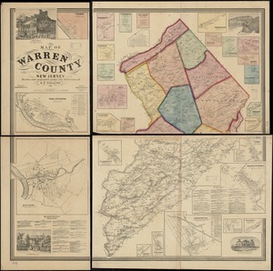
Map of Warren County, New Jersey
4507.
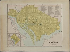
Map of Washington
4508.
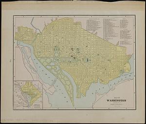
Map of Washington ; map of Cincinnati
4509.
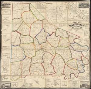
Map of Washington Co., Pennsylvania : from actual surveys
4510.
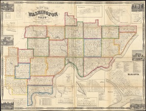
Map of Washington County, Ohio
4511.
Map of Washington County, Vermont
4512.
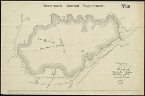
Map of Webster Lake, Franklin, N.H
4513.
Map of West Roxbury
4514.
Map of West Virginia showing coal, oil, gas and limestone areas
4515.
Map of West Virginia showing railroads and county products
4516.
A map of Westborough
4517.
Map of Westborough Mass
4518.
Map of White Pass & Yukon Route and connections
4519.
Map of Whitley County
4520.
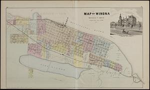
Map of Winona, Winona Co., Minn. : T.107.N.R.7.W. of 5th P.M.
‹ Prev
Next ›
1
2
…
222
223
224
225
226
227
228
229
230
…
434
435


![[Map of W. Dall's lots in Athens County, Washington County, and Gallia County, Ohio]](https://bpldcassets.blob.core.windows.net/derivatives/images/commonwealth:w9505s00n/image_thumbnail_300.jpg)