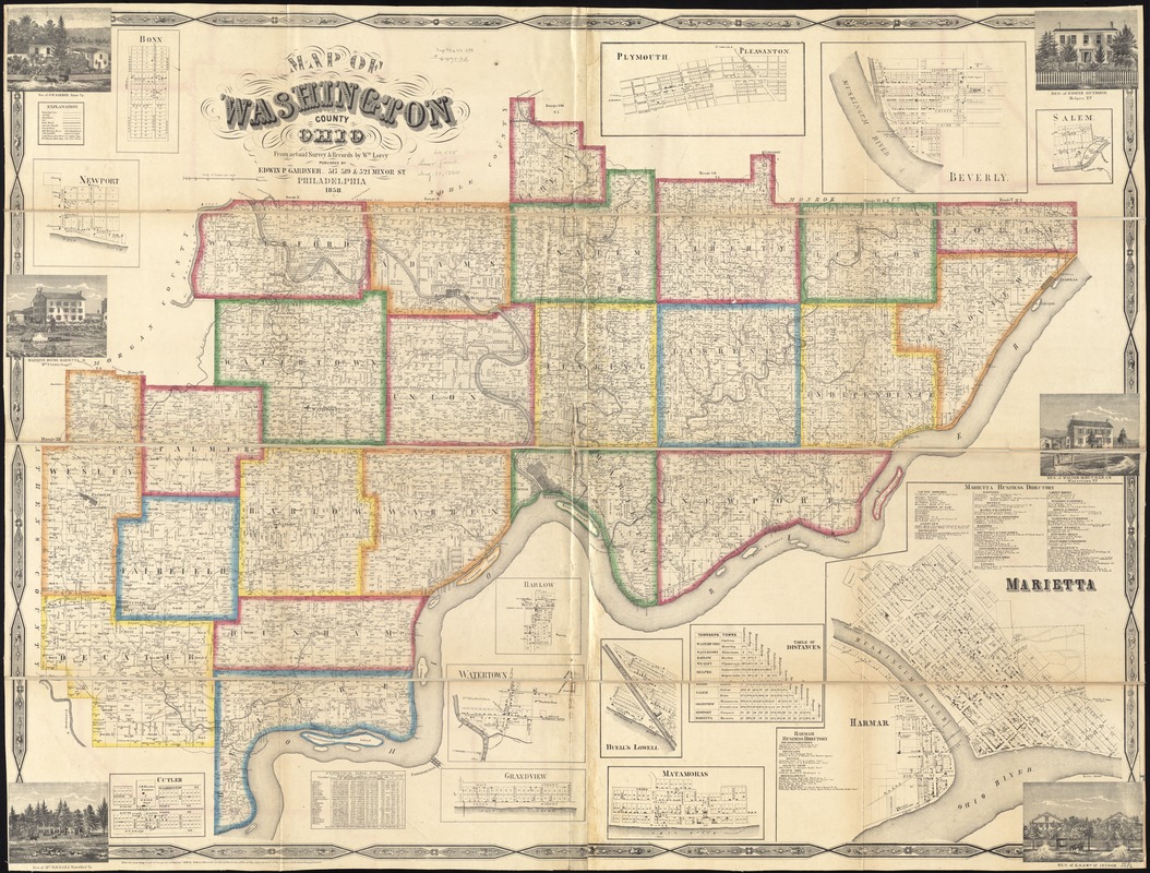
Map of Washington County, Ohio
Item Information
- Title:
- Map of Washington County, Ohio
- Creator:
- Lorey, Wm. (William)
- Name on Item:
-
from actual survey & records by Wm. Lorey.
- Date:
-
1858
- Format:
-
Maps/Atlases
- Location:
-
Boston Public Library
Norman B. Leventhal Map & Education Center - Collection (local):
-
Norman B. Leventhal Map & Education Center Collection
- Subjects:
-
Buildings--Ohio--Washington County--Pictorial works
Real property--Ohio--Washington County--Maps
Landowners--Ohio--Washington County--Maps
Marietta (Ohio)--Maps
- Places:
-
OhioWashington (county)Marietta
- Extent:
- 1 map : hand col. ; 102 x 140 cm.
- Terms of Use:
-
No known copyright restrictions.
No known restrictions on use.
- Publisher:
-
Philadelphia :
Edwin P. Gardner
- Scale:
-
Scale [1:50,588]
- Language:
-
English
- Notes:
-
Shows landownership.
Includes business directory, statistical table, table of distances, 12 insets, and 6 views of buildings.
Insets: Bonn -- Newport -- Cutler -- Barlow -- Watertown -- Grandview -- Plymouth; Pleasanton -- Buell's Lowell -- Matamoras -- Beverly -- Marietta -- Salem.
"Entered according to Act of Congress in the year 1858 by Robert Pearsall Smith in the clerks office of the district court of the eastern district of Pennsylvania."
BPL copy assembled, sectioned to 4 sheets and mounted on cloth.
- Identifier:
-
06_01_011296
- Call #:
-
G4083.W3 1858 .L67
- Barcode:
-
39999065683375
- LCCN:
-
2006636760


