Toggle navigation
LMEC Home
Exhibitions
Georeferencing
Tools for Teachers
Collections
My Favorites
Sign Up / Log In
Search
Search the map portal
Map Collection
Map Collection
Map Sets
Search
Search
Search for
Search In
All Fields
Creator
Title
Subject
Place
Search All Digital Collections
Advanced Search
8811 Results
My Search
Start Over
More Like
commonwealth:w9505s62n
Remove constraint More Like: commonwealth:w9505s62n
Filter your Search
Place
North and Central America
6,011
United States
4,927
Massachusetts
2,079
Europe
1,396
Suffolk (county)
1,046
Boston
1,019
Canada
501
Asia
438
more
Place
»
Topic
Boston (Mass.)--Maps
586
United States--Maps
282
Real property--Massachusetts--Boston--Maps
175
Massachusetts--Maps
162
Landowners--Massachusetts--Boston--Maps
133
North America--Maps--Early works to 1800
111
United States--Maps--Early works to 1800
103
New England--Maps
102
more
Topic
»
Date
Date range begin
–
Date range end
Current results range from
1482
to
2023
View distribution
Creator
United States. Hydrographic Office
595
O.H. Bailey & Co
148
Des Barres, Joseph F. W. (Joseph Frederick Wallet), 1722-1824
123
United States. Post Office Dept
120
Ptolemy, 2nd cent
100
Walling, Henry Francis, 1825-1888
94
Jefferys, Thomas, -1771
88
Geological Survey (U.S.)
86
more
Creator
»
Format
Maps/Atlases
8,751
Manuscripts
217
Prints
56
Books
36
Objects/Artifacts
10
Drawings/Illustrations
8
Posters
5
Georeferenced
Yes
872
No
7,939
Collection
Norman B. Leventhal Map & Education Center Collection
8,696
Boston and New England Maps
2,233
Urban Maps
2,023
Maritime Charts and Atlases
1,083
American Revolutionary War-Era Maps
729
Boston Redevelopment Authority Collection
87
MacLean Collection Map Library
67
New York Public Library Collection
16
more
Collection
»
Available to use
No known restrictions
8,556
Creative Commons license
81
Search Constraints
Sort by relevance
relevance
title
date (asc)
date (desc)
Number of results to display per page
20 per page
10
per page
20
per page
50
per page
100
per page
View results as:
grid view
map view
Search Results
3401.
The Manchu Empire and the European powers, 1644-1912, A.D.
3402.
Manhattan : first city of America
3403.
Manitoba
3404.
Manitoba : map showing disposition of lands
3405.
Manitoba : map showing disposition of lands
3406.
Manitoba : map showing disposition of lands
3407.
Mansfield, Massachusetts : 1888
3408.
Manufacturing center of Lynn, Mass : 1879
3409.
[Manuscript map of coast from Maine to Delaware]
3410.
[Manuscript map of New England and eastern Canada, showing the routes of Champlain's voyage]
3411.
Manuscript map of the United States
3412.
Manuscript maps of U.S. states
3413.
Manuscript maps of U.S. states, possibly drawn by a schoolchild
3414.
Manuscript plan of the Bulfinch Triangle, Boston, MA : [text]
3415.
Manuscript plan of the Bulfinch Triangle, Boston, MA : [sheet 2]
3416.
Manuscript plan of the Bulfinch Triangle, Boston, MA : [sheet 1]
3417.
Manuscript survey of a property in Kittery, Maine
3418.
A map & chart of the bays harbours post roads and settlements in Passamaquoddy & Machias with the large island of Grand Manan
3419.
Map & profiles of the Vt. Central and Vt. and Canada Railroads
3420.
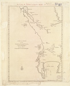
A Map and chart of the Cape of Good Hope, with the soundings in Table Bay, False Bay and Saldanha Bay
‹ Prev
Next ›
1
2
…
167
168
169
170
171
172
173
174
175
…
440
441


![[Manuscript map of coast from Maine to Delaware]](https://bpldcassets.blob.core.windows.net/derivatives/images/commonwealth:x633f976h/image_thumbnail_300.jpg)
![[Manuscript map of New England and eastern Canada, showing the routes of Champlain's voyage]](https://bpldcassets.blob.core.windows.net/derivatives/images/commonwealth:qb98n8061/image_thumbnail_300.jpg)