Toggle navigation
LMEC Home
Exhibitions
Georeferencing
Tools for Teachers
Collections
My Favorites
Sign Up / Log In
Search
Search the map portal
Map Collection
Map Collection
Map Sets
Search
Search
Search for
Search In
All Fields
Creator
Title
Subject
Place
Search All Digital Collections
Advanced Search
8627 Results
My Search
Start Over
More Like
commonwealth:w9505r437
Remove constraint More Like: commonwealth:w9505r437
Filter your Search
Place
North and Central America
5,865
United States
4,784
Massachusetts
2,052
Europe
1,359
Suffolk (county)
1,034
Boston
1,007
Canada
453
Asia
422
more
Place
»
Topic
Boston (Mass.)--Maps
577
United States--Maps
273
North America--Maps--Early works to 1800
180
Real property--Massachusetts--Boston--Maps
174
Massachusetts--Maps
160
Landowners--Massachusetts--Boston--Maps
132
New England--Maps
99
Europe--Maps
78
more
Topic
»
Date
Date range begin
–
Date range end
Current results range from
1482
to
2023
View distribution
Creator
United States. Hydrographic Office
594
O.H. Bailey & Co
148
Des Barres, Joseph F. W. (Joseph Frederick Wallet), 1722-1824
123
United States. Post Office Dept
120
Ptolemy, 2nd cent
100
Walling, Henry Francis, 1825-1888
94
Jefferys, Thomas, -1771
90
Geological Survey (U.S.)
86
more
Creator
»
Format
Maps/Atlases
8,568
Manuscripts
217
Prints
56
Books
36
Objects/Artifacts
10
Drawings/Illustrations
8
Posters
4
Georeferenced
Yes
872
No
7,755
Collection
Norman B. Leventhal Map & Education Center Collection
8,558
Boston and New England Maps
2,205
Urban Maps
1,936
Maritime Charts and Atlases
1,081
American Revolutionary War-Era Maps
679
Boston Redevelopment Authority Collection
87
New York Public Library Collection
32
Richard H. Brown Revolutionary War Map Collection at Mount Vernon
18
more
Collection
»
Available to use
No known restrictions
8,411
Creative Commons license
110
Search Constraints
Sort by relevance
relevance
title
date (asc)
date (desc)
Number of results to display per page
20 per page
10
per page
20
per page
50
per page
100
per page
View results as:
grid view
map view
Search Results
3141.
Kingdom of the Caliphs
3142.
The kingdoms of Spain and Portugal, divided into their great provinces
3143.
King's Bay ... : Lunenburg
3144.
Kingston, capitale de la Jamaique : bâtie par les Anglois en 1692
3145.
Kingston-Port-au-Prince
3146.
A kite view of Philadelphia and the Sesqui Centennial International Exposition
3147.
Klamath project, Oregon-California
3148.
Das königreich Griechenland mit den Ionischen Inseln
3149.
Königreich Griechenland nach den neuesten grenzbestimmungen
3150.
Das königreich Hellas oder Griechenland und die Ionischen Inseln (Ephtánisos)
3151.
Das königreich Hellas oder Griechenland und die Republik der Sieben Ionischen Inseln (Ephtánisos)
3152.
Kootenai National Forest, Montana
3153.
Korea Strait-- Japan, Tsu Sima Sound, (Tatamura) : from British & Russian surveys in 1859 & 1861 ; republication of British...
3154.
Kriegs-karte 1870
3155.
Kriegsschauplatz uebersichtskarte der Europäischen Türkei mit den vasallenstaaten Montenegro, Serbien, Rumænien u. Griechenland
3156.
Kurzer weg nach und von Amerika via Rotterdam, Amsterdam oder Boulogne s/M
3157.
Küstenländer des Schwarzen Meeres
3158.
Lac Superieur et autres lieux ou sont les missions des peres de la Compagnie de Iesus comprises sous le nom d'Outaouacs
3159.
Lacrosse County, Wis.
3160.
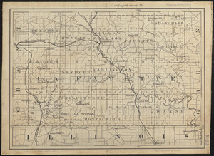
Lafayette County, Wis.
‹ Prev
Next ›
1
2
…
154
155
156
157
158
159
160
161
162
…
431
432