Toggle navigation
LMEC Home
Exhibitions
Georeferencing
Tools for Teachers
Collections
My Favorites
Sign Up / Log In
Search
Search the map portal
Map Collection
Map Collection
Map Sets
Search
Search
Search for
Search In
All Fields
Creator
Title
Subject
Place
Search All Digital Collections
Advanced Search
577 Results
My Search
Start Over
More Like
commonwealth:vx0273587
Remove constraint More Like: commonwealth:vx0273587
Filter your Search
Place
North and Central America
458
United States
241
North America
236
Canada
75
Asia
30
New York
26
Pennsylvania
18
Great Lakes Region
15
more
Place
»
Topic
North America--Maps--Early works to 1800
240
United States--Maps--Early works to 1800
55
Canada--Maps--Early works to 1800
49
Great Britain--Colonies--America--Maps--Early works to 1800
18
Great Lakes Region (North America)--Maps--Early works to 1800
14
Asia--Maps--Early works to 1800
12
America--Maps--Early works to 1800
11
New England--Maps--Early works to 1800
11
more
Topic
»
Date
Date range begin
–
Date range end
Current results range from
1528
to
1999
View distribution
Creator
Jefferys, Thomas, -1771
29
Mitchell, John, 1711-1768
22
Sayer, Robert, 1725-1794
20
Gibson, J. (John), active 1750-1792
19
Bellin, Jacques Nicolas, 1703-1772
17
Anville, Jean Baptiste Bourguignon d', 1697-1782
16
Robert Sayer and John Bennett (Firm)
16
Faden, William, 1749-1836
14
more
Creator
»
Format
Maps/Atlases
575
Manuscripts
5
Paintings
3
Ephemera
1
Objects/Artifacts
1
Prints
1
Georeferenced
Yes
6
No
571
Collection
American Revolutionary War-Era Maps
448
MacLean Collection Map Library
379
Norman B. Leventhal Map & Education Center Collection
127
New York Public Library Collection
32
Richard H. Brown Revolutionary War Map Collection at Mount Vernon
18
Mapping Boston Collection
10
Sidney R. Knafel Map Collection at Phillips Academy
9
British Library Collection
3
more
Collection
»
Available to use
No known restrictions
121
Creative Commons license
64
Search Constraints
Sort by relevance
relevance
title
date (asc)
date (desc)
Number of results to display per page
20 per page
10
per page
20
per page
50
per page
100
per page
View results as:
grid view
map view
Search Results
401.
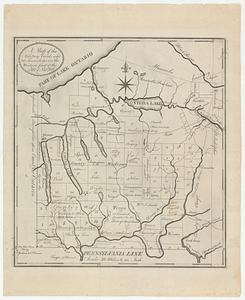
A map of the military lands and 20 townships in the western part of the state of New York
402.
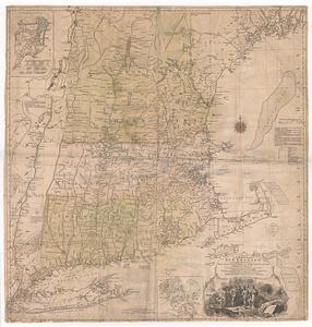
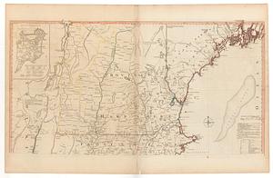
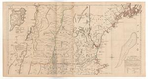
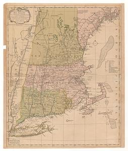
A map of the most inhabited part of New England, containing the provinces of Massachusets Bay and New Hampshire, with the...
403.
A map of the most inhabited part of New England, containing the provinces of Massachusets Bay and New Hampshire, with the...
404.
A map of the most inhabited part of New England, containing the provinces of Massachusets Bay and New Hampshire, with the...
405.
A map of the most inhabited part of New England containing the provinces of Massachusets Bay and New Hampshire with the...
406.
A map of the most inhabited part of New England, containing the provinces of Massachusetts Bay and New Hampshire, with the...
407.
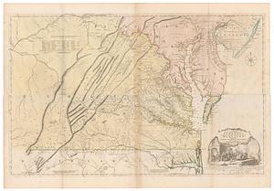
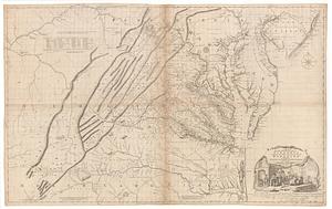
A map of the most inhabited part of Virginia containing the whole province of Maryland with part of Pensilvania, New Jersey and...
408.
A map of the most inhabited part of Virginia containing the whole province of Maryland with part of Pensilvania, New Jersey and...
409.
Map of the mouth of the Mississippi
410.
A map of the new northern archipelago discover'd by the Russians in the seas of Kamtschatka & Anadir
411.
A map of the north weft parts of the United States of America
412.
A map of the northern and middle states : comprehending the western territory and the British dominions in North America from...
413.
A map of the northern and middle states : comprehending the western territory and the British dominions in North America ;...
414.
A map of the northern and middle states : comprehending the western territory and the British dominions in North America, from...
415.
A map of the northern and middle states : comprehending the western territory and the British dominions in North America :...
416.
A map of the Oneida Reservation including the lands leased to Peter Smith
417.
A map of the province of New York, with part of Pensilvania, and New England
418.
A map of the province of South Carolina with all the rivers, creeks, bays, inletts, islands, inland navigation, soundings, time...
419.
A map of the province of upper Canada, describing all the new settlements, townships, &c. with the countries adjacent, from...
420.
A map of the several dispositions of the English fleet & army on the river S.t Laurence, to the taking of Quebec
‹ Prev
Next ›
1
2
…
17
18
19
20
21
22
23
24
25
…
28
29