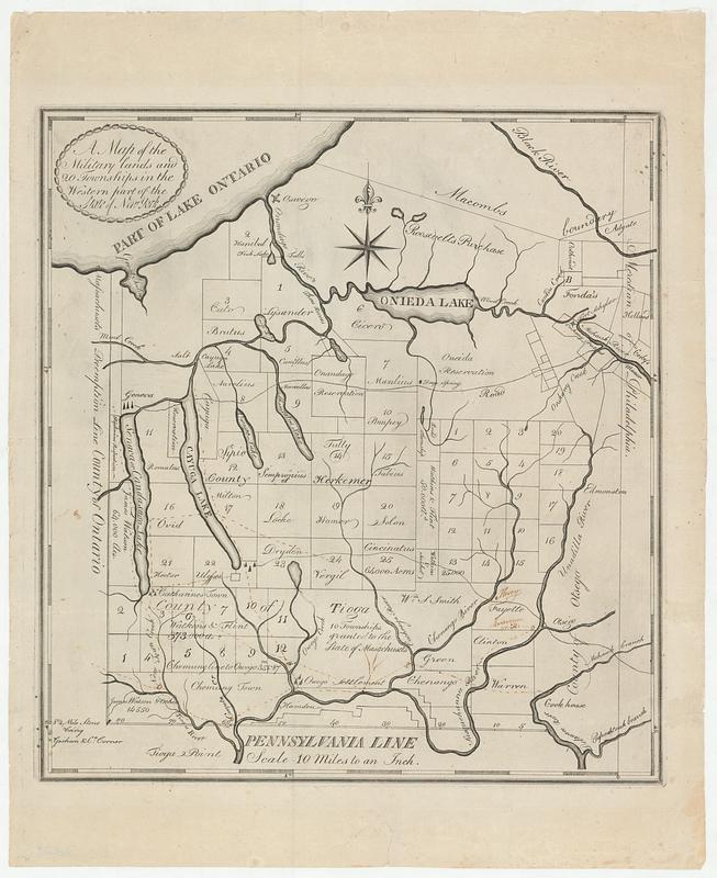
A map of the military lands and 20 townships in the western part of the state of New York
This map is also available in American Revolutionary Geographies Online (ARGO), a collections portal especially built for material relating to the American Revolutionary War Era. Visit ARGO to learn more about this item and explore the historical geography of North America in the late eighteenth century.
Item Information
- Title:
- A map of the military lands and 20 townships in the western part of the state of New York
- Contributor:
- DeWitt, Moses, 1766-1794
- Publisher:
- Hardenbergh, Abraham
- Date:
-
[ca. 1789]
- Format:
-
Maps/Atlases
- Location:
- MacLean Collection Map Library
- Collection (local):
-
MacLean Collection Map Library
- Subjects:
-
New York (State)--Administrative and political divisions--Maps--Early works to 1800
Syracuse Region (N.Y.)--Administrative and political divisions--Maps--Early works to 1800
Finger Lakes Region (N.Y.)--Administrative and political divisions--Maps--Early works to 1800
- Places:
-
New York
- Extent:
- 1 map ; 316 x 292 mm
- Terms of Use:
-
Public Domain/No known restrictions on use. Contact host institution to download image.
Contact host institution for more information.
- Place of origin:
-
Albany
- Scale:
-
Scale ca. 1:633,600
- Language:
-
English
- Identifier:
-
MC_34621
- Call #:
-
34621


