Toggle navigation
LMEC Home
Exhibitions
Georeferencing
Tools for Teachers
Collections
My Favorites
Sign Up / Log In
Search
Search the map portal
Map Collection
Map Collection
Map Sets
Search
Search
Search for
Search In
All Fields
Creator
Title
Subject
Place
Search All Digital Collections
Advanced Search
8733 Results
My Search
Start Over
More Like
commonwealth:tt44pw742
Remove constraint More Like: commonwealth:tt44pw742
Filter your Search
Place
North and Central America
5,964
United States
4,882
Massachusetts
2,080
Europe
1,396
Suffolk (county)
1,084
Boston
1,057
Canada
449
Asia
438
more
Place
»
Topic
Boston (Mass.)--Maps
587
United States--Maps
282
Real property--Massachusetts--Boston--Maps
180
Massachusetts--Maps
162
Landowners--Massachusetts--Boston--Maps
138
North America--Maps--Early works to 1800
103
New England--Maps
102
City planning--Massachusetts--Boston--Maps
97
more
Topic
»
Date
Date range begin
–
Date range end
Current results range from
1482
to
2023
View distribution
Creator
United States. Hydrographic Office
595
O.H. Bailey & Co
148
Des Barres, Joseph F. W. (Joseph Frederick Wallet), 1722-1824
123
United States. Post Office Dept
120
Boston Redevelopment Authority
100
Ptolemy, 2nd cent
100
Walling, Henry Francis, 1825-1888
94
Geological Survey (U.S.)
86
more
Creator
»
Format
Maps/Atlases
8,673
Manuscripts
215
Prints
56
Books
36
Objects/Artifacts
10
Drawings/Illustrations
8
Posters
5
Georeferenced
Yes
870
No
7,863
Collection
Norman B. Leventhal Map & Education Center Collection
8,696
Boston and New England Maps
2,266
Urban Maps
2,055
Maritime Charts and Atlases
1,083
American Revolutionary War-Era Maps
616
Boston Redevelopment Authority Collection
119
Massachusetts Real Estate Atlases
5
Applied Geographics, Inc. Records
1
more
Collection
»
Available to use
No known restrictions
8,585
Creative Commons license
48
Search Constraints
Sort by relevance
relevance
title
date (asc)
date (desc)
Number of results to display per page
20 per page
10
per page
20
per page
50
per page
100
per page
View results as:
grid view
map view
Search Results
5121.
A new general chart of the West Indies from the latest marine journals and surveys regulated and ascertained by astronomical...
5122.
A new general chart of the West Indies from the latest marine journals and surveys regulated and ascertained by astronomical...
5123.
A new general map of America
5124.
A new generall chart for the West Indies of E. Wrights projection vul. Mercators chart
5125.
A new generall map of the seat of war from Vpper Hungary to the Isle of Candia : with exact prospects of Napoli di Romania,...
5126.
New Glasgow, Nova Scotia
5127.
New Hampshire
5128.
New Hampshire
5129.
New Hampshire
5130.
New Hampshire by recent survey : made under the supreme authority and published according to law
5131.
New Hartford, Conn : 1878
5132.
New Haven
5133.
New historical map of metropolitan Boston
5134.
New index geological map of the British Isles, and adjacent coast of France constructed from published documents,...
5135.
New Jersey
5136.
New Jersey showing forest area and its relation to the principal watersheds
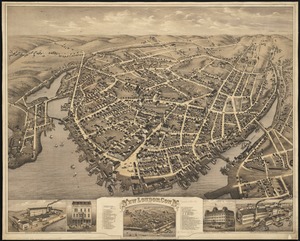
5137.
New London, Conn : 1876
5138.
A new map containing the English Empire Golf of Mexico Caribes Islands Granada Guiana Amazone and Peru
5139.
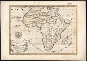
A new map of Africk : shewing its present general divisions cheif cities or towns, rivers, mountain &c. : dedicated to His...
5140.
A new map of America from the latest observations
‹ Prev
Next ›
1
2
…
253
254
255
256
257
258
259
260
261
…
436
437